Our time in Portland has quickly come to a close. It’s hard to believe that 4 months have passed since we said good-bye for now to Louisville and embarked on this Western journey. As you read this we’re making the 1,200 mile drive to Denver, which we’ll call home for the next 4 months. We’re excited to soak in all the sun, mountains, and beer that Colorado has to offer.
Since moving away from Louisville one of my self-imposed challenges has been to find foods to fill the void left behind by our favorite hometown eats. While donuts certainly aren’t something we eat weekly (anymore), they are a wonderful weekend treat we indulge in about once a month. Nord’s was our go-to back home, and it has been my goal to find a suitable substitute in Portland. There is apparently a lot of debate over which place has the best donuts, so we set out to taste them ourselves.
first up….
Voodoo Donut
By now, everyone has probably heard of Voodoo. It’s practically synonymous with Portland.
They have multiple locations around town, but the original is situated in Old Town. We tried this after a day of hiking. Luckily the line was non-existent at 2pm on a Saturday so we were able to walk right up and had our pick of the menu. Matt opted for the Voodoo Doll, which is jelly filled, while I rolled with the cream-filled, Oreo-topped Pot Hole. We also split a maple bacon, because who can say no to that combo? These may have been “safer” choices when there were Fruity Pebble covered and bubblegum flavored options, but that’s okay by us.
Overall, we’d have to say the donuts, while interesting, were nothing too special. Sure they’re good and the gimmicky flavors are fun to look over and try, but they were a bit too sweet. The price isn’t bad, but keep in mind they are cash only. If you’re in Portland it’s worth a shot, but if you want a truly good donut, keep reading.
Donut rating:
Blue Star Donuts
Creme brulee (with a vial of Cointreau) and blueberry bourbon basil doughnuts from Blue Star
In all my research on Portland donuts, Blue Star was always on the top of the list. It’s apparently a hipster favorite and I can see why. Their flavors are unique and the shops are clean and hip. I tried these during the week so, unfortunately, Matt didn’t get to taste them. As you can see, I went with the Creme brulee and blueberry bourbon basil.
The creme brulee had a crunchy top from the toasted sugar and a good cream inside. However the Cointreau shot put it a little over the top and I could’ve done without that. The blueberry was a solid donut, but I didn’t get any flavor of the bourbon or basil. The dough also had a slightly off flavor; while it wasn’t terrible, it wasn’t quite the sweetness I would expect from a donut. At $3.50 a pop, these are not a cheap treat. While they get a lot of hype, I would save my money and skip Blue Star.
Donut rating:
Helen Bernhard Bakery
I had high hopes for Helen Bernhard Bakery…just look at that case of donuts! It’s located in the Lloyd District of Portland and is in a small house-looking building. The inside is your standard bakery – cases of baked goods and fresh bread all around. We went as soon as they opened on a Sunday and there was already a line of people.
I honestly don’t remember the exact donuts we got, but we did a half dozen assorted. They were good, standard donuts. The glaze was nice but Matt’s apple fritter was the star of the bunch. We didn’t realize that on Sundays they do day old donuts, so that might have factored a little into the flavor and made them a bit more stale than fresh ones. The plus about going on a Sunday, though, is that everything is half priced! We got a half dozen donuts for about $3.50 (the same price as ONE from Blue Star). If you’re looking for a solid donut, this isn’t a bad option….just don’t go on a Sunday.
Donut rating:
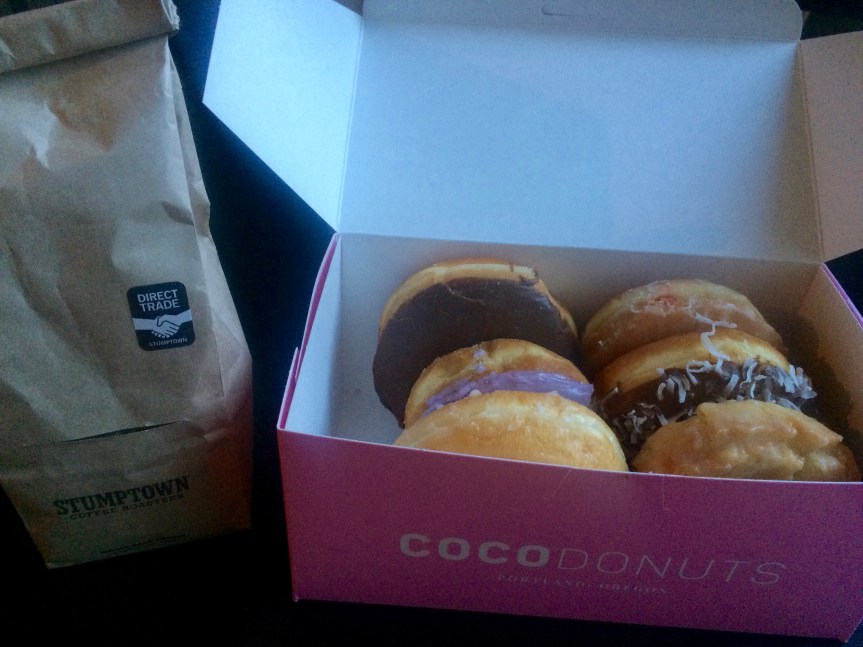
Coco Donuts
Coco donuts, like Voodoo and Blue Star, have multiple locations around town. Luckily for us there is one just a few blocks away. We swung by here on a Friday morning to grab a morning pick-me-up. As you can see, we got a half dozen assorted: custard filled, glazed, and lavender for Beth; jelly filled, chocolate coconut, and old fashioned for Matt.
These donuts were what I’d been waiting for! The were light, fluffy, and not cloyingly sweet. The flavors were perfect. I initially wasn’t sure of the lavender as I’ve cooked with the flavor before and it can get very overpowering, but it was done perfectly. There was just a hint of lavender in the glaze and it was a great complement to the dough. Matt’s old fashioned was another show stopper. Normally we’re not fans of cake donuts, but this was great. It wasn’t dense and had a great texture to it. They were very reasonably priced with the whole lot costing around $7. If you’re looking for a really good donut to go with your Stumptown brew, we highly recommend Coco.
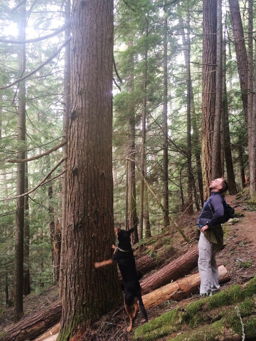
I wanted to write this while it was still early in the year, so you can appreciate the weather we encountered! It was a beautiful, clear, 80 degree day in Portland which means we were looking for a hike! It was time to head a bit north, back into the Washington side of the Cascades.
We chose what is supposed to be one of the most spectacular views of the Columbia River Gorge and the surrounding mountains (at least 4 of them!) on a clear day—we headed to the Silver Star Mountain in the Gifford Pichot National Forest. We chose to go via the Grouse Vista Hike due to the fact it was mid range distance at 3.2 miles out and aggressive elevation gain of 2,000 ft. The drive up was long and slow, since it was utilizing gravel logging roads, but when you get to the trailhead you see it is clearly open to the public with a dozen vehicles on this pre-season day.
The trail goes straight up 500 ft in the first half mile then settles in to a doable grade for most of the remainder. Early on you are rewarded with some great valley views in an open meadow-like field that still shows signs of what must have been a massive forest fire that tore through in the early 20th century.
The Grouse Vista trail
The Grouse Vista trail is just starting to green at 3,000 ft in April
[Beth- There were also rock faces that would be a climber’s dream; we actually ran into a guy who was climbing through the crevasses looking for a wallet he dropped the day before. Talk about bad luck!]
[Beth- The most surprising thing to us was when we encountered snow! And now just slushy remnants of months ago, but legitimate 2 foot deep snow covering the entire trail. It was pretty packed down for most of it, but it was slippery. It might’ve been more work to traverse the snow than to climb that first 500 ft.]
The snow on the trails was surprising and plentiful! As soon as we moved into the shaded side of the trails, we were up to mid-shins in the stuff. The air temp when we started was 67 F, so we were sweating in shorts and t-shirts at the beginning of the hike! Although the snow as deep and cold, the air was still warm enough, especially with the uphill battle we had to get up these snow-covered paths.
Snow-covered trails beginning at 3500 ft
The pup really enjoyed the snow!
Beth coming up the last, and snowiest, leg of the trail.
The last leg to the top was the snowiest, knee-deep for most of it! The bright sun was doing it’s job melting the snow, and it provided a good, hard pack for us to walk on top for most of it. After that last snowy leg, the whole mountain opened up into a saddle. THIS was the view that made the whole thing worth it! Silver Star Mountain is claimed to be one of the best views in the Columbia River Valley, and I believe it. We were able to see everything on this clear sunny day- Mount Hood to the East, Mount St. Helens and Mount Rainier to the North, and Mount Jefferson and 3 Sisters to the South–we were able to see more but they remain unidentifiable to me. Take a few minutes to check out these panoramic shots.
Beth and Snickers on the highest point (around 4500 ft), which is a the foundation for a long-gone fire watchtower.
After spending some time enjoying the breath-taking views on the windy ridge and eating some nuts and fruit, we started our way back down. We met several other dog-friendly groups that were making their way to the top! Plenty of people dressed similarly skimpy, so we didn’t feel so bad. The trip down was still a lot of work. In fact, this was the coldest part of our trip because we kept sinking into mid-shin deep snow! Our ankles were getting very cold, so we were glad to pick up the pace to get to the lower, dry trails.
We got back to the car and made the slow drive down the logging trails back to the main roads!
If you are ever in Portland (and the rain stops for a few hours), get on top of a hill (Mount Tabor is a great place) and look East! You cannot miss the soul-filling sight of 10,000 ft, ice-capped Mount Hood. Unfortunately, the camera doesn’t do it justice from the ground on Portland, so I snapped this shot on a flight into PDX at about 10k ft, to give you a sense of the grandeur.
Mount Hood (front) from the plane into PDX at 10k ft; Mount Jefferson (??) in the way back
Ever since the clouds parted the first week we were in Portland and we were able to see this mountain, we knew we had to get close enough to at least hike the base–we were finally able to do it on the last weekend in March 2016.
We took the Mount Hood Scenic Byway (Highway 26) down towards Rhododendron, OR. We picked the Ramona Falls Hike due to it’s accessibility from Portland, dog-friendliness, and length (7 mi out-and-back)–check out the Ramona Falls Garmin Tracks we took! As we approached the small access roads, we found them barricaded since the campgrounds are closed through March, for the winter. Ugh, that was annoying! We didn’t realize and now needed to find another hike; at least there were plenty of other people who saw the same thing and turned around. However, there were plenty of cars parked, so some must be in the area. We decided to park here, and do the 2 mile hike on the blocked, paved access road to the trail head–this was going to turn around 7 mi hike to closer to 12 miles! We were game [Beth here – but ask us again in 10 miles 🙂 ].
2 mile paved-road hike back to the Romona Falls trail head, due to winter closures
The trail was traveled, but very few people on it this day, due to the 2 mile hurdle to get back to the trail. The trail head markers were very clear when we started- the bridge to cross the river has been out for nearly 2 years with no plans to put it back into place. Of course that’s a deterrent for family hikers, but they also had instructions for proper crossing during the summer. Luckily, it is much lower in the winter and early part of the year, so we were game! We found one particularly well-worn log crossing most of the water and rocks, which served as an excellent bridge! Even though Snickers was unsure, she crossed it with ease–brave little pup.
Romona Falls river crossing- downed trees and rocks everywhere
Pup making it across the log bridge
This is the best crossing point on the river
Once we crossed, we walked into a floodplain that gave a perfect vista of Mount Hood- THIS is the picture we wanted! We walked along this for nearly a mile, allowing the mountain to come into full, glorious view before we split off.
First look at Mount Hood- that looks _cold_!
Mount Hood- good luck getting a better shot, this was amazing!
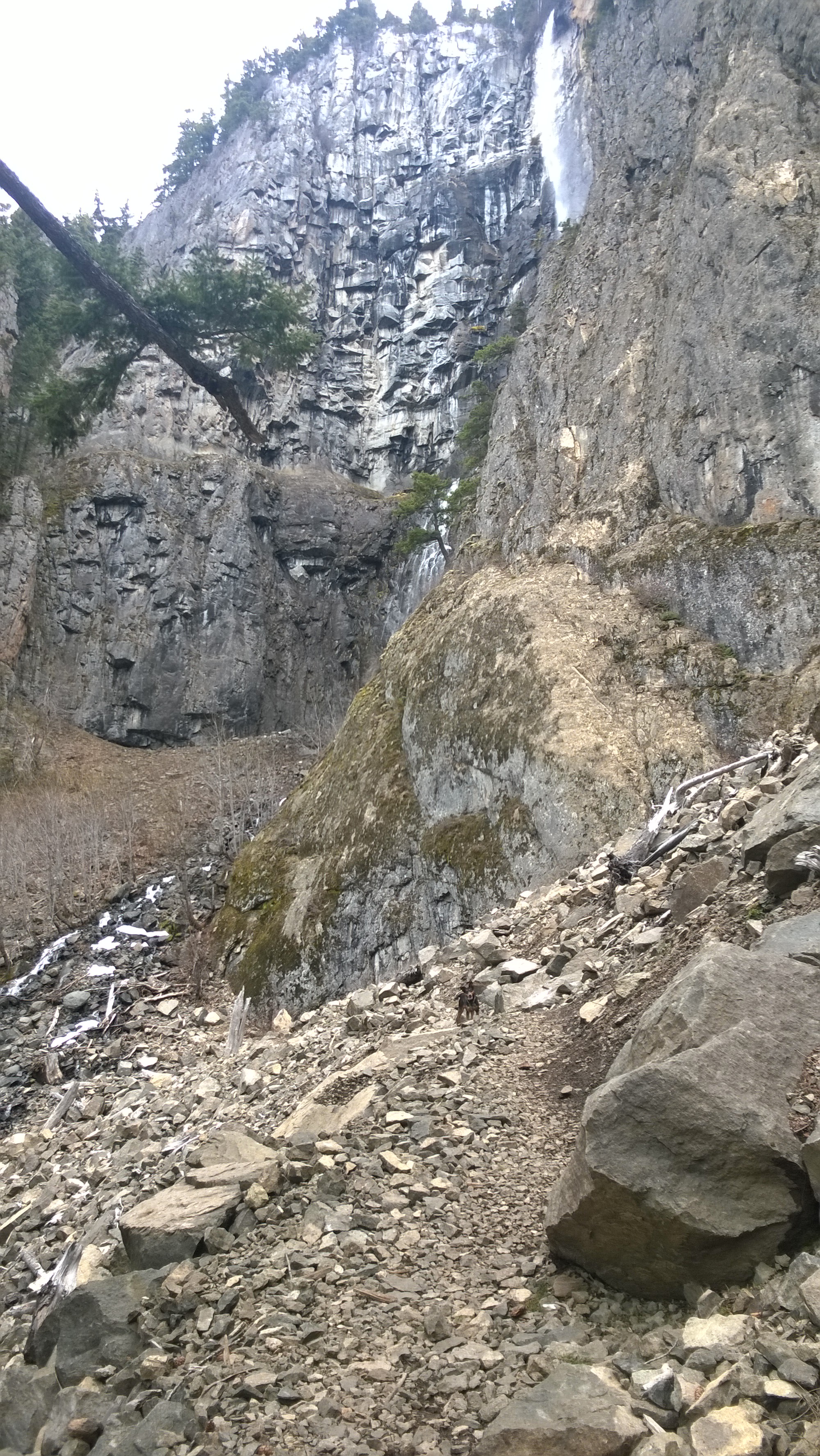
The trail went back into the banks, into the woods, and met up with a segment of the Pacific Crest Trail. The trail kept taking us up, closer to Mount Hood, but we never got to see another great view of it [Beth here – the day also got more and more overcast so even if the trees opened to a clearing, we wouldn’t have seen much. Typical PNW]. The higher we gradually climbed, the more snow we encountered! Before we hit Ramona falls we were ankle-deep in quickly-melting snow. That’s when we hit Ramona Falls, which is a wide, beautiful wall of water in a well-shaded side of the valley. We spent only a few minutes here, since it was very wet and cold.
Temps in the 50’s and sunny, so even with snow on the trails short sleeves were right for the uphill hike
Snow gets deeper a little higher up and further in
Romona Falls! Beautiful
We missed a pic of Beth in front of Romona Falls, so she gets this tiny falls. 🙂
We continued on and found some beautiful rock-faces on the valley walls, some escarpments came out 20 ft or more over the valley floor and it really felt like it was towering above us. The rest of the walk back was along the creek on the far side of the valley in which we entered. At some point the pup had a nice gash on the bottom of her foot; she must have cut it on a sharp rock at one of the creek crossings–she was being a trooper. By the time we got back to the main river crossing we were getting tired, but still 3 miles to get back to the car!
Once back to the car, we were *done*! Take off those hiking boots and settle in for the 1.5 hour drive back to Portland. Of course, we scarfed the rest of our food- a second PB&J, jerky, almonds, and an orange. 🙂
We can cross another thing off our our Pacific Northwest bucket list…we went to Seattle! After weeks of endless rain, Mother Nature finally bestowed some sun and warmth on us and we took advantage with a road trip. Snickers and I took off after work on Thursday armed with snacks and podcasts for the three hour drive to meet Matt in the Emerald City. The sky was clear, which made for some magnificent views of all the big mountains: Mt. Hood, Mt. Saint Helen’s, and Mt. Rainier. Those views made sitting in Portland traffic a little more bearable.
We made it to Bellevue just outside of Seattle before dark and met Matt at the hotel. We chose to stay in Bellevue Thursday night to save a couple buck on hotel and parking since we both had to work on Friday. We wandered around downtown Bellevue Thursday night and Friday afternoon in search of food and parks and found some surprisingly good options – Mediterranean and smoothie/sandwich shop. Matt and Snickers even ran around under the cherry blossoms at a local park at lunch.
Finally work ended and we could head into the city. Since the weather was so nice – 65 and sunny…hallelujah! – our first stop was at gas works park. The park was the former site of Seattle Gas Light Company’s gasification plant and contains remnants of the only remaining coal gasification plant in the US! Cool! Here is Matt moodily displaying some of the equipment. [Matt- this was the Gas Works Park just north of the city, and an awesome place to explore on a sunny day!]
Matt’s future Album cover “Gasworks”
Gas Works Park
Downtown Seattle
Matt playing acrobat!
They had lots of equipment around that you could touch, which they’ve since painted and turned into a children’s play area. We didn’t really see any children playing, but it’s apparently also a good spot for teenagers to take very suggestive photos. [Matt here- yeah, that was weird, but we don’t want to judge in a new city! And I had fun playing Acrobat on whatever that yellow thing was- I found out I am really good at climbing!] We mostly enjoyed walking around until we wore ourselves out and needed some sustenance. We went to Din Tai Fung for some dumplings and stuffed ourselves silly. This place was good! If you’re in the mood for potstickers, dumplings, and wontons I’d highly recommend a stop here. [Matt here- it’s the only location in the US and it’s easily worth a stop, it’s fast and hearty.]
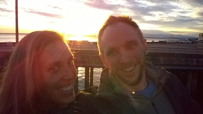
Most of our time in Seattle involved walking aimlessly around the city. We were able to walk all along the waterfront – though they were doing a lot of construction so we weren’t able to walk along the actual water – and caught the sunset over Olympic National Park across the Puget Sound.
Sunset over Olympic Park from the Warf 60(??)
We strolled through Pike Place market Saturday morning and witnessed some fish throwing and rows upon rows of fresh tulips. Nothing screams springtime quite like tulips. We stopped at a couple of places in the market to grab some breakfast; Russian piroshky’s at Piroshky Piroshky and coffee at Seattle Coffee Works.
Pike Place Market
The weather was still cooperating on Saturday so we took advantage and put some miles on our sneakers. First stop was Volunteer park, an Olmsted park right in the middle of the city. It was reminiscent of Cherokee Park in Louisville, and we loved it. There was an old water tower that you could walk up and had amazing 360 degree views of the city as well as a conservatory which was filled with plants galore. They even had an original wading pool that’s like the 1900s equivalent of the modern splash pad. We loved it; it was probably our favorite stop of the trip.
Water tower at Volunteer Park
Inside the water tower
Conservatory at Volunteer ParkBig sittin’ tree in Volunteer Park
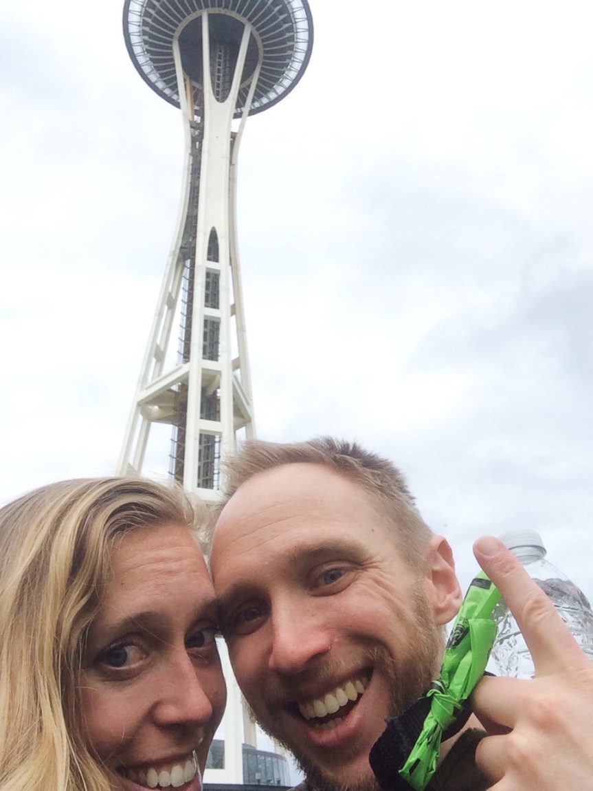
We continued our adventure down to the water after stopping at Portage Bay for brunch and a beer. It wouldn’t be a trip to Seattle without a stop at the Space Needle. We took our obligatory photo, but skipped going up because of the long line and also…we just didn’t feel like it. It was right next to the sculpture garden so we checked that out on the way back to the hotel.
Obligatory Space Needle picture
Our dogs were barking (figuratively, not literally. Snickers doesn’t bark 🙂 ) so a nap was in order. [Matt- that was about 12 miles of urban hiking by my FitBit estimates!] We were able to drag ourselves out of the hotel once more for pizza and beer. Everyone has time for pizza and beer. Our brewery of choice was Rooftop Brewing, which had a nice outdoor area that was covered and heated for the cool night. The beer was great and we had a couple of pints while waiting for our pizza to be delivered from the local chain Pagliacci. [Matt- the beer really hit the spot and Rooftop is in a quiet area near the river, just outside the main hipster part of town, and the pizza had some fresh, local ingredients that really nourished.]
Sunday we planned to hike around Mt. Rainier since the weather had be so great all weekend. [Matt here- we started Sunday with a quick trip to the ultra-premium (expensive, hipster) donut shop, General Porpoise (awesome name!). Only 4 kinds of donuts, all filled with some delicious goos, but at $4 a donut, you’ll want to choose carefully and avoid the marmalade!]
Unfortunately, this is the PNW so good weather doesn’t last forever. It was so overcast and rainy that we couldn’t even see the mountain. Whomp whomp. We didn’t let that stop us from hiking, though. The original plan was to hit up a 6-ish mile trail on the north side of the mountain then circumnavigate around the eastern side on the way home. What we failed to research was that they close the mountain passes in the winter and don’t open until they feel like it, which is maybe sometime in May. Luckily the trail we planned to hike was before the closer to at least we got to hike. It was right near Crystal Mountain Ski Resort so we even got to see some snow! The hike was moderate and climbed up to waterfall before looping back to the parking lot.
Looking for squirrels
[Matt here- We tried to take the 410 and 123 to circumnavigate Mount Rainier on our way back to Portland; however, we made it as far as Crystal Mountain Ski Resort before we ran into road closed barriers. Apparently the pass closes between Nov and April-May or, as the local shop keeper we asked said “whenever they get around to opening it.” — Thanks, shop keep. We were so close to Mount Rainier, but the clouds that day made it impossible to see! We’ll have to try to get some shots of that 14k ft splendor some other time.]
We had a long drive back to Portland since Matt decided to take the scenic route. This also led to a bout of carsickness on my part, but we made it back in one piece.
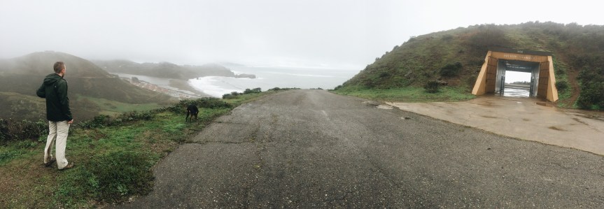
When we moved to Portland, we made a list of all the places we needed to see in our short time here. Some of our favorite hikes this trip have been along the coast (Big Sur, Na’pali, Muir Beach), so Cannon Beach was high on the list. You may recognize the location from a little piece of 80s cinema – The Goonies. The last weekend in February, we truffle shuffled our way to the Oregon coast in search of some vitamin sea.
Look familiar?
Look again.
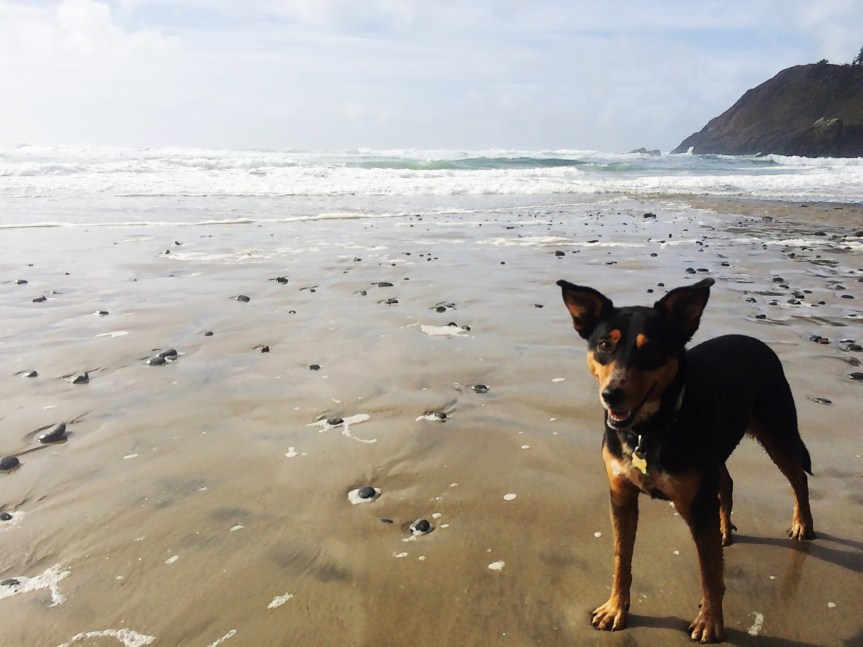
The forecast called for rain, but the weather ended up being absolutely beautiful! We found a 6 mile trail that wound up the coast and ended with a view of the Tillamook Rock Lighthouse. The trail had some climbs and technical aspects, but overall was rated moderate. The most difficult part was navigating through all the mud! While Beth was not a fan (we were ill equipped with trail running shoes rather than hiking boots) Snickers had the time of her life. That pup lives for the trails.
There were quite a few people on the first half of the trail, but once it hit the beach not many people continued on. We stopped at the water to play in the surf for a bit then went on for another 3 miles. Snickers has come a long way from when she first met the Pacific; she still won’t jump in the water (can you blame her? It’s 50 degrees!) but she will “attack” the foam.
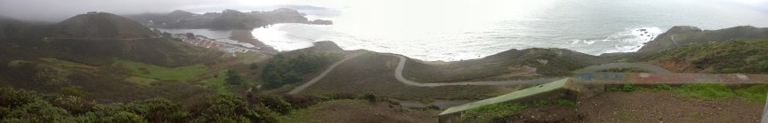
The second half of the trail was much drier and climbed a bit higher towards the Tillamook Lighthouse. That part of the hike got more direct sunlight, so we were able to shed some layers and feel the sun on our arms! It was much welcome after the chilly rains we’ve been having. We had some gorgeous views along the coast and couldn’t help but stop and take it all in. If you look closely in the second picture below you can see the Tillamook Rock Lighthouse – it’s the tiny speck on the far right. We looped around and ended up back at the beach. Rather than taking the same route, we walked part of the way back along the beach to get out of the mud for a minute, and had some fun running from the waves…they’ll sneak up on you as Matt found out.
On our way home, we stopped at the Cannon Beach Hardware store for lunch. Yep, a hardware store; there were a lot of screw and brew jokes, naturally. We downed some grub and had a beer before heading home. While it’s a drive, we definitely recommend making the day trip to the coast if you find yourself in Oregon.
We did it! We made it through another month (and 2 weeks, time is flying!). I must say, although this month certainly had its challenges, it was a million times easier than January. We’re still settling in and exploring the city (so much to do!) but so far we’re loving it.
The city at night, right outside our apartment
The two biggest differences between January and February were: 1.) Matt started his job, and 2.) we didn’t have to pack up and move weekly. For those of you who aren’t aware, Matt is working with a consulting company now and travels for work 4 days a week. We decided to be stationary for a few months so that he can still experience the area on the weekends and because, quite frankly, packing up our lives and a dog by myself sounds like a nightmare. As with any big change, there’ve been growing pains but we’re slowly figuring things out.
So…Portland. We rented an apartment right in the heart of downtown. We are a stone’s throw from pretty much everything. We’re walking distance to the Willamette River, Pearl and Alphabet Districts, and a quick drive or bus ride across the river to all the breweries.
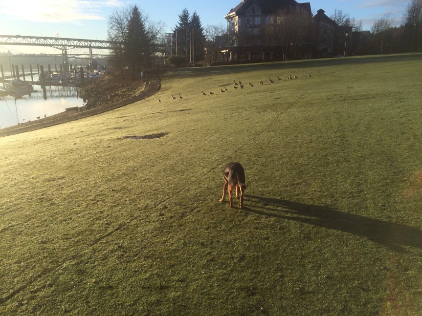
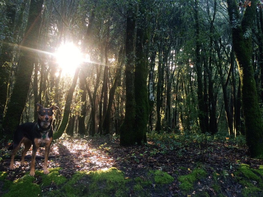
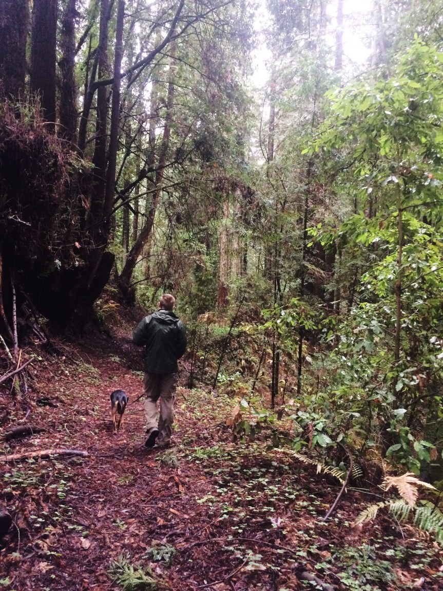
There’s been a lot of this:
Hamilton Mountain Trail at Beacon Rock Park, WA
A little lot of this (but, hey, we’re averaging 7 miles of walking a day so it evens out 🙂 )
PB&J chocolate ice cream from Salt and Straw
Creme brulee (with a vial of Cointreau) and blueberry bourbon basil doughnuts from Blue Star
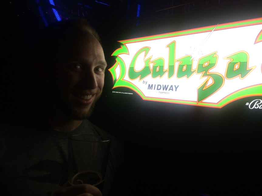
And even more of this:
Drinking buddy
We’re excited to see what else we can get into these next two months (already have a trip to Seattle, a MLS game. and some big hikes planned). Stay tuned!
Oh, and there’s also been a little of this, because when you’re home alone with a dog for half the week you have to entertain yourself:
While we didn’t love everything about our time in California, we did manage to find some hikes that we thoroughly enjoyed. One major thing we noticed was that very few California State Parks are dog friendly, so while it wasn’t impossible to find hiking it made it a little more difficult to find nice, long hikes that Snickers could partake in with us–parking lots constitute dog friendly park icons but we are talking about actual trails. That dog loves hiking maybe more than she loves Beth, but not Matt. She could never love anything more than she loves him.
Henry Cowell State Park
Afternoon in Henry Cowell State Park
Our first couple of hikes were around the Santa Cruz area at Henry Cowell State Park and the Land of Medicine Buddha. You can see some pictures from them in Santa Cruz in pictures. Henry Cowell State Park was a major letdown. Before we went, we did our research and it said that there were dog-friendly trails and found one that looked to be about 5 miles of single-track trail. Unfortunately, when we got there there were signs everywhere indicating that no dogs were allowed on that trail. In fact, the only trails that were actually dog friendly were paved trails or service roads…oh and the one “trail” that was actually a runoff ditch on the side of the road. It did look like there were decent hiking trails around and the forest was beautiful with all the redwoods, but if you’re going with a dog we’d say skip it.
Land of Medicine Buddha
Redwoods in Land of Medicine Buddha
The Land of Medicine Buddha, despite it’s weird name, was much better. The land is privately-owned and they have all sorts of wellness retreats there. The best part was they were extremely dog friendly! One of the very few places we found in Santa Cruz that was. We went on a drizzly day, and there were surprisingly a lot of people (and dogs) who had the same idea. We did a 6 mile loop around the property, which wound its way along a creek and through new redwood growth with plenty of ups and down to get our heart rates up. We’d give this hike four muddy puppy paws!
Reflective trails at Land of Medicine Buddha
Muir Beach to Rodeo Beach
While we were up in Napa we ventured to the coast and did our longest hike of the trip: 11 miles! We started at Muir Beach just north of San Francisco and made our way down the coast to Rodeo Beach. It was muddy, a bit rainy, and not crowded for most of it. The clouds and rain hindered our views a bit, but when the skies opened up we got some spectacular views of the mountains and coast. This trail kicked our butts. It was long, and it was up and down A LOT. We’re talking one whole mile uphill and one mile down. And it was an out and back so even though the downhills were nice, we knew we’d have to go right back up them. Needless to say we were tired and happy when we finished this one. We give this four muddy puppy paws and four exhausted human thumbs up.
Looking out over Rodeo Beach
just a boy and his girlfriend’s dog
Coastal Trail
Muir Beach
Wet day on Muir Beach trail
Wet day on Muir Beach trail
Yippee Kai Yay!
Panoramic of the trail down to Rodeo Beach, just when the sun breaks
Anthony Chabot Regional Park
Now it’s Matt’s turn! The dog and I took a backpacking trip to Anthony Chabot Regional Park, just East of Oakland, CA.
Anthony Chabot Regional Park Lake overlook (Oakland in the distance)
This was my last week before starting the new job, so I figured I had to take advantage of being out of work. I had originally planned to make the trek out to Lake Tahoe area to do some backcountry camping and hiking; however, when I made a call to the ranger station about permits I asked about the trail conditions and he said “they are not bad right now, only a foot of snow on most of it, but when you head up above 8,000 ft you will need snowshoes.” OMG, I thought, there is no way a foot of snow is “not bad”! I thanked him and decided I needed a non-snowy option.
I found Anthony Chabot a quick 1 hour drive from the southern side of San Jose. I wasn’t expecting much since it was listed as a regional park, and I was only able to do some car camping in marked spots. When I first entered the park I realized I was very wrong about my preconceived notions! The park is located on a high ridge about 20-30 miles East of Oakland, with some nice 3rd(??) growth redwoods.
Anthony Chabot Lake
Matt and Snickers backpacking in the 60 degree Jan CA afternoon
During the week at the end of January there were very few people camping, so I had my pick of sites. The dog and I first set out, though, a few hours before dark for a full-pack hike around the park. We did about 4 miles that first afternoon, making a loop from the campsite–check out the Garmin Anthony Chabot- 4mi tracks. After the hike we (I!) set up the tent with the remaining daylight and got the firewood purchased at the camp entrance ready! I had only packed necessary provisions, which consisted of a rice and beans soup mix (thank you for the Xmas gift McClains!). However, since I was car camping, I wanted additional sustenance, so the dog and I went out to get s’mores, hot dogs, and beer! My beer of choice was a good camping beer, Bourbon Barrel Aged Arrogant Bastard Stout. The campfire wood was pretty wet, so it made a sorry fire for the most part, but it heated the hot dogs and I must have chowed down on half the pack before bed.
Camping supplies
Set firewood for a tiny fire
Snickers and I curled up under the same sleeping bag when we were both finally able to settle down–sorry, no pics!
Anthony Chabot Lake in the morning
Turkeys in the campgrounds at Anthony Chabot morning
The next morning we struck camp and went for a 8 mile hike around the remainder of the park with the full pack–it simulated backcountry camping. We covered a lot of ground and had some really grueling hills. Too bad my Garmin died, so I didn’t get the tracks for the second day. After that sweaty romp, we were both beat and ready to head back to San Jose, to my sister’s place, for a shower, a nap, and to pack for a San Francisco weekend and moving to Portland!


")
")
")
")
")
")
")
")
")
")
")