Utah Progress Report: Months 2-4

Whew, the summer truly flew by. We haven’t done a progress report since early June, so this is long overdue. Most of our posts have been about hiking – with a few recipes thrown in for good measure – but we haven’t popped in for a proper life update. So, here goes.

20180811_133809

June, July, and August came and went faster than we expected. We had a couple of visitors and some personal trips planned, which led to busy few months. We went to southern Utah with Matt’s parents, Moab with Beth’s parents, Beth went to Boston, and Matt went to Vegas and on his annual fishing trip to Canada.

We were initially going to head to our next destination at the end of August, but due to some job flux and a rigorous running schedule, we’ve decided to stay put for another month. We’re a little torn because we were looking forward to spending a month or so in Wyoming. Luckily we’re a quick drive to Jackson Hole, so we’re planning to spend a long weekend exploring Yellowstone in a couple of weeks.

IMG_9340
Salt Lake City and County Building

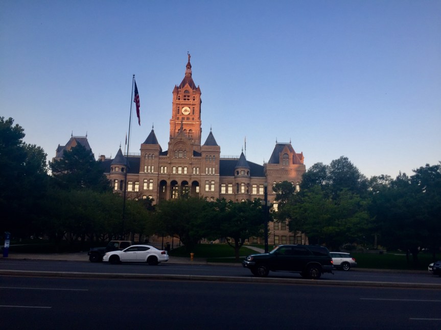
As far as the rest of our summer, it’s been great. We’ve gotten into a routine in our time here, so, while it might not be the most exciting, we’ve gotten to do the things we love: hike and drink good coffee and beer. The summers in Utah are HOT! It’s been great for getting to the pool, but there’s not a lot of shade in town so the sun can be a little unrelenting. Thankfully, the mountains are so close and we can hop in the car and be 20 degrees cooler in a quick 30 minutes. We also haven’t had much rain in the last 3 months so the grass is dry and wildfires are rampant. The skies have been pretty hazy and some mornings you can even smell the smoke. We actually saw a fire less than a mile from our apartment behind the Capitol!

18-06-02 11-43-18 8938

We’ve spent a lot of time on the trails, both in town and in the mountains, and it’s been great. The wildflowers are in bloom and you can’t beat a mountain trail. Beth’s been training for a race in October and has logged quite a few miles on the trails with Matt and Snickers joining at the end as the support crew. We also managed to get out to a professional rugby game one weekend. The only place you won’t see a line at the beer stand during halftime!

18-06-12 16-10-28 8969

18-06-23 08-58-22 9098

20180623_151323

With all of the travel, we haven’t tried too many new restaurants and breweries since our first update. We have managed to go back to a few favorites and have hit a handful of new “wins.” We tried RoHa the other week, and loved their selection on tap, plus their take-home high gravity beers. We also found some good lunch spots – Caputo’s deli for a meaty, Italian sandwich and Bagels and Greens for a bagel sandwich (Lox and Loaded is a go-to) that goes great with a cup of coffee. Speaking of coffee, Publik is a new favorite with bright, airy spaces and robust roasts. We’ve also hit up some nicer establishments for date night: Laziz Kitchen had some killer Mediterranean food, Water Witch was a nice, intimate spot for some pre-dinner cocktails, Takashi was amazing for sushi (we did omakase where we left the choice up to the chef and it was all so good; definitely worth the wait), and White Horse had tasty cocktails and tapas.

20180715_110103

We never thought Utah would be the place we’d stay the longest (5 months!), but we’re really enjoying our time here.

20180630_114827

July 2018 Hikes

Here are a few hikes we enjoyed in July.

Frary Peak Trail

Frary Peak is a 7 mile out-and-back hike on Antelope Island. We did this as a sunset hike on the 4th of July. To read Matt’s full recap, check out our post: Antelope Island Sunset Hike.

Devil’s Garden Double O Arch Trail

The Double O Arch Trail is located in the Devil’s Garden area of Arches National Park. We left Snickers at the hotel for this one since dogs aren’t allowed on trails in the National Parks. To be honest, we didn’t make it all the way back to the Double O Arch because it was sunset and we wanted to be off the trail before dark, but there are many other arches along the trail. The trail starts on a flat, sandy surface and winds through the fins to the Landscape Arch, which at 290ft is the world’s longest arch! It then scrambles along some slickrock faces to a ridge line. This is where we turned around and stopped at Navajo Arch and Partition Arch on the return.

Screen Shot 2018-08-01 at 4.32.55 PM

Corona Arch Trail 

Corona Arch trail is a moderately trafficked 2.5 mile trail in Moab. The trail has a slight climb at the beginning and then winds along the smooth rock to the towering arch. There is a section that you have to climb rock using cables and another section with a ladder, but overall it was a fairly moderate hike. Dogs are allowed on the trail but may need some assistance on the cables/ladder portions. It was easily 100 degrees the day we went, so go early to try and beat some of the desert heat. The arch at the end is worth the sweat.

Screen Shot 2018-08-01 at 4.34.39 PM

Spring Creek – Flying Dog Trail

The Flying Dog trail from Spring Creek is a 16.5 mile trail in Park City. It is heavily used by mountain bikes, but if you get there early enough, you can get some decent hiking in. Beth did this as part of a training program and did the entire loop in the counterclockwise direction while Matt and Snickers did an out-and-back meeting up at their mile 5. The loop gains 2,000 ft elevation over the course of 16 miles, but there are long switchbacks that make it less daunting. The first few miles winds through some neighborhoods making its way into the Aspen forest. After mile 8, the trail is pretty much downhill to the end with a slight climb around mile 13. It was a good way to log some distance, but with all of the bikes, we probably wouldn’t do it again.

Screen Shot 2018-08-01 at 4.35.42 PM

Lofty Lake Loop Trail – Uinta National Forest

The Uinta National Forest is located near the high Uintas wilderness area of the Uinta Mountains – roughly 80 miles from downtown Salt Lake. The drive through the mountains is gorgeous as you ascend from the valley through Park City and into the pine forests of the Uintas. The trail itself is lightly-to-moderately trafficked and not too difficult. There are areas of climbing, but they are concentrated in small sections with most of the trail being relatively flat. It is a 4.2 mile loop that winds through the wilderness past many lakes. One thing we loved was just how many lakes are concentrated in a small area. The wildflowers were in full bloom at the end of July making for more gorgeous scenery.

Screen Shot 2018-08-01 at 4.36.40 PM

Moab, UT

The second week in July, we hit the road for Moab – about 230 miles, or just shy of a 4 hour drive southeast from Salt Lake City. Maybe it was a bit crazy to hike in the desert when the temps were in the 100s, but we were hell-bent on visiting the two National Parks in the area: Arches and Canyonlands.

Arches National Park

IMG_4992 - IMG_4994_v1
Balanced Rock – Arches National Park

Arches is located on the Colorado Plateau near the Colorado River. With over 2,000 arches, it has the largest concentration of natural arches in the world. The majority of the rock in the park is sandstone. The arches are formed as water seeped into cracks and through the freeze-thaw cycle ice created pressure breaking off parts of the rock. As wind cleaned out loose particle, fins remained, which further give way to water and wind and became arches. You can see the some of the progress below – the pictures on the right shows the fin stage while the one on the left shows an arch. Fun fact, Skyline Arch (pictured in the photo on the right below) was actually only half that size until 1940 when a boulder fell out and doubled the opening. While we didn’t get to the most famous arch in the park – Delicate Arch – there are so many other beauties to see.

We went in the evening to beat the heat, and while it was still in the 90s the shade made it much more bearable. We drove through the park stopping at Balanced Rock and Skyline Arch before hiking through Devil’s Garden. We passed the Landscape Arch, which is one of the longest arches in the world, before climbing up the rock face to head back toward Double O Arch. We ended up turning around before we got there because the sun was setting and we didn’t want to be scrambling in the dark, but we were able to stop at the Partition and Navajo Arches on the way back. In the dark, we pulled up to the Delicate Arch viewpoint to try and capture it with a long exposure.

Corona Arch

Corona Arch is located along a trail in a side canyon along the Colorado River. The arch is partially free-standing and has an impressive 140 ft x 105 ft opening. The trail is relatively easy with only a few short, steep sections,  and is 2.3 miles round trip. It’s easy to follow with cairns and green paint to mark the way. While summer is probably not the most ideal time to hike in Moab, we went early in the morning before the sun got too high in the sky. This allowed for some shade along the way from the canyon walls and we were able to finish before the trail got too crowded. We ended the hike with a quick splash (for the dog) in the Colorado River.

Canyonlands National Park

Canyonlands National Park covers over 330,000 acres of land in southeastern Utah. It is one of the more remote National Parks with very little for services throughout; the NPS encourages you to take anything you might need for your visit with you due to the remoteness. The park is divided into three “districts” that are bounded by the Colorado and Green Rivers. You cannot access the different areas from within the park as there are no roads that cross the rivers. To get from one district to the next is anywhere from a 2-6 hour car ride.

IMG_5217 - IMG_5219_v1

The three districts that make up Canyonlands are: Island in the Sky,  The Needles, and The Maze. Island is the Sky, with its proximity to Moab, is the most highly visited area. Island in the Sky is a sandstone mesa that sits over 1,000 above the surrounding terrain. We visited the Grand Viewpoint, which is at the southernmost point of the scenic drive. It gives a great vista of the White Rim – a sandstone formation above the river convergence, as well as The Needles and The Maze.

The Needles is east of the Colorado River and is named after rock pinnacles that can be found in the landscape. The Needles was once the home of Pueblos, and there are still traces of their heritage including well-preserved petroglyphs. The Maze is located to the west of the Colorado and Green Rivers and is the most primitive area in Canyonlands. It is also one of the most remote and inaccessible areas in the entire United States, which has led to it being called on of the most dangerous places to hike. It has many geological features unique to the area including Orange Cliffs and Golden Stairs.