July 2018 Hikes

Here are a few hikes we enjoyed in July.

Frary Peak Trail

Frary Peak is a 7 mile out-and-back hike on Antelope Island. We did this as a sunset hike on the 4th of July. To read Matt’s full recap, check out our post: Antelope Island Sunset Hike.

Devil’s Garden Double O Arch Trail

The Double O Arch Trail is located in the Devil’s Garden area of Arches National Park. We left Snickers at the hotel for this one since dogs aren’t allowed on trails in the National Parks. To be honest, we didn’t make it all the way back to the Double O Arch because it was sunset and we wanted to be off the trail before dark, but there are many other arches along the trail. The trail starts on a flat, sandy surface and winds through the fins to the Landscape Arch, which at 290ft is the world’s longest arch! It then scrambles along some slickrock faces to a ridge line. This is where we turned around and stopped at Navajo Arch and Partition Arch on the return.
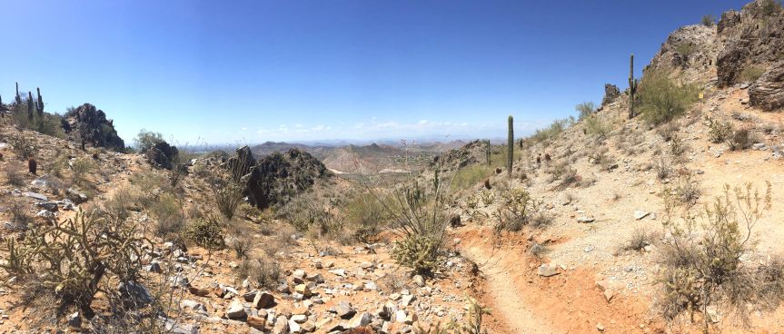
Screen Shot 2018-08-01 at 4.32.55 PM

Corona Arch Trail 

Corona Arch trail is a moderately trafficked 2.5 mile trail in Moab. The trail has a slight climb at the beginning and then winds along the smooth rock to the towering arch. There is a section that you have to climb rock using cables and another section with a ladder, but overall it was a fairly moderate hike. Dogs are allowed on the trail but may need some assistance on the cables/ladder portions. It was easily 100 degrees the day we went, so go early to try and beat some of the desert heat. The arch at the end is worth the sweat.

Screen Shot 2018-08-01 at 4.34.39 PM

Spring Creek – Flying Dog Trail

The Flying Dog trail from Spring Creek is a 16.5 mile trail in Park City. It is heavily used by mountain bikes, but if you get there early enough, you can get some decent hiking in. Beth did this as part of a training program and did the entire loop in the counterclockwise direction while Matt and Snickers did an out-and-back meeting up at their mile 5. The loop gains 2,000 ft elevation over the course of 16 miles, but there are long switchbacks that make it less daunting. The first few miles winds through some neighborhoods making its way into the Aspen forest. After mile 8, the trail is pretty much downhill to the end with a slight climb around mile 13. It was a good way to log some distance, but with all of the bikes, we probably wouldn’t do it again.

Screen Shot 2018-08-01 at 4.35.42 PM

Lofty Lake Loop Trail – Uinta National Forest

The Uinta National Forest is located near the high Uintas wilderness area of the Uinta Mountains – roughly 80 miles from downtown Salt Lake. The drive through the mountains is gorgeous as you ascend from the valley through Park City and into the pine forests of the Uintas. The trail itself is lightly-to-moderately trafficked and not too difficult. There are areas of climbing, but they are concentrated in small sections with most of the trail being relatively flat. It is a 4.2 mile loop that winds through the wilderness past many lakes. One thing we loved was just how many lakes are concentrated in a small area. The wildflowers were in full bloom at the end of July making for more gorgeous scenery.

Screen Shot 2018-08-01 at 4.36.40 PM

Moab, UT

The second week in July, we hit the road for Moab – about 230 miles, or just shy of a 4 hour drive southeast from Salt Lake City. Maybe it was a bit crazy to hike in the desert when the temps were in the 100s, but we were hell-bent on visiting the two National Parks in the area: Arches and Canyonlands.

Arches National Park

IMG_4992 - IMG_4994_v1
Balanced Rock – Arches National Park

Arches is located on the Colorado Plateau near the Colorado River. With over 2,000 arches, it has the largest concentration of natural arches in the world. The majority of the rock in the park is sandstone. The arches are formed as water seeped into cracks and through the freeze-thaw cycle ice created pressure breaking off parts of the rock. As wind cleaned out loose particle, fins remained, which further give way to water and wind and became arches. You can see the some of the progress below – the pictures on the right shows the fin stage while the one on the left shows an arch. Fun fact, Skyline Arch (pictured in the photo on the right below) was actually only half that size until 1940 when a boulder fell out and doubled the opening. While we didn’t get to the most famous arch in the park – Delicate Arch – there are so many other beauties to see.

We went in the evening to beat the heat, and while it was still in the 90s the shade made it much more bearable. We drove through the park stopping at Balanced Rock and Skyline Arch before hiking through Devil’s Garden. We passed the Landscape Arch, which is one of the longest arches in the world, before climbing up the rock face to head back toward Double O Arch. We ended up turning around before we got there because the sun was setting and we didn’t want to be scrambling in the dark, but we were able to stop at the Partition and Navajo Arches on the way back. In the dark, we pulled up to the Delicate Arch viewpoint to try and capture it with a long exposure.

Corona Arch

Corona Arch is located along a trail in a side canyon along the Colorado River. The arch is partially free-standing and has an impressive 140 ft x 105 ft opening. The trail is relatively easy with only a few short, steep sections,  and is 2.3 miles round trip. It’s easy to follow with cairns and green paint to mark the way. While summer is probably not the most ideal time to hike in Moab, we went early in the morning before the sun got too high in the sky. This allowed for some shade along the way from the canyon walls and we were able to finish before the trail got too crowded. We ended the hike with a quick splash (for the dog) in the Colorado River.

Canyonlands National Park

Canyonlands National Park covers over 330,000 acres of land in southeastern Utah. It is one of the more remote National Parks with very little for services throughout; the NPS encourages you to take anything you might need for your visit with you due to the remoteness. The park is divided into three “districts” that are bounded by the Colorado and Green Rivers. You cannot access the different areas from within the park as there are no roads that cross the rivers. To get from one district to the next is anywhere from a 2-6 hour car ride.

IMG_5217 - IMG_5219_v1

The three districts that make up Canyonlands are: Island in the Sky,  The Needles, and The Maze. Island is the Sky, with its proximity to Moab, is the most highly visited area. Island in the Sky is a sandstone mesa that sits over 1,000 above the surrounding terrain. We visited the Grand Viewpoint, which is at the southernmost point of the scenic drive. It gives a great vista of the White Rim – a sandstone formation above the river convergence, as well as The Needles and The Maze.

The Needles is east of the Colorado River and is named after rock pinnacles that can be found in the landscape. The Needles was once the home of Pueblos, and there are still traces of their heritage including well-preserved petroglyphs. The Maze is located to the west of the Colorado and Green Rivers and is the most primitive area in Canyonlands. It is also one of the most remote and inaccessible areas in the entire United States, which has led to it being called on of the most dangerous places to hike. It has many geological features unique to the area including Orange Cliffs and Golden Stairs.


Weekend trip to Southern Utah

Beth and Casey came to visit us back in June, and we road tripped to southern Utah to take in the sights. Utah is home to 5 National Parks, third only to Alaska and California, which both boast 8. Not only does Utah have these gorgeous parks, but it also ranks 3rd for most federally owned land – this includes not only the National Parks, but National Monuments, National Forests, and wilderness areas, to name a few. This is especially important because these publicly-owned lands provide protections to the land and wildlife, ensuring their preservation for the future.

We could go on and on about the benefits of preserving nature and how we shouldn’t be stripping those protections away, but that’s a post for another day :).

Back to our trip. We loaded up the car early Saturday morning heading to our final destination – Zion National Park. Since Utah has such amazing scenery and a high concentration of these lands are in the south, we made sure to detour and see as much as possible. On the list: Grand Staircase Escalante National Monument, Dixie National Forest, Bryce Canyon National Park, Zion National Park, and Cedar Breaks National Monument. For more about our hikes through all of these parks, check out our post on June 2018 Hikes.

Grand Staircase Escalante National Monument

20180616_143923_pano_v1

Grand Staircase Escalante – whose name derives from the Escalante River and geological “steps” corresponding to various time periods over millions of years – stretches from Bryce Canyon to the Grand Canyon. It is among some of the most remote in the country and was the last part of the contiguous United States to be mapped. There are five “steps” in the Grand Staircase: the pink cliffs formed of pink and red limestones that has many different rock formations including Bryce Canyon’s famous hoodoos; grey cliffs made of Cretaceous sandstone comprising the area between Bryce Canyon and Zion; white cliffs formed of Navajo sandstone and home of the majestic cliffs of Zion; the vermillion cliffs made of silt and found near Kanab; and the chocolate cliffs, which are the oldest formed of Kaibab limestone and makes the North Rim of the Grand Canyon. Needless to say, the sights were spectacular. Driving through the changing landscapes and noting the different geologic periods that made this possible kept us in awe of just how small we are in the grand scheme of things.

Bryce Canyon National Park

IMG_4589 - IMG_4590_v1

Bryce Canyon National Park has the highest concentration of hoodoos in the world. It’s at 8,000-9,000 ft elevation at the rim, which looks out over the canyon filled with hoodoos. Bryce Canyon is technically not a canyon, but an amphitheater created by headward erosion wherein erosion occurs at the origin of a stream in the opposite direction of the flow. This erosion has led to the exposure of hoodoos where a layer of soft rock (typically mudstone) has been covered by a layer of hard rock (limestone, sandstone) leaving spires. We only made it to Sunrise-Sunset point, where the views were spectacular, but there are many other viewpoints and hikes throughout the park.

Zion National Park

18-06-17 09-45-08 9060_v1

Zion National Park could have an entire post of its own. After visiting a handful of National Parks in the last couple of months, what struck us most about Zion is how majestic it is. While the park actually encompasses a large area from Zion Canyon to Kolob Canyon, most people only go through Zion Canyon in the southern end of the park. The north fork of the Virgin River cut through the Navajo sandstone creating looming, red cliffs. The park winds through a canyon, and due to the small size and high traffic is only accessible by shuttle in the summer months. There are plenty of trails and sights to see through the canyon including the Court of Patriarchs – a trio of peaks named after biblical figures Abraham, Isaac, and Jacob, Angel’s Landing – a rock formation that got its name because it appears that only angels could summit, and the famous narrows – the narrowest section of the canyon and an incredibly popular hike. We didn’t get to hike Angel’s Landing this time, but it’s on our list for our next visit.

Cedar Breaks National Monument

20180617_172628_pano_v1

Cedar Breaks is off the beaten path and easy to skip even if you’re in the area, but we would highly recommend visiting. It’s a natural “amphitheater” that stretches 3 miles wide and 2,000 feet deep. It’s not an amphitheater in the casual sense – no concerts are held there – but it is a rock formation that naturally amplifies sound. It is at 10,000 feet elevation and has rock formations similar to Bryce Canyon. We only ventured along the rim, but were awestruck by the magnitude of the space and just how far you could see out into the valley.

20180617_174605_pano (2).jpg

Dixie National Forest

Dixie National Forest is the largest forest in Utah, stretching across 2 million acres at the southern end of the state. In fact, most of the above national lands lie within the areas of Dixie. We were constantly passing through the forest as we wound our way to all of the National Parks and Monuments. The area is composed of many different ecosystems and is quite beautiful to behold.

To note: National Parks are not dog-friendly, but National Monuments and National Forests are.

June 2018 Hikes

Indian Trail – Ogden


In early June we headed up to Ogden to hike the Indian Trail. The trail is just shy of 8.5 miles and has 2,700 feet of gain. It follows an old Shoshoni Indian trail through the mountain pass, climbing up to Ogden Canyon and descending into Cold Water Canyon. It’s a steep climb and goes through various terrain – rocky and exposed at the bottom, winding through shady pines, and descending into a lush forest on the backside. The second half of the trail winds along a creek, which our (sometimes) water-loving dog thoroughly enjoyed. Once we got to the bottom, we turned around and did the whole thing in reverse.Screen Shot 2018-06-26 at 8.56.43 AM

Escalante Natural Bridge – Grand Staircase Escalante


Escalante Natural Bridge is a 4 mile out and back trail in the Grand Staircase Escalante National Monument. There will be a more detailed post about our trip to the National Monuments/Parks in Southern Utah later, but suffice to say, Grand Staircase Escalante is amazing. We detoured here on our way to Bryce Canyon for the simple fact that National Parks don’t allow dogs and we wanted to hike with Snickers. The trail itself is flat and easy, though it is very sandy and there are about 4 stream crossings. We’d recommend wearing sandals or shoes you don’t mind getting wet. The trail goes through a canyon surrounded by sheer, red rock faces. There are supposedly petroglyphs on the walls, though we didn’t see any. It makes its way through desert landscape until it ends at a gorgeous natural bridge. We went in the afternoon and the trail was completely empty despite the parking lot being full. It was a perfect place to stretch our legs after a long drive.

Screen Shot 2018-06-26 at 9.09.27 AM

Navajo Loop Trail – Bryce Canyon National Park


Bryce Canyon is unlike anything we’ve ever seen before. It’s spotted with hoodoos, which are tall, thin spires of rock that formed when a thick layer of soft rock (mudstone, sandstone) is covered by a thin layer of hard rock (limestone, basalt) that protects the softer layer from erosion. Our initial plan was to just go to some of the lookouts and walk the Sunrise-Sunset trail since that’s the only place dogs are allowed, but Beth and Casey offered to hang out with Snickers on the rim so Matt and I could do a quick hike of the Navajo Loop Trail. The trail is short (1.3 miles) and not too difficult. It winds down via switchbacks into an amphitheater and loops around through fir trees before climbing back up to Sunset Point. The views were amazing throughout and the rock formations were incredible. The trail meets up with other trails at the bottom, so you could easily log some miles in the canyon if you have time (and don’t have a dog).

The Narrows – Zion National Park

The Narrows is the last stop along the Zion Canyon bus ride.  This place is aptly named, as you drive up this curvy road the walls becoming closer and higher until you arrive at the bus stop where you are in the flat washout from a hard cut river with tower rocks on both sides.  There is a 1 mile walk from the bus stop to the Narrows proper where you will see hundreds (thousands!) of people wearing goofy rental water hiking shoes in the mid-morning going for a COLD! walk in the shallow, rocky water.  We walked maybe a half mile up the river where it never gets above waist deep; however, the more adventurous will want to start at the end and do the 14 mile water hike descent.


My parents had this as their must-see item on the trip into Zion and it doesn’t disappoint.  No dogs allowed on this section, so it was just the three of us here while Beth did the Pa’rus trail.

Pa’rus trail – Zion National Park


18-06-17 10-15-59 9072_v1

While Matt, Beth, and Casey were off enjoying the Narrows, Snickers and I explored Zion a different way. Unfortunately dogs aren’t allowed (which we knew going in) so we walked along the Pa’rus trail and up the Scenic Road for a total of 10 miles. The Pa’rus trail is a nice, paved path that winds along the Virgin River and into the canyon. You can see all of the incredible rock formations that Zion is known for with very little disruption from other people. Snickers loved getting to play in the river to cool off and I enjoyed a leisurely walk. Since we knew it would be a while before the gang got back, we also walked along the road to Zion Lodge so we could experience a taste of what goes on in the park. Cars aren’t allowed on the road during the summer – only shuttle buses – so we didn’t have to worry too much about traffic. The pink and red sandstone cliffs are a sight to behold and we enjoyed just being outside and exploring.

Screen Shot 2018-06-26 at 9.26.01 AM

Holbrook Canyon Trail – Bountiful

We hiked this trail back in May, but came back for an easy weekend hike/jog in June. Check out our May Hikes post if you want to see this trail again 🙂

Everything Bagels

Not to turn this into a baking blog, but here’s another recipe we tried and loved.

I’m typically a sweet > savory person when it comes to breakfast foods, but Matt may have changed my mind when it comes to lox bagels. We like having bagel sandwiches for breakfast or lunch, and since we don’t have many food options close by in SLC we decided to make our own.

Yeasted dough is a bit of a time commitment because it needs to rise twice, but it could be made the night before and allowed to do the second rise in the fridge; just make sure to let it come to room temperature before baking for an even bake.  You could easily make this recipe sweet with the addition of blueberries or cinnamon and raisin, or even just make them plain. We actually made a few with jalapeño and cheddar, which were fantastic with a little cream cheese, egg, and bacon. The possibilities for combinations are endless!

For the everything bagel seasoning, you can make your own, but we use Everything But the Bagel seasoning from Trader Joe’s. It’s convenient and has all the goodies pre-mixed. We loaded these bagels with smoked salmon, cream cheese, capers, and red onions. Yum!

20180518_114609_v1

Bagels

Makes 5 medium-sized bagels

Mix water, sugar, and yeast together in a small bowl or measuring cup and allow to sit for ~10 minutes until yeast has bloomed and is bubbly.

In a large bowl or bowl of stand mixer combine 1 C of flour and salt. Mix in activated yeast mixture and work with hands or bread attachment until a sticky dough has formed. Continue to add in remaining flour until dough is stiff. Knead with hands on a lightly floured surface or in mixer with bread attachment for 8-10 minutes until dough is smooth and elastic.

Lightly oil a large bowl and place dough inside, turning to coat. Cover with a damp cloth and let rest for 15-20 minutes. Punch down dough and divide into 5 even portions. To form the dough, either roll dough into a ball, poke a hole in the middle with your finger, and stretch until it is about 1-2 in diameter, or roll into a rope and pinch the ends together. Let rise for 20-30 minutes.

While dough is rising, preheat oven to 350°F and fill a large pot with water and boil on the stove. When dough has risen, drop into boiling water and boil for 30 seconds to 1 minute on each side (1-2 minutes total per bagel). Pat dry with a paper towel and place on baking sheet.

Beat egg in a small bowl and brush over the top of the boiled bagels. Sprinkle liberally with seasoning mix. Bake for 20-30 minutes until golden brown.

20180518_114632_v1

Utah Progress Report: Month 1

We’ve been in Utah for a month now! Since neither of us had been to Utah before, we didn’t know what to expect and we’ve been pleasantly surprised by how much we’re enjoying it here.

The thing we love the most is the outdoors and how accessible the mountains are. Our biggest gripe with Denver was that we had to drive a good 30-45 minutes to get to any trails in the foothills, but here they’re basically our “backyard.” We can’t help but be awestruck when we’re walking down the street and see the snow-capped peaks looming in the distance. And we’re only 2 miles away from the closest trail! Another thing that we can’t get over is how many rose bushes there are. We thought Portland had a lot, but SLC is giving them a run for their money. It seems like every yard is littered with giant bushes in a myriad of colors from yellow to red to coral and lavender. The city sure is beautiful in the spring.

IMG_8935

The weather has been nothing short of amazing. Sure, there have been some cool, rainy days, but for the most part we’ve had sunny skies and warm temperatures. It’s been great for getting out on hikes or just lounging around the pool after work. When the storm clouds do roll in, the skies get all moody and some really neat cloud formations hang over the mountain tops.

18-05-14 16-08-03 8878_v1
Storm clouds over the foothills
20180508_114528
Afternoon work from the pool

We spend a lot of time just walking around and getting to know the neighborhood. A typical evening for us usually involves walking up to the Capitol and letting Snickers play in the grass or just checking out all of the interesting houses in the Marmalade District. We found out that many of the homes were built before the housing laws were enacted, so there are vastly different styles (we’re talking log cabin, Victorian, 50s style ranch) nestled next to each other. It’s been fun learning some of the history of the area.

Our apartment is just north of downtown right at the base of Capitol Hill. The views of the city from the rooftop are pretty spectacular. We chose this particular building because it has great amenities – we have a state of the art gym and a fantastic rooftop pool – but the drawback is there aren’t many food options around. We’re about a mile from the nearest coffee shop and restaurant, so grabbing a quick lunch or latte while we’re working isn’t much of an option. On the plus side we’re cooking a lot more at home than we have in a while!

Speaking of restaurants, we’ve hit up our fair share in the time we’ve been here. We’ve found a plethora of Mexican food and some really delicious Asian fare. Some places we’ve tried and liked:

  • Mexican food: Red Iguana 2
  • Asian: All Chay (Vietnamese), Hong Kong Tea House (Chinese and Dim Sum), Laan Na Thai, Korea House
  • Lunch fare: Spitz (Mediterranean style)
  • Sweets: Banbury Cross Donuts, Normal (soft serve ice cream), Fresh Donut and Deli
  • Pizza: The Pie (greasy and loaded – perfect after a hike)
  • Dinner fare: Pallet (good cocktails and charcuterie board)

18-05-16 18-35-49 8885_v1

While there are some crazy liquor laws in this state (have you ever heard of brandy in a margarita??) there’s no shortage of breweries serving up tasty brews. The downside is that they can only serve 4% beer in the breweries, but the plus side is they’re pretty cheap. All of the breweries do make high gravity beers, you just have to buy them in bottles or cans and take them home – can’t drink them in house. Epic is the exception to this rule because of a loophole they use: it’s a “tapless” tap house (i.e. they pour from the bottles). They only have 6 seats, you have to be seated to taste, and also have to order food, but it’s a really cool space and concept.

  • Kiito’s: nestled in an old, industrial area of town it’s serving up tasty sours and ales. The row of pinball machines and a pizza food truck outside made it so we could’ve stayed for hours.
  • Fisher: great outdoor patio, and very dog-friendly. Decent beers on tap.
  • Mountain West: this is actually a cider house! We’re not the biggest cider fans, but they have some crisp brews that are nice on a hot summer day. They also have a large patio and serve beer from Red Rock if you’re not into cider.
  • Red Rock: not a tasting room, but right down the street and good place to get bottles to go.
  • Proper: huge area with a tasting room and restaurant. We just picked up a couple of bottles here, but would love to go back and stay a while.
  • Epic: It’s a very small tasting room, but worth it if you can snag a seat. The tasters are super cheap – ranging from 50 cents to $1 for a 2oz pour. We tried just about everything on the menu and it was all superb.

20180503_162748.jpg

All-in-all we’re thoroughly enjoying ourselves here and can’t wait to see what we get into the next few months!

20180504_154809
Utah is Snickers approved

May 2018 Hikes

Bonneville Shoreline Trail

The Bonneville Shoreline Trail (BST) is part of a system that runs along the Wasatch foothills along the shoreline of ancient Bonneville Lake. Right now there are roughly 100 miles of completed trail, but the hope is to have a trail that stretches from the Idaho border to Nephi, UT – closet to 280 miles of trail! Luckily for us, it runs right through downtown Salt Lake City, and is a mere 2-3 miles from our apartment. We love doing small portions for an easy, accessible weekday run. The trail is on the easy side of moderate and doesn’t gain much elevation, so it’s been a great way to get in some trail time without killing ourselves. We like to start either at City Creek near the Capitol or at the Terrace Hills Trailhead.

Emigration Canyon Miner’s Trail

We hiked the 6 mile Miner’s Trail in Emigration Canyon our first weekend in Utah. The road into the canyon is packed with bikers going up and coming down – it made us a little sad we didn’t bring our bikes along. There isn’t much parking at the trailhead, so best to get there early, but it also makes for a relatively undisturbed hike. The first portion of the trail was rocky and exposed with a slight grade. The wildflowers were in full bloom which made for a gorgeous backdrop across the canyon. There is a small creek about halfway up, and most people stop there. We continued on along the backside of the hill towards Red Butte Canyon. The trail climbed quickly, was muddy, and still covered in snow in places which made for a slippery climb. The effort was worth it for the views at the top across the Salt Lake Valley.

Screen Shot 2018-05-28 at 4.10.14 PM

Holbrook Canyon

Holbrook Canyon trail is a 5 mile trail near Bountiful, UT, just north of Salt Lake City. The trail runs along a creek and there are numerous creek crossings. It gains a bit of elevation, but it’s gradual and doesn’t feel too taxing. Some of the crossings have bridges, but once you get about a mile in, there are just logs and rocks. If the water is high, be prepared to get your feet wet. We went after a rain and had soggy shoes by the end. The trail is nicely shaded and lightly trafficked. While you don’t get much for views in the canyon that you do on some of the other trails, its secluded nature made it one of the most enjoyable hikes we’ve been on in a while.

Screen Shot 2018-05-28 at 4.09.50 PM

Grandeur Peak – West Side

Grandeur Peak West Side trail is a 5 mile out and back trail located 13 miles south of downtown Salt Lake City. There are two trails leading to the peak – the east side is more accessible with less elevation and a moderate climb while the west side is rated difficult and climbs over 3,000 ft. in 2.5 miles. The trail starts steep and climbs steadily all the way to the top. We took it slow and steady, but it’s a leg burner for sure. The views were spectacular all along the trail; you get amazing views of the Valley on the way up and even better ones of Parley’s Canyon to the north and east once you reach the summit. It’s best to do this route on a cool or overcast day as there’s little shade, though the summit – at 8,200 ft. – can be quite cool. The hike down is equally difficult and killed our quads; definitely a great way to get in a workout.

Screen Shot 2018-05-28 at 4.09.19 PM

Rob’s Trail

We combined Rob’s Trail to Mid Mountain Trail to Ridge Connector for a hike/run just shy of 9 miles. The trail is in Park City, UT and is used for both hiking and mountain biking. The trail is an out-and-back and gains about 1,800 feet over the course of 4.5 miles. It starts at around 7,100 ft. elevation and climbs to just shy of 9,000 – while SLC is at about 4,500 ft. we still found ourselves gasping for air on more than one occasion. It’s a gradual climb with plenty of switchbacks and is well shaded. There are quite a few intersections with other trails, but all are very well marked with signs and maps. It’s a beautiful location, and a great spot to do as much or little trail as you desire. Park City is a ski town, so you can see plenty of runs down the mountain and the trail crosses them a few times. There was still a bit of snow in the upper, shaded portions of the trail, which Snickers loved and seemed to gain energy from :). We turned around when we got to the ridge line, but there were trails in either direction leading up to double black diamond ski slopes. We did a combo hike/jog – mostly hiking on the uphills and running on the way down.

Screen Shot 2018-05-28 at 4.08.37 PM

Phoenix Hikes

We unfortunately didn’t get to do a ton of hiking while we were in Phoenix. We had a few days of glorious weather, but most days the sun got so hot by 10am that we couldn’t be out as much or as long as we would have liked. Regardless, we managed to find plenty of trails in the area to get our legs moving and blood pumping.

Petrified Forest National Park


We didn’t actually hike through here, but there are plenty of trails winding through the park. We ended up doing a detour on our way from Albuquerque to Phoenix to drive through the Petrified Forest. Pets are allowed on all trails – a rarity for National Parks and a huge plus for us! The park is filled with petrified wood and colorful badlands providing a very unique and beautiful backdrop. The trees are hundreds of millions of years old and have become fossils from silica deposits. The painted desert area is amazing with it’s stratified layers of different rock – siltstone, shale, and mudstone.

Papago Park

Papago Park is located between Tempe and Scottsdale and has plenty of biking and hiking trails. While none of them are very strenuous, it can’t be beat for a quick outing inside the city. We went to this park a couple of times – once for a short walk and another for a trail run. There’s a short trail to the “Hole in the Rock” (pictured above) that provides a nice vista of Tempe and downtown Phoenix. The park is also scattered with some ponds and backs up to the botanical gardens. For a trail run or a longer walk, there are numerous trails up to and around the buttes that’s an easy way to log a few miles.

Phoenix Mountain Preserve

18-04-20 13-55-36 8754_v1

This park is just north of Phoenix. A popular hike is to Piestewa Peak, but it’s very crowded and dogs aren’t allowed so we bypassed that in favor of the circumference trail. The first time I went with Snickers with the hopes of circumventing the peak, but at 9am the sun was blazing and I barely had enough water for Snickers so we just did a quick 3 miles out and back. The second time, I left the dog at home and did the full 4.5 miles solo. While not an impossible trail, it’s not for the faint of heart. In 4.5 miles, the trail climbs about 1,300 feet, but the views at the top are well worth the effort and the backside is deserted providing a fun, mostly downhill jog.

Lake Pleasant

Lake Pleasant is about 40 miles directly north of Phoenix. We ventured up one weekend with the hopes of doing a 6 mile run, but cut it to a 3 mile walk so we could enjoy the new scenery and conserve water. We walked along a burro trail near a wash surrounded by plenty of cacti and some decent views of the lake. It was a really lightly trafficked trail – we only saw two people! This trail in the Sonoran Desert is littered with saguaro cacti. Fun fact: saguaros only start growing arms when they reach 15ft. in height, which takes about 75 years!!

McDowell Mountain Regional Park

About 40 miles northwest of Phoenix lies McDowell Mountain Regional Park, which is a veritable playground for mountain bikers. We did the Scenic Trail, a relatively mild 4.5 mile trail through quintessential dessert landscape. Just a short climb and we had some great views for miles across the Valley. If we had a little more time, we would’ve loved to go back and log some serious miles on our feet.

Lemon Cream Cheese Cookies

IMG_4416_v1

This is a bit of a detraction from our usual style, but I came across these cookies and had to share. This is a Nordstrom recipe that a friend sent me and I altered slightly. The cookies have a light, cake-like texture that is brightened by the lemon zest. The frosting adds a sharp, citrusy zing that elevates the cookies to another level. We recommend pairing them with a nice cup of coffee :).

IMG_4418_v1

Lemon cream cheese cookies

Note: dough needs to made 1 day ahead of time so it can be frozen prior to baking

1 1/4 cups all-purpose flour
1 1/2 teaspoons baking powder
1 1/2 teaspoons salt
1/2 cup (1 sticks) unsalted butter, at room temperature
1 cup granulated sugar
1 large egg
1 – 8oz package of cream cheese
Grated zest of 2 lemons
Juice from 1/2 lemon

  1. Mix flour, baking powder, and salt together in a bowl and set aside.
  2. Cream butter and sugar in large bowl until light and fluffy (~2-3 minutes). Add in the egg and mix until incorporated. On low speed, add in the cream cheese until well mixed. Mix in lemon zest and juice.
  3. Gradually add in the flour mixture and mix until incorporated. Dough will be very soft – almost like a muffin batter.
  4. Line a baking sheet with parchment paper or silpat and portion out ~12 balls of dough. Freeze until solid, at least 12 hours.
  5. When ready to bake, preheat oven to 325, and line a baking sheet with parchment paper or silpat. Place dough on prepared sheets spaced roughly 2 inches apart. Let stand at room temperature while oven is preheating (~20-30 mins).
  6. Bake for 20-25 minutes until lightly browned; rotate pans halfway through baking.
  7. Let cool completely before icing.

Lemon buttercream frosting

1/4 cup unsalted butter, at room temperature
1 1/2 cups powdered sugar
Juice of 1/2 lemon
Grated zest of 1 lemon

  1. Cream butter until light. Add powdered sugar and mix until blended. Add lemon juice and mix until smooth.

Once cookies have cooled, spread icing over the top and sprinkle with lemon zest.

IMG_4422_v1

IMG_4424_v1

Original recipe for Nordstrom Lemon Ricotta Cookies

Utah!

We’ve only been in Salt Lake City for a week and a half, but are quickly realizing why so many people love it here. For starters, it is completely surrounded by mountains with no shortage of trails in just a 3 mile radius. Snickers and I snapped this photo on our run this past week, and let’s just say we can’t wait to put some more miles on our paws.

IMG_8856

We’re here through the end of August, so if anyone wants to come visit let us know! We got a two bedroom apartment this time so we’re well equipped to host. Did I mention the rooftop pool with 360° mountain views??

And, for kicks, here is a photo from our drive up from Arizona. We took the eastern route around the Grand Canyon and stopped at Horseshoe Bend in Page, AZ for a quick stretch of the legs. The views did not disappoint 😊.

IMG_8810