
We unfortunately didn’t get to do a ton of hiking while we were in Phoenix. We had a few days of glorious weather, but most days the sun got so hot by 10am that we couldn’t be out as much or as long as we would have liked. Regardless, we managed to find plenty of trails in the area to get our legs moving and blood pumping.
Petrified Forest National Park


We didn’t actually hike through here, but there are plenty of trails winding through the park. We ended up doing a detour on our way from Albuquerque to Phoenix to drive through the Petrified Forest. Pets are allowed on all trails – a rarity for National Parks and a huge plus for us! The park is filled with petrified wood and colorful badlands providing a very unique and beautiful backdrop. The trees are hundreds of millions of years old and have become fossils from silica deposits. The painted desert area is amazing with it’s stratified layers of different rock – siltstone, shale, and mudstone.
Papago Park


Papago Park is located between Tempe and Scottsdale and has plenty of biking and hiking trails. While none of them are very strenuous, it can’t be beat for a quick outing inside the city. We went to this park a couple of times – once for a short walk and another for a trail run. There’s a short trail to the “Hole in the Rock” (pictured above) that provides a nice vista of Tempe and downtown Phoenix. The park is also scattered with some ponds and backs up to the botanical gardens. For a trail run or a longer walk, there are numerous trails up to and around the buttes that’s an easy way to log a few miles.
Phoenix Mountain Preserve
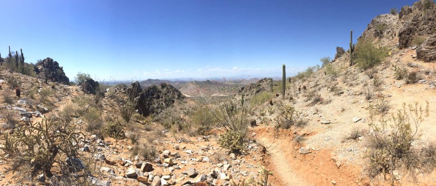
This park is just north of Phoenix. A popular hike is to Piestewa Peak, but it’s very crowded and dogs aren’t allowed so we bypassed that in favor of the circumference trail. The first time I went with Snickers with the hopes of circumventing the peak, but at 9am the sun was blazing and I barely had enough water for Snickers so we just did a quick 3 miles out and back. The second time, I left the dog at home and did the full 4.5 miles solo. While not an impossible trail, it’s not for the faint of heart. In 4.5 miles, the trail climbs about 1,300 feet, but the views at the top are well worth the effort and the backside is deserted providing a fun, mostly downhill jog.
Lake Pleasant


Lake Pleasant is about 40 miles directly north of Phoenix. We ventured up one weekend with the hopes of doing a 6 mile run, but cut it to a 3 mile walk so we could enjoy the new scenery and conserve water. We walked along a burro trail near a wash surrounded by plenty of cacti and some decent views of the lake. It was a really lightly trafficked trail – we only saw two people! This trail in the Sonoran Desert is littered with saguaro cacti. Fun fact: saguaros only start growing arms when they reach 15ft. in height, which takes about 75 years!!
McDowell Mountain Regional Park


About 40 miles northwest of Phoenix lies McDowell Mountain Regional Park, which is a veritable playground for mountain bikers. We did the Scenic Trail, a relatively mild 4.5 mile trail through quintessential dessert landscape. Just a short climb and we had some great views for miles across the Valley. If we had a little more time, we would’ve loved to go back and log some serious miles on our feet.

One thought on “Phoenix Hikes”