June 2018 Hikes

Indian Trail – Ogden


In early June we headed up to Ogden to hike the Indian Trail. The trail is just shy of 8.5 miles and has 2,700 feet of gain. It follows an old Shoshoni Indian trail through the mountain pass, climbing up to Ogden Canyon and descending into Cold Water Canyon. It’s a steep climb and goes through various terrain – rocky and exposed at the bottom, winding through shady pines, and descending into a lush forest on the backside. The second half of the trail winds along a creek, which our (sometimes) water-loving dog thoroughly enjoyed. Once we got to the bottom, we turned around and did the whole thing in reverse.Screen Shot 2018-06-26 at 8.56.43 AM

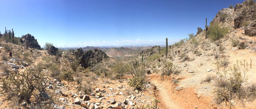
Escalante Natural Bridge – Grand Staircase Escalante


Escalante Natural Bridge is a 4 mile out and back trail in the Grand Staircase Escalante National Monument. There will be a more detailed post about our trip to the National Monuments/Parks in Southern Utah later, but suffice to say, Grand Staircase Escalante is amazing. We detoured here on our way to Bryce Canyon for the simple fact that National Parks don’t allow dogs and we wanted to hike with Snickers. The trail itself is flat and easy, though it is very sandy and there are about 4 stream crossings. We’d recommend wearing sandals or shoes you don’t mind getting wet. The trail goes through a canyon surrounded by sheer, red rock faces. There are supposedly petroglyphs on the walls, though we didn’t see any. It makes its way through desert landscape until it ends at a gorgeous natural bridge. We went in the afternoon and the trail was completely empty despite the parking lot being full. It was a perfect place to stretch our legs after a long drive.

Screen Shot 2018-06-26 at 9.09.27 AM

Navajo Loop Trail – Bryce Canyon National Park


Bryce Canyon is unlike anything we’ve ever seen before. It’s spotted with hoodoos, which are tall, thin spires of rock that formed when a thick layer of soft rock (mudstone, sandstone) is covered by a thin layer of hard rock (limestone, basalt) that protects the softer layer from erosion. Our initial plan was to just go to some of the lookouts and walk the Sunrise-Sunset trail since that’s the only place dogs are allowed, but Beth and Casey offered to hang out with Snickers on the rim so Matt and I could do a quick hike of the Navajo Loop Trail. The trail is short (1.3 miles) and not too difficult. It winds down via switchbacks into an amphitheater and loops around through fir trees before climbing back up to Sunset Point. The views were amazing throughout and the rock formations were incredible. The trail meets up with other trails at the bottom, so you could easily log some miles in the canyon if you have time (and don’t have a dog).

The Narrows – Zion National Park

The Narrows is the last stop along the Zion Canyon bus ride.  This place is aptly named, as you drive up this curvy road the walls becoming closer and higher until you arrive at the bus stop where you are in the flat washout from a hard cut river with tower rocks on both sides.  There is a 1 mile walk from the bus stop to the Narrows proper where you will see hundreds (thousands!) of people wearing goofy rental water hiking shoes in the mid-morning going for a COLD! walk in the shallow, rocky water.  We walked maybe a half mile up the river where it never gets above waist deep; however, the more adventurous will want to start at the end and do the 14 mile water hike descent.


My parents had this as their must-see item on the trip into Zion and it doesn’t disappoint.  No dogs allowed on this section, so it was just the three of us here while Beth did the Pa’rus trail.

Pa’rus trail – Zion National Park


18-06-17 10-15-59 9072_v1

While Matt, Beth, and Casey were off enjoying the Narrows, Snickers and I explored Zion a different way. Unfortunately dogs aren’t allowed (which we knew going in) so we walked along the Pa’rus trail and up the Scenic Road for a total of 10 miles. The Pa’rus trail is a nice, paved path that winds along the Virgin River and into the canyon. You can see all of the incredible rock formations that Zion is known for with very little disruption from other people. Snickers loved getting to play in the river to cool off and I enjoyed a leisurely walk. Since we knew it would be a while before the gang got back, we also walked along the road to Zion Lodge so we could experience a taste of what goes on in the park. Cars aren’t allowed on the road during the summer – only shuttle buses – so we didn’t have to worry too much about traffic. The pink and red sandstone cliffs are a sight to behold and we enjoyed just being outside and exploring.

Screen Shot 2018-06-26 at 9.26.01 AM

Holbrook Canyon Trail – Bountiful

We hiked this trail back in May, but came back for an easy weekend hike/jog in June. Check out our May Hikes post if you want to see this trail again 🙂

May 2018 Hikes

Bonneville Shoreline Trail

The Bonneville Shoreline Trail (BST) is part of a system that runs along the Wasatch foothills along the shoreline of ancient Bonneville Lake. Right now there are roughly 100 miles of completed trail, but the hope is to have a trail that stretches from the Idaho border to Nephi, UT – closet to 280 miles of trail! Luckily for us, it runs right through downtown Salt Lake City, and is a mere 2-3 miles from our apartment. We love doing small portions for an easy, accessible weekday run. The trail is on the easy side of moderate and doesn’t gain much elevation, so it’s been a great way to get in some trail time without killing ourselves. We like to start either at City Creek near the Capitol or at the Terrace Hills Trailhead.

Emigration Canyon Miner’s Trail

We hiked the 6 mile Miner’s Trail in Emigration Canyon our first weekend in Utah. The road into the canyon is packed with bikers going up and coming down – it made us a little sad we didn’t bring our bikes along. There isn’t much parking at the trailhead, so best to get there early, but it also makes for a relatively undisturbed hike. The first portion of the trail was rocky and exposed with a slight grade. The wildflowers were in full bloom which made for a gorgeous backdrop across the canyon. There is a small creek about halfway up, and most people stop there. We continued on along the backside of the hill towards Red Butte Canyon. The trail climbed quickly, was muddy, and still covered in snow in places which made for a slippery climb. The effort was worth it for the views at the top across the Salt Lake Valley.

Screen Shot 2018-05-28 at 4.10.14 PM

Holbrook Canyon

Holbrook Canyon trail is a 5 mile trail near Bountiful, UT, just north of Salt Lake City. The trail runs along a creek and there are numerous creek crossings. It gains a bit of elevation, but it’s gradual and doesn’t feel too taxing. Some of the crossings have bridges, but once you get about a mile in, there are just logs and rocks. If the water is high, be prepared to get your feet wet. We went after a rain and had soggy shoes by the end. The trail is nicely shaded and lightly trafficked. While you don’t get much for views in the canyon that you do on some of the other trails, its secluded nature made it one of the most enjoyable hikes we’ve been on in a while.

Screen Shot 2018-05-28 at 4.09.50 PM

Grandeur Peak – West Side

Grandeur Peak West Side trail is a 5 mile out and back trail located 13 miles south of downtown Salt Lake City. There are two trails leading to the peak – the east side is more accessible with less elevation and a moderate climb while the west side is rated difficult and climbs over 3,000 ft. in 2.5 miles. The trail starts steep and climbs steadily all the way to the top. We took it slow and steady, but it’s a leg burner for sure. The views were spectacular all along the trail; you get amazing views of the Valley on the way up and even better ones of Parley’s Canyon to the north and east once you reach the summit. It’s best to do this route on a cool or overcast day as there’s little shade, though the summit – at 8,200 ft. – can be quite cool. The hike down is equally difficult and killed our quads; definitely a great way to get in a workout.

Screen Shot 2018-05-28 at 4.09.19 PM

Rob’s Trail

We combined Rob’s Trail to Mid Mountain Trail to Ridge Connector for a hike/run just shy of 9 miles. The trail is in Park City, UT and is used for both hiking and mountain biking. The trail is an out-and-back and gains about 1,800 feet over the course of 4.5 miles. It starts at around 7,100 ft. elevation and climbs to just shy of 9,000 – while SLC is at about 4,500 ft. we still found ourselves gasping for air on more than one occasion. It’s a gradual climb with plenty of switchbacks and is well shaded. There are quite a few intersections with other trails, but all are very well marked with signs and maps. It’s a beautiful location, and a great spot to do as much or little trail as you desire. Park City is a ski town, so you can see plenty of runs down the mountain and the trail crosses them a few times. There was still a bit of snow in the upper, shaded portions of the trail, which Snickers loved and seemed to gain energy from :). We turned around when we got to the ridge line, but there were trails in either direction leading up to double black diamond ski slopes. We did a combo hike/jog – mostly hiking on the uphills and running on the way down.

Screen Shot 2018-05-28 at 4.08.37 PM

Phoenix Hikes

We unfortunately didn’t get to do a ton of hiking while we were in Phoenix. We had a few days of glorious weather, but most days the sun got so hot by 10am that we couldn’t be out as much or as long as we would have liked. Regardless, we managed to find plenty of trails in the area to get our legs moving and blood pumping.

Petrified Forest National Park


We didn’t actually hike through here, but there are plenty of trails winding through the park. We ended up doing a detour on our way from Albuquerque to Phoenix to drive through the Petrified Forest. Pets are allowed on all trails – a rarity for National Parks and a huge plus for us! The park is filled with petrified wood and colorful badlands providing a very unique and beautiful backdrop. The trees are hundreds of millions of years old and have become fossils from silica deposits. The painted desert area is amazing with it’s stratified layers of different rock – siltstone, shale, and mudstone.

Papago Park

Papago Park is located between Tempe and Scottsdale and has plenty of biking and hiking trails. While none of them are very strenuous, it can’t be beat for a quick outing inside the city. We went to this park a couple of times – once for a short walk and another for a trail run. There’s a short trail to the “Hole in the Rock” (pictured above) that provides a nice vista of Tempe and downtown Phoenix. The park is also scattered with some ponds and backs up to the botanical gardens. For a trail run or a longer walk, there are numerous trails up to and around the buttes that’s an easy way to log a few miles.

Phoenix Mountain Preserve

18-04-20 13-55-36 8754_v1

This park is just north of Phoenix. A popular hike is to Piestewa Peak, but it’s very crowded and dogs aren’t allowed so we bypassed that in favor of the circumference trail. The first time I went with Snickers with the hopes of circumventing the peak, but at 9am the sun was blazing and I barely had enough water for Snickers so we just did a quick 3 miles out and back. The second time, I left the dog at home and did the full 4.5 miles solo. While not an impossible trail, it’s not for the faint of heart. In 4.5 miles, the trail climbs about 1,300 feet, but the views at the top are well worth the effort and the backside is deserted providing a fun, mostly downhill jog.

Lake Pleasant

Lake Pleasant is about 40 miles directly north of Phoenix. We ventured up one weekend with the hopes of doing a 6 mile run, but cut it to a 3 mile walk so we could enjoy the new scenery and conserve water. We walked along a burro trail near a wash surrounded by plenty of cacti and some decent views of the lake. It was a really lightly trafficked trail – we only saw two people! This trail in the Sonoran Desert is littered with saguaro cacti. Fun fact: saguaros only start growing arms when they reach 15ft. in height, which takes about 75 years!!

McDowell Mountain Regional Park

About 40 miles northwest of Phoenix lies McDowell Mountain Regional Park, which is a veritable playground for mountain bikers. We did the Scenic Trail, a relatively mild 4.5 mile trail through quintessential dessert landscape. Just a short climb and we had some great views for miles across the Valley. If we had a little more time, we would’ve loved to go back and log some serious miles on our feet.

Grand Canyon and Sedona

We’re rounding out our third week in Phoenix and have been loving the sun and warm weather. The nights are cool and the days are hot and sunny and we have the tans to prove it 🙂 – not to rub it in for everyone in the Midwest who is still dealing with snow.

We decided to take advantage of a free weekend and headed north to the Grand Canyon and Sedona. Since we are both working remotely, we went up on a Sunday afternoon and worked from the hotel Monday – this is where working Eastern time while on Pacific time comes in handy since we log off at 2pm and can use our entire afternoon for fun. We left a little later in the day, which worked out to our advantage because we got to the Grand Canyon in the late afternoon when crowds were mostly non-existent.

We took a slight detour to Prescott on the drive to grab some lunch and stretch our legs. We stopped at Watson Lake for a quick walk – the scenery was gorgeous! At 5,000 ft. elevation, the scenery was a bit different from the desert we get in the Phoenix valley with lots of scrub bushes, juniper trees, and an absence of cacti. Snickers especially enjoyed chasing birds through the mud.

18-04-15 13-14-31 8711_v1

Since we had the dog with us, we were limited in the hiking we could do at the Grand Canyon (National Parks are notoriously dog-unfriendly). We parked at the Bright Angel trailhead and walked about 3 miles out and back along the Rim Trail. The great thing about this location was that no cars are allowed beyond that point and most people ride the shuttle rather than walking. We had the trail mostly to ourselves, and even though it was paved we had a very enjoyable time. It’s amazing to see all of the striations along the canyon walls and think about how the Colorado River cut it out over millions of years. It’s impossible to capture the grandeur in pictures, but suffice to say we were constantly uttering “wow, this is amazing!” even though we’d both visited before. We definitely recommend a visit at least once in your lifetime.


Sunday night we drove down to Flagstaff to stay for the night. Our time was mostly spend in the hotel since it was a Monday and we had to work, but we did end up grabbing beer at Dark Sky Brewing (highly recommend!), some lunch at Macy’s Coffee House (delicious lattes and healthy food), and walking the trail that runs through town (such a great use of space!).

Once we were finished with work, we headed to Sedona for a hike. The drive down was on mountain roads that cut through the rocks and provided amazing views. The weather was cloudy and cool – 70s – which was actually perfect for the hike since the desert sun can be brutal. We did 6 miles on the Chuckwagon Trail to Devil’s Arch. Very few people were on the Chuckwagon Trail, but the last 0.8 miles up to the arch we ran into quite a few hikers. I can’t blame them because the view was spectacular! The hike itself wasn’t too strenuous and we ended up running about 3 miles of it. Snickers, our resident mountain goat, had a blast running up the rocks at the end and nearly gave Matt a heart attack when she ran to the edge to survey the land. The red rock landscape is something that you just can’t see anywhere and even though they weren’t lit up by the sun we were amazed by their beauty. Matt didn’t brave walking on the bridge, but Snickers and I ran out there to snag a quick photo before our descent.


IMG_4340 - IMG_4341-edit_v1

All-in-all, we had a fantastic weekend!