We did it! We made it through another month (and 2 weeks, time is flying!). I must say, although this month certainly had its challenges, it was a million times easier than January. We’re still settling in and exploring the city (so much to do!) but so far we’re loving it.
The city at night, right outside our apartment
The two biggest differences between January and February were: 1.) Matt started his job, and 2.) we didn’t have to pack up and move weekly. For those of you who aren’t aware, Matt is working with a consulting company now and travels for work 4 days a week. We decided to be stationary for a few months so that he can still experience the area on the weekends and because, quite frankly, packing up our lives and a dog by myself sounds like a nightmare. As with any big change, there’ve been growing pains but we’re slowly figuring things out.
So…Portland. We rented an apartment right in the heart of downtown. We are a stone’s throw from pretty much everything. We’re walking distance to the Willamette River, Pearl and Alphabet Districts, and a quick drive or bus ride across the river to all the breweries.
There’s been a lot of this:
Hamilton Mountain Trail at Beacon Rock Park, WA
A little lot of this (but, hey, we’re averaging 7 miles of walking a day so it evens out 🙂 )
PB&J chocolate ice cream from Salt and Straw
Creme brulee (with a vial of Cointreau) and blueberry bourbon basil doughnuts from Blue Star
And even more of this:
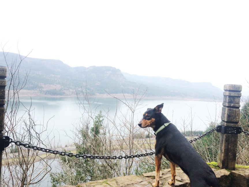
Drinking buddy
We’re excited to see what else we can get into these next two months (already have a trip to Seattle, a MLS game. and some big hikes planned). Stay tuned!
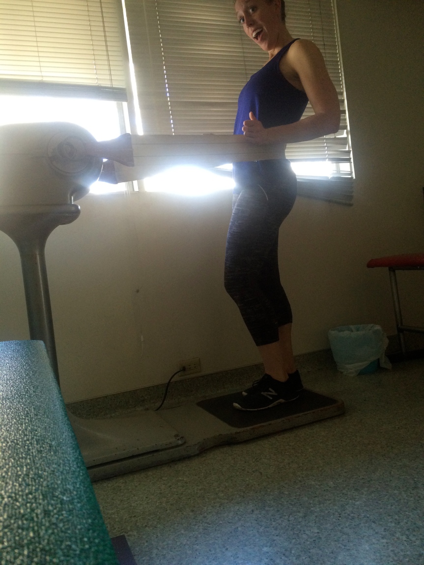
Oh, and there’s also been a little of this, because when you’re home alone with a dog for half the week you have to entertain yourself:
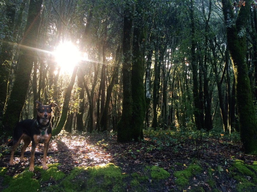
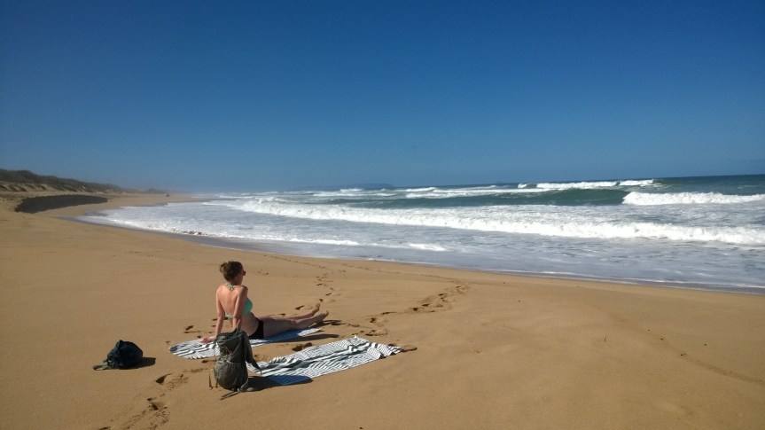
While we didn’t love everything about our time in California, we did manage to find some hikes that we thoroughly enjoyed. One major thing we noticed was that very few California State Parks are dog friendly, so while it wasn’t impossible to find hiking it made it a little more difficult to find nice, long hikes that Snickers could partake in with us–parking lots constitute dog friendly park icons but we are talking about actual trails. That dog loves hiking maybe more than she loves Beth, but not Matt. She could never love anything more than she loves him.
Henry Cowell State Park
Afternoon in Henry Cowell State Park
Our first couple of hikes were around the Santa Cruz area at Henry Cowell State Park and the Land of Medicine Buddha. You can see some pictures from them in Santa Cruz in pictures. Henry Cowell State Park was a major letdown. Before we went, we did our research and it said that there were dog-friendly trails and found one that looked to be about 5 miles of single-track trail. Unfortunately, when we got there there were signs everywhere indicating that no dogs were allowed on that trail. In fact, the only trails that were actually dog friendly were paved trails or service roads…oh and the one “trail” that was actually a runoff ditch on the side of the road. It did look like there were decent hiking trails around and the forest was beautiful with all the redwoods, but if you’re going with a dog we’d say skip it.
Land of Medicine Buddha
Redwoods in Land of Medicine Buddha
The Land of Medicine Buddha, despite it’s weird name, was much better. The land is privately-owned and they have all sorts of wellness retreats there. The best part was they were extremely dog friendly! One of the very few places we found in Santa Cruz that was. We went on a drizzly day, and there were surprisingly a lot of people (and dogs) who had the same idea. We did a 6 mile loop around the property, which wound its way along a creek and through new redwood growth with plenty of ups and down to get our heart rates up. We’d give this hike four muddy puppy paws!
Reflective trails at Land of Medicine Buddha
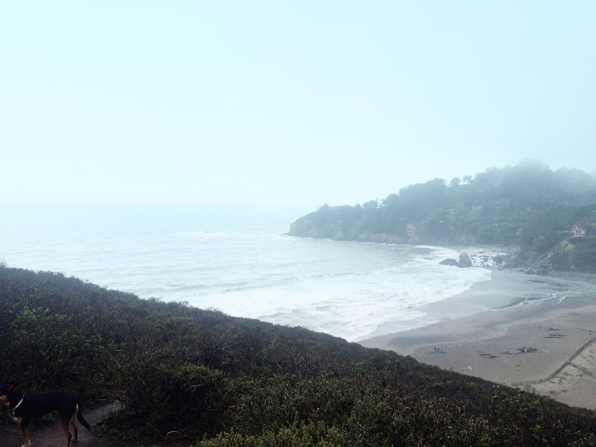
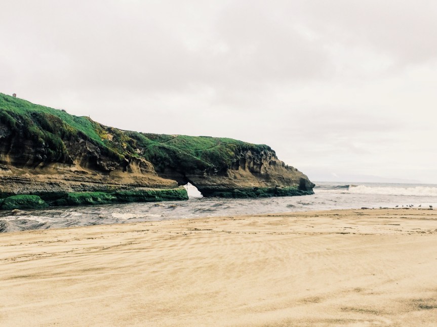
Muir Beach to Rodeo Beach
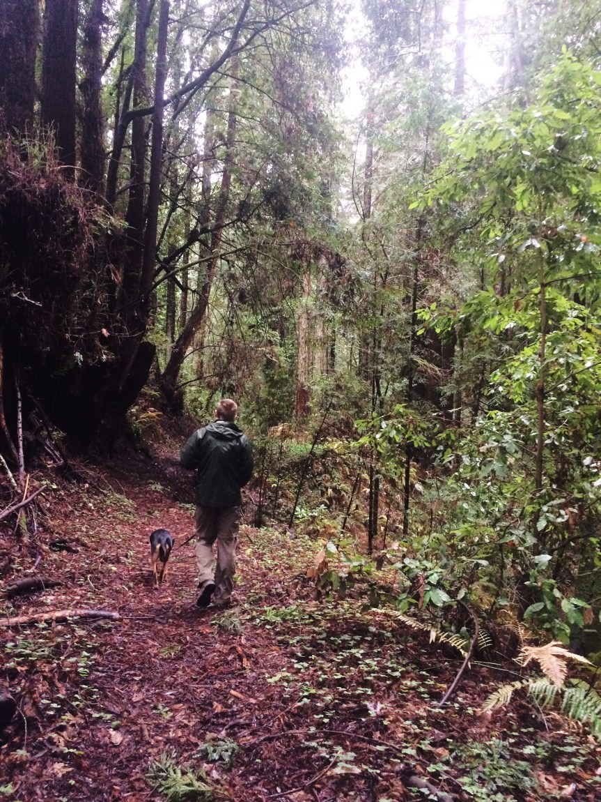
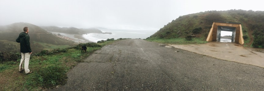
While we were up in Napa we ventured to the coast and did our longest hike of the trip: 11 miles! We started at Muir Beach just north of San Francisco and made our way down the coast to Rodeo Beach. It was muddy, a bit rainy, and not crowded for most of it. The clouds and rain hindered our views a bit, but when the skies opened up we got some spectacular views of the mountains and coast. This trail kicked our butts. It was long, and it was up and down A LOT. We’re talking one whole mile uphill and one mile down. And it was an out and back so even though the downhills were nice, we knew we’d have to go right back up them. Needless to say we were tired and happy when we finished this one. We give this four muddy puppy paws and four exhausted human thumbs up.
Looking out over Rodeo Beach
just a boy and his girlfriend’s dog
Coastal Trail
Muir Beach
Wet day on Muir Beach trail
Wet day on Muir Beach trail
Yippee Kai Yay!
Panoramic of the trail down to Rodeo Beach, just when the sun breaks
Anthony Chabot Regional Park
Now it’s Matt’s turn! The dog and I took a backpacking trip to Anthony Chabot Regional Park, just East of Oakland, CA.
Anthony Chabot Regional Park Lake overlook (Oakland in the distance)
This was my last week before starting the new job, so I figured I had to take advantage of being out of work. I had originally planned to make the trek out to Lake Tahoe area to do some backcountry camping and hiking; however, when I made a call to the ranger station about permits I asked about the trail conditions and he said “they are not bad right now, only a foot of snow on most of it, but when you head up above 8,000 ft you will need snowshoes.” OMG, I thought, there is no way a foot of snow is “not bad”! I thanked him and decided I needed a non-snowy option.
I found Anthony Chabot a quick 1 hour drive from the southern side of San Jose. I wasn’t expecting much since it was listed as a regional park, and I was only able to do some car camping in marked spots. When I first entered the park I realized I was very wrong about my preconceived notions! The park is located on a high ridge about 20-30 miles East of Oakland, with some nice 3rd(??) growth redwoods.
Anthony Chabot Lake
Matt and Snickers backpacking in the 60 degree Jan CA afternoon
During the week at the end of January there were very few people camping, so I had my pick of sites. The dog and I first set out, though, a few hours before dark for a full-pack hike around the park. We did about 4 miles that first afternoon, making a loop from the campsite–check out the Garmin Anthony Chabot- 4mi tracks. After the hike we (I!) set up the tent with the remaining daylight and got the firewood purchased at the camp entrance ready! I had only packed necessary provisions, which consisted of a rice and beans soup mix (thank you for the Xmas gift McClains!). However, since I was car camping, I wanted additional sustenance, so the dog and I went out to get s’mores, hot dogs, and beer! My beer of choice was a good camping beer, Bourbon Barrel Aged Arrogant Bastard Stout. The campfire wood was pretty wet, so it made a sorry fire for the most part, but it heated the hot dogs and I must have chowed down on half the pack before bed.
Camping supplies
Set firewood for a tiny fire
Snickers and I curled up under the same sleeping bag when we were both finally able to settle down–sorry, no pics!
Anthony Chabot Lake in the morning
Turkeys in the campgrounds at Anthony Chabot morning
The next morning we struck camp and went for a 8 mile hike around the remainder of the park with the full pack–it simulated backcountry camping. We covered a lot of ground and had some really grueling hills. Too bad my Garmin died, so I didn’t get the tracks for the second day. After that sweaty romp, we were both beat and ready to head back to San Jose, to my sister’s place, for a shower, a nap, and to pack for a San Francisco weekend and moving to Portland!
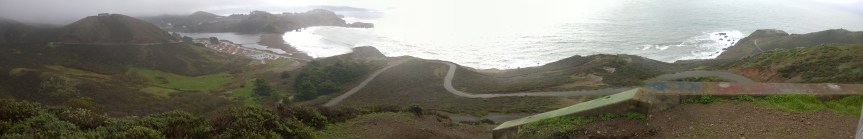
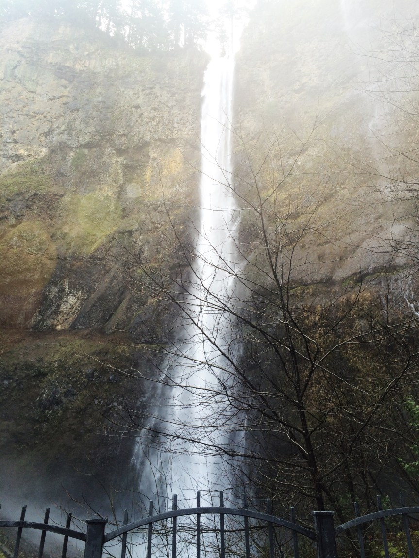
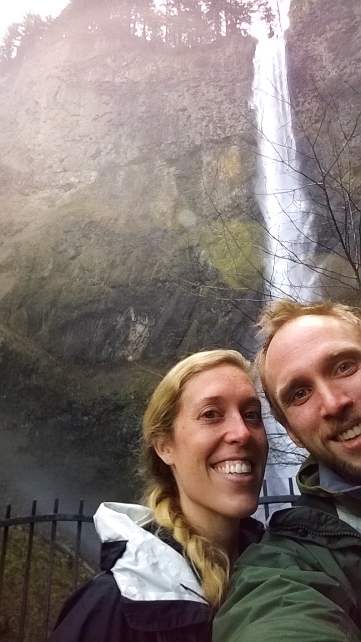
A couple of weekends ago, we decided to head out of the city and go on our first Pacific Northwest hike. While Matt would’ve liked to summit Mt. Hood, it’s unfortunately snow-capped and we have zero winter clothes with us, so Multnomah Falls it was!
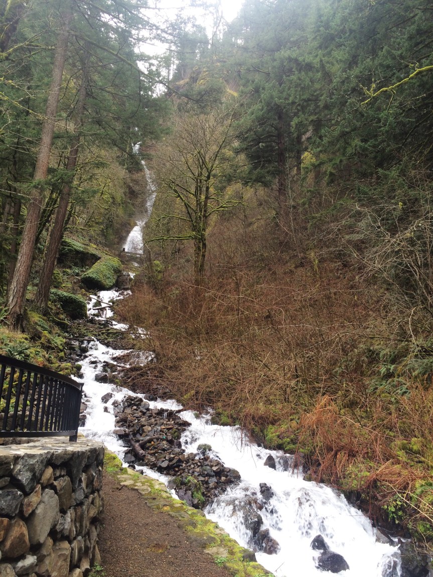
About 30 miles east of downtown Portland, through the Columbia River Gorge, is a moderate hike that meanders through the woods between two giant waterfalls. We started at the much more popular Multnomah Falls and ended the hike at Wahkeena Falls. The falls were 600ft and powerful! There was so much spray coming off of them, that the raincoats really came in handy.
There were a lot of people there that morning, but it seemed that most were just there for the shops at the bottom. Once we got past the bridge over the falls (~.25 miles) the number of people on the trail dropped by about 75%, then once we passed the lookout point (~1 mile) the trail was all but deserted. We enjoyed the moderate 5 mile loop as it climbed up and down and passed a handful of smaller waterfalls. Snickers especially enjoyed running through all the mud.
Although Wahkeena Falls was significantly less crowded, it was just as beautiful as Multnomah. It literally took my breath away…seriously, the wind and spray was so powerful on the bridge across it that it knocked the wind out of me. Oof. At the end of the hike, we got a gorgeous view of Washington across the Columbia River.
Wahkeena Falls
Overall it was a great day hike and we’d recommend it if you’re in the area. Oh, and afterwards we had a lunch of champions: donuts and beer 🙂 (Voodoo Donuts and Culmination Brewing for inquiring minds)
We took a pure vacation-vacation to Hawaii. It was our Christmas gift to each other. We took advantage of the cheap, cheap flights in Mid-January from San Jose (since we were on the West coast!) that went 6 hours directly to the Garden Island of Kauai, Hawaii. It was such a great trip: white sand beaches, 80 degrees for highs with upper 60’s for lows, mountain hiking, small towns, and plenty of nature and waterfalls!
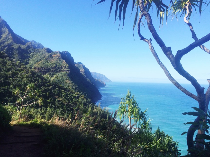
Napali coast, gorgeous
We stayed at the pleasant Kauai Beach Resort, which is located an easy 10-min drive from the airport. The resort is a great place to relax, if expensive; however, the most appealing reason to stay here is that it is centrally-located on the island, making all of your day trip activities less than an hour away. That is because there is really only 1 road on the perimeter of the island and it is about 70 miles from point to point, which does not quite circumnavigate island, leaving inaccessible about 20 miles of the Northwestern Na Pali coast, only available by some vigorous hiking. We rented a car and were very happy we did–it’s really the only way to get around and see the entire island. The tiny Chevy Spark did the trick for us, no need for the Jeep even on the off-road paths we took to some beaches–though you will see a lot of locals with big trucks and sand tires for off-road and on-beach driving.
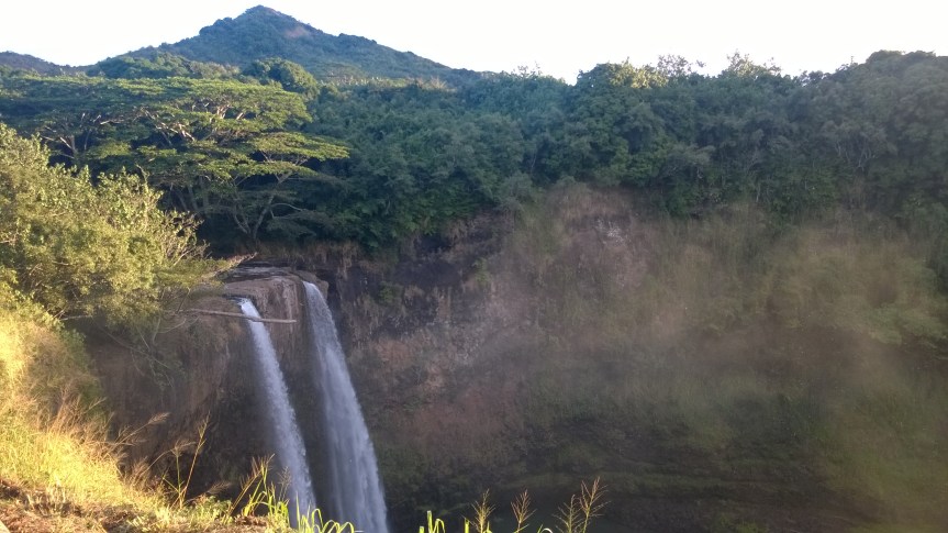
The first morning, and each subsequent morning, we dined at the wonderful local spot Tip Top Café in Lihue! Everything there was good, with some hearty breakfasts to enjoy before a grueling hike, but top on the list is the banana macadamia nut pancakes topped with the coconut syrup (you have to request this syrup!!). After that we took a beautiful morning drive to Wailua Falls. On a Wed morning before 7:30a, we were the only ones there, but when we went back on a Mon afternoon there were dozens of cars so that you aren’t even able to park. Go early for some of the best morning light and to enjoy it with some privacy.
Sun cresting near Wailua FallsWailua Falls in the morning
After that quick trip we were ready for some adventure and decided to go all the way to the Northwest coast where the road ends to Polihale State Park. This required a drive on a rough gravel road, but with our tiny rental car and a slow 40 min, we were able to make it back to some relatively secluded and completely un-developed beaches. There were several tents and it would be a gorgeous place to spend a night camping under the stars. The water was much too rough here to swim, but it was a wonderful place to soak up some rays! It may be worth noting that this is the western-most public beach in the USA.
Sunning on a remote Polihale State Park beach
On our way back, we took a side-trip to the Grand Canyon of the Pacific, Waimea Canyon. The drive up to and back from the canyon was more beautiful than the canyon itself, in my mind. So take your time and enjoy the changing landscape that quickly brings you from 0 ft to over 3000 ft above sea level–pro tip is to take 552 up to the canyon and take 550 back down to get some amazing ocean views. And, on your way back, be sure to stop at Jo-Jo’s Shaved Ice for some of the most delicious ice cream/shaved ice combinations you will have, not to mention they donate all profits to a local children’s charity.
The next day took us to the other far end of the island, to the Northeast past Princeville, where the highway ends at Haena State Park. This is where we took a vigorous hike along the Napali coast and the Kalalau Trail! We took a good day hike 2 miles along the most gorgeous costal hiking trail to the beach and then turned inland another 2 miles following the stream to the jaw-dropping 300ft Hanakapiai Falls. We were warm after the 4 mile morning hike, so I decided to join several other hikers and take a dip in the 55 degree (!!) pool under the waterfall. Worth it! After a quick shore lunch, we made the 4 mile hike back to the car, passing so many people making the hike to the falls–go early to make sure you have space and time to see it. If you wanted a good 22 mile round-trip overnight hike, you need a permit to continue to perhaps the most remote beach on the island for an excellent backpacking adventure, I hear. After our 8 mile hike, we treated ourselves to some Huli Huli chicken next to the Anahola Café–it was a German woman with an organic stand next to the road and pretty sure the chicken was the free-range ones that are so prevalent on the island which I give two thumbs up!
Jungle on the Kalalau Trail
Wonders of the falls
Napali coast, gorgeous
300 foot falls, I feel so tiny
300 foot falls!
Long shot of the falls
Napali coast, gorgeous
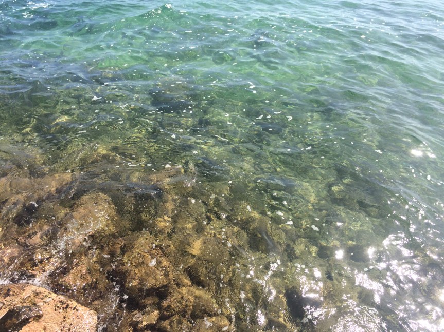
For some less strenuous activities, there are many. We visited the Kauai Coffee Company one day, which features a plethora of coffee tasting a small walking tour of their campus. The most amazing part is the miles of coffee trees that surround the company. As you drive through the area, you will smell the wet, bitter, caffeine filled air. It is worth a visit, especially if you have never seen any part of the coffee making process. Earlier that morning we also took some time to go snorkeling! There is no shortage of places that rent equipment, but we went to the Poipu area to rent and got recommendations for some beautiful spots in that area. A quick tip, since we are in this area. Poipu is a developed, touristy area. So, if you on the same page with my tastes, I would recommend to _avoid_ this area except for a half day of snorkeling. Though, you will find excellent snorkeling all around Kauai, just look for a beach with a rocky bottom. By the way, this was my first snorkeling experience, and I didn’t realize how *easy* is it to snorkel! You just float there and breath through the tube. The tropical fish, coral, and other marine life was so colorful, beautiful, and easy to see through the crystal clear water.
Perfect snorkeling waters
Another tip is that although a Hawaiian luau sounds like an essential Hawaii vacation experience, Beth and I found it an *expensive* and hokey experience and one that you should SKIP. Even with an open bar and buffet, you will not be able to drink enough Mai Tais or eat enough pork to make it worth your time. The show we watched was good, but not to make up for the hotel conference room in which it was hosted–yeah, you read that correctly.
I drank so many Mai Tais… and loved it! Can’t pass up that fresh Hawaii pineapple juice and rum. I did have a few beers and, not surprisingly, they all seemed made for drinking on the beach. 🙂 I see a long Wikipedia List of Hawaii Breweries, but I encountered only a few of them and 1 or 2 of them on tap at the Kauai bars–Kauai is the garden island so perhaps the less metropolitan towns makes for a smaller selection. Kona Brewery Longboard Island Lager is everywhere and is a rosy-looking refreshing draught.
Some last thoughts:
During your stay, go to a grocery store and pick up some delicious, refreshing longons and a real Hawaii pineapple to snack on–it doesn’t get any better than that since Hawaii pineapples don’t come to the mainland. Apparently you can check a case of pineapples on your plane flight back.
You also _have to_ try real poke and there is no better place than Fish Express in Lihue, which features deli-style containers of so many good, fresh things. We made that our first and last stop around our flights–we even took some with us to eat on the long flight back for dinner.
Thank you for taking this trip with us! Aloha and Mahalo!
Our first month away was a whirlwind, to say the least. Here was how it was supposed to go down:
7 days in Santa Cruz
10 days in Corralitos
5 days in Hawaii – Vacation!!
5 days in San Jose
Drive to Portland on 1/31
But….as they say: the best laid plans of mice and men often go awry. And go awry it did. So, here’s how it actually went:
7 days in Santa Cruz
1 day in Corralitos
9 days in Napa
5 days in Hawaii – Vacation!!
for Beth: 2 days in Phoenix
for Matt: 2 days in San Jose
2 days in San Francisco
Drive to Portland on 1/30
We learned a lot in our first month and will surely experience more growing pains as we figure out this lifestyle. The biggest obstacle we’ve faced is figuring out housing. When we left Louisville our plan was to use AirBNB and HomeAway to find short term, furnished rentals. After our first month, it became apparent that was not a viable option for a couple of reasons: a.) it’s expensive, like way over budget expensive, and b.) we felt more like guests in someone’s home rather than like we had our own space.
There were citrus trees everywhere! Fresh squeezed OJ for breakfast? Yes, please.
Our first week away wasn’t bad. We stayed in a small guest house in Midtown Santa Cruz that was very walkable and had everything we needed. The main downside was that it was a “guest house,” though it was actually connected to the main house so I’m not sure if that’s even an accurate description. While we had our own space, it still very much felt like we didn’t especially since the owner’s dog could be heard barking on the other side o the connecting door. Strike one, AirBNB.
Our time in Corralitos got cut from 10 days to 1 for similar reasons. The house was not like it was listed on the site (i.e. said non-smoking but smelled like smoke; said it was in town but was in the middle of nowhere), and the owner left all sorts of personal belongings that made me feel like I was intruding. Could we use the coffee? Why was there half-used food in the fridge? Luckily we were able to cancel that reservation, but only after the owner tried to change her cancellation policy so we wouldn’t be able to get a full refund. Thankfully AirBNB doesn’t allow those changes to take place retroactively. Strikes two and three.
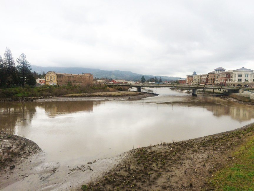
Rainy day in Napa
We ended up staying in hotels for the remainder of the month, which were similar costs and also provided us our own space. Bonus: we stayed in extended stays so we had a kitchen and two bedrooms!
The Phoenix trip was for work and sprung upon me days before we left for Hawaii. And San Jose was replaced by San Francisco because there’s not a whole lot to do in San Jose. Unfortunately we didn’t get to experience much of the city because Matt got his work assignment (Topeka!) and, surprisingly – or not so surprisingly – there aren’t many flights to Kansas from Portland. We drove up a day early so we could get settled before he jetted off to work.
We’re in Portland through the end of April so hopefully we can relax a bit and enjoy the city at a less-than-breakneck pace.
Rainy day at the coast. Notice a trend? I don’t know what this “drought” is all about, it rained practically the entire time we were there 🙂
We’re finishing up the California leg of our journey and heading north to Portland, OR! We’ll have a full recap (or two or three) of the first month away soon, but for now we’re looking forward to settling into the rain for the next three months.
Since we are done with our Santa Cruz adventure, I thought it would be time to tell you about the food+beer experiences in Santa Cruz.
The first thing I wanted to note was that Midtown Santa Cruz has an abundance of citrus trees available in every yard- including lemons, limes, blood oranges, and pomegranates. What a wonderfully tasty bounty–I didn’t realize all of that grew so well down here! We cooked a couple meals in the Midtown AirBNB rental utilizing these fruits, a local Shoppers market, and the Buttery bakery both down the street.
Starting with the food and beer. It was about the third day Beth had to work that I was getting a little stir-crazy in the small apartment, so she sent me to “Husband Daycare”–I went to downtown Santa Cruz to get a few beers and watch the new Star Wars movie. 🙂 I was looking for a local brewery to start my daycare trip, and the closest one was my first choice- I tried Uncommon Brewery (http://www.uncommonbrewers.com). It lead me to an interesting small-business area near downtown. I walked up to their door to see a burly bearded dude wearing a beer shirt and carrying a few Uncommon 6-packs. I figured I got the right spot. I asked him if they served beer inside and he told me they don’t serve at this location, but a taproom across the way was being built–FAIL! He also informed me of a bar that serves their beers in cans and tap. With that information, I was on my way to a local bar a mile down the road, 99 Bottles (http://www.99bottles.com).
99 Bottles is a typical local bar in an upscale area, but with an extensive local and regional CA tap list. After looking at the list and talking with the bartender for a few minutes, I was armed with new knowledge. I started with a refreshing Uncommon Framboos raspberry ale (not usually to my liking, but it was hoppy and sweetness was not lingering). I followed up with a buffalo chicken sandwich (ok) and delicious waffle fries paired with a Sante Adairius Chaves Porter which made a wonderful combination. Word on the street is that Sante Adairius (http://rusticales.com) is a hot, regional brewer specializing in farmhouse ales, sour beers, and funky ales, and it is in Santa Cruz and I regret not making it to their brewery to try more, but make the trip if you’re in the area! Solid choices, good buzz- now time to walk to the movie.
A few days later it was time for Beth and me to go out on a beer-venture. We wanted good beer and good food–who doesn’t? Well, we headed to West Santa Cruz to go to Santa Cruz Mountain Brewery (http://www.scmbrew.com) for some suds. It was located in the Santa Cruz West end a newer small business park with plenty of wine and food places. It was a cool, rainy evening but we got a flight of everything they had to offer, at a bit of a high cost, and enjoyed the dog-friendly outside area–too bad the pup stayed at home. The beer was pretty lackluster, there was a wheat that had a bit of flavor (which is the best I can say for it) and a porter that was ok. Needless to say, we downed those fast and moved on to find some better beer and definitely some food! Luckily for us, there was a nice, upscale restaurant just across the way.
West End Tap & Kitchen (http://westendtap.com) was the next stop because we were hungry (hangry??) and ready for some satisfying beer. This place was upscale with a modern layout, and at 5:30p Pacific time was already hopping–our stomachs were still on Eastern time so it suited us. The food here was good, if a bit pricy; we split a flatbread pizza that had good bread and toppings and some delicious breaded/fried [Pacific??] calamari. Ok, so that was the food which paired well with the delicious flights we ordered. You can see from the attached photo the array of local (including beers made at/for this place) and regional beers, and they were all good. We had a hoppy red ale that would appeal to the hop heads (thinking of you, Jake!). However, the final beer on each flight was barrel-aged and were I found my favs. Just to list a few- West End Stout (house beer, v. good), Corralitos Red, 2 Tun Imperial Stout.
The final beer stop in Santa Cruz (Soquel) was, what better, a bottle shop and pour house[sic] called Beer Thirty (http://www.bthirty.com). I can’t say enough good things about this place! Think Louisville Beer Store, but less pretentious with a better outdoor space. The front area has corrugated steel enclosed dog-friendly front patio and a dedicated food stand–very nice look and feel to it. The selection in the back looks good- you can see from the photo; in fact, I was surprised to see a barrel-aged Narwhal and some Against the Grain cans! We dropped by this place after a nice 7-mi hike, so we didn’t partake in the taps, only grabbed a couple bottles. Side note- had we been there just week earlier, we would have been there for a stout/barrel-aged tap takeover (argh- I want it!!). We picked 2 CA barrel-aged beers to take with us. The first I already imbibed and it is a complex, beautiful Coronado Collection Barrel Aged Stupid Stout. I am also going to rest a Fifty-Five Brewing Co. Imperial Eclipse Stout – Elijah Craig (12 Year), per the salesperson’s recommendation (said it was a bit hot). I guess I am going to carry bottles on our trip the rest of the year (or until I get a craving and drink it!).
To summarize-
99 Bottles- Do it; a bar worth a visit for local/regional taps
Uncommon Brewer- Do it late 2016(??); when their taproom opens go, but find it in most local bars
Sante Adairius- Do it now
Santa Cruz Mountain Brewery- Pass; nice outdoor area but lackluster beer
West End Tap & Kitchen- do it, it is a bit pricey, but beer flights are a great deal, and an outdoor area
Beer Thirty- DO IT, for taps or bottles, dog friendly and must do it- can do it after a hike in Land of Medicine Buddha
Sorry if this is long-winded. Just trying to get the drive documented so we can move onto the fun stuff. Onward!
Day 3 – Are we there yet?
It’s amazing what a good night’s sleep can do for morale. We were up and on the road early after chowing down on some waffles shaped like Texas. Today we decided to make a couple of stops along the way and try to see a little of what Texas and New Mexico had to offer.
Our first stop was just outside of Amarillo to the famous Cadillac Ranch! We didn’t have any spray paint with us, but we found a bottle that wasn’t quite empty and made our mark. The cars were so textured from layers of built up paint, which is something you don’t see from afar.
Snickers makes her mark on Cadillac Ranch
We hit the road and before long found ourselves crossing the New Mexico border. We stopped in Santa Rosa, NM to see the Blue Hole. We didn’t know what to expect, and luckily we didn’t have any expectations because it would’ve fallen miserably short of them. Basically it’s an 80ft hole that has clear blue water and is a constant 60ish degrees. You can swim and dive here, but since there was snow on the ground we decided to pass. Though Snickers and Ariel had a nice little rendezvous.
Scuba Snickers
Then it was straight on to Albuquerque. Sadly, we didn’t get any crystal blue persuasion as Walter White is no longer in the business, but we did get some good beer at Marble Brewery. With bellies full of beer (2 flights) and brisket nachos, we paused our drive and took a walk around Petroglyph National Monument. There were ancient markings on volcanic rock from Native Americans and Spanish settlers. It was a nice 2 mile walk to stretch our legs and digest our food.
The landscape through the rest of New Mexico was amazing! The sun came out and lit up the mountains and the rocks were illuminated with a red hue. Our goal was to make it to Flagstaff before calling it a night. For whatever reason, the hotels were filled up and it was expensive, but we found a decent place right near the University of Northern Arizona and called it a night.
Distance travelled: 608 miles
Beth’s favorite part: Cadillac Ranch followed closely by TX waffles
Matt’s favorite part: Petroglyph National Monument
Day 4 – Let’s hike!
We were up early in Flagstaff and ready to start the next leg of the journey. We weren’t ready for the freezing temps! It was in the teens as we loaded up the car! We found a hike just outside Flagstaff to work off breakfast and get the little pup some exercise; it was a 2.5 mile loop at the Elden Lookout trailhead. It wasn’t too strenuous, but the ice and snow on the trail made us glad we packed our boots. Luckily it was sunny and we got a great lookout of the city from the top.
Driving down the western side of the mountain was breathtaking. The sun played off the mountains and the scenery was a much welcomed change from the desert the previous two days. After a couple of hours we reached the California border!!!! Huzzah! Too bad we were still a day and a half from our destination 😦
We stopped at a hole in the wall Mexican restaurant to refuel, and were a bit underwhelmed by the lack of spices in our burrito and tacos. We were also price gouged for gas ($3.70! A GALLON!), but when you’re about to hit the Mojave Desert and the next gas station isn’t for 70 miles you gotta do what you gotta do. It probably didn’t make up for it, but later in the evening we were averaging 58 MPG going down a mountain into Bakersfield. I wish I knew what that drive looked like, but it was dark so we were basically careening blindly down a mountain.
Distance travelled: 480 miles
Matt’s favorite part: coming down out of the mountains
Beth’s favorite part: hiking in Flagstaff
Snickers’ favorite part: ditto to the hiking (woof!)
Day 5 – BIG SUR
This could really be a post of its own, but let’s just put it here and get the drive recap over with. We got up early (again) in Bakersfield; since the hotel didn’t have a complimentary breakfast – the first time this trip! – we treated ourselves to breakfast at Cope’s Knotty Pine Café. It was a greasy spoon diner with hearty helpings and hit the spot. Initially we were going to go with Google Map’s directions to Santa Cruz, but at the last minute changed our route to drive the coast up Highway 1. That was the best decision we could have made! It added about 2 hours to our drive time, but the views were well worth it. If you ever find yourself having to make that decision, just drive the coast.
The first hour or two was mostly desert; there were grape vines and almond farms as far as the eye could see. Then out of nowhere (well over the mountain) the scenery did a complete 180 and changed into lush greenery with rolling hills. There were wineries everywhere! We made it to the coast and made our first stop at a dog-friendly beach. We were able to walk up and down and let Snickers off leash to experience sand and seawater for the first time. She loved running around in the sand…and antagonizing the beached elephant seal, but she wasn’t so keen on the waves. I guess a giant moving object could be a little scary.
We drove the rest of the way up the coast through Big Sur. The views were incredible! Mountains to the east, ocean to the west! I wish we had more time to hike through there, but we were exhausted and just wanted to get to Santa Cruz. We will be back eventually to hike and camp.
We made it to our AirBNB and settled in for the week. The place was small, but comfortable, if not a bit overcrowded with furniture. The area was extremely walkable and we were relatively close to the beach. We cooked dinner in our small kitchenette and had fresh blood oranges from a tree out back. The computers were set up and it was time to settle in and enjoy the week in Santa Cruz!
WE MADE IT!
Distance travelled: 290 miles
Matt’s favorite part: driving through Big Sur
Beth’s favorite part: seeing Snickers in the ocean


 West End Tap & Kitchen (
 The final beer stop in Santa Cruz (Soquel) was, what better, a bottle shop and pour house[sic] called Beer Thirty (


