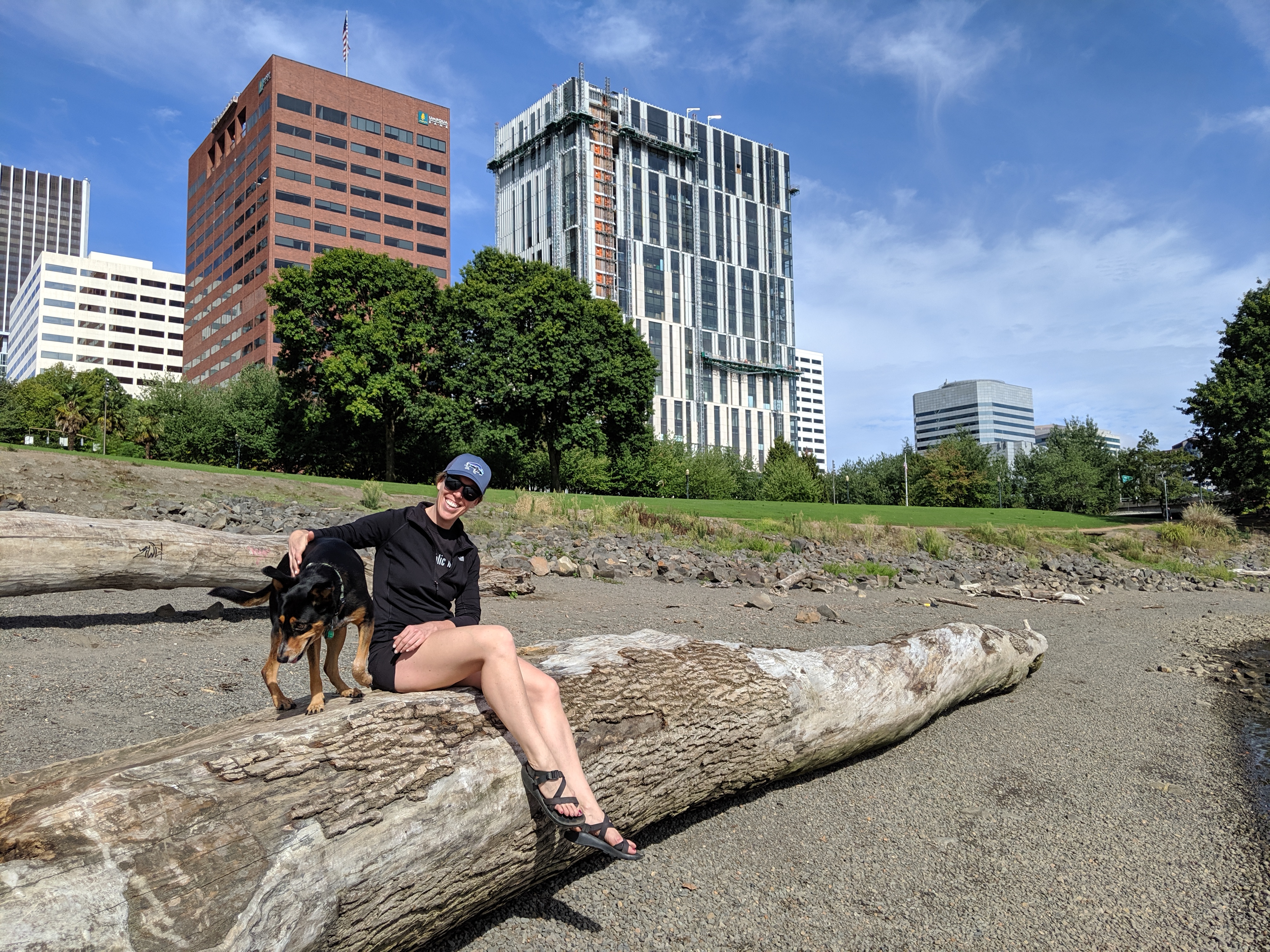
Sadly, our year in Portland has come to a close and we’re now calling San Diego home. We haven’t done a proper update in a long time, so wanted to pop in a quick recap for posterity’s sake.
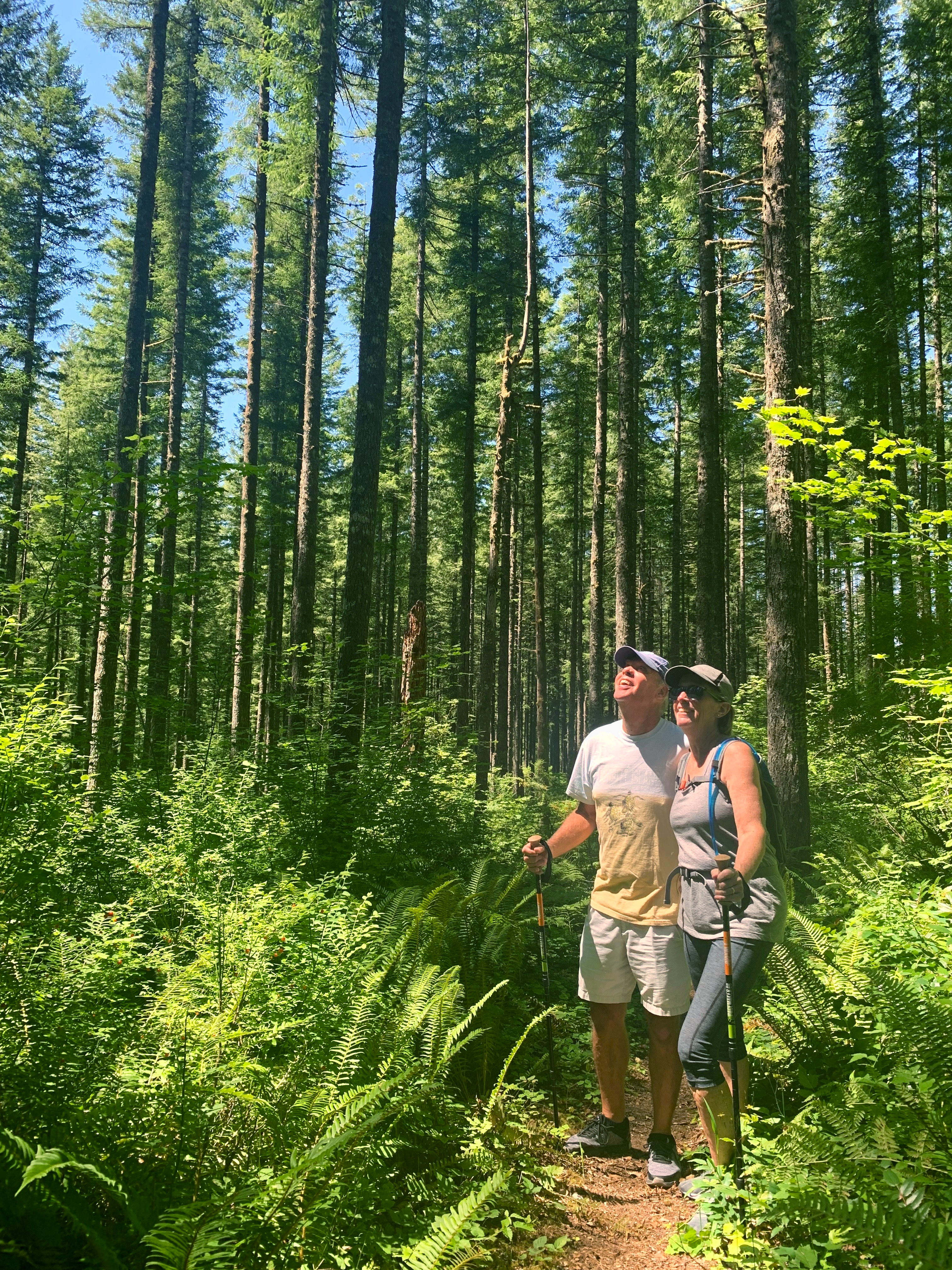
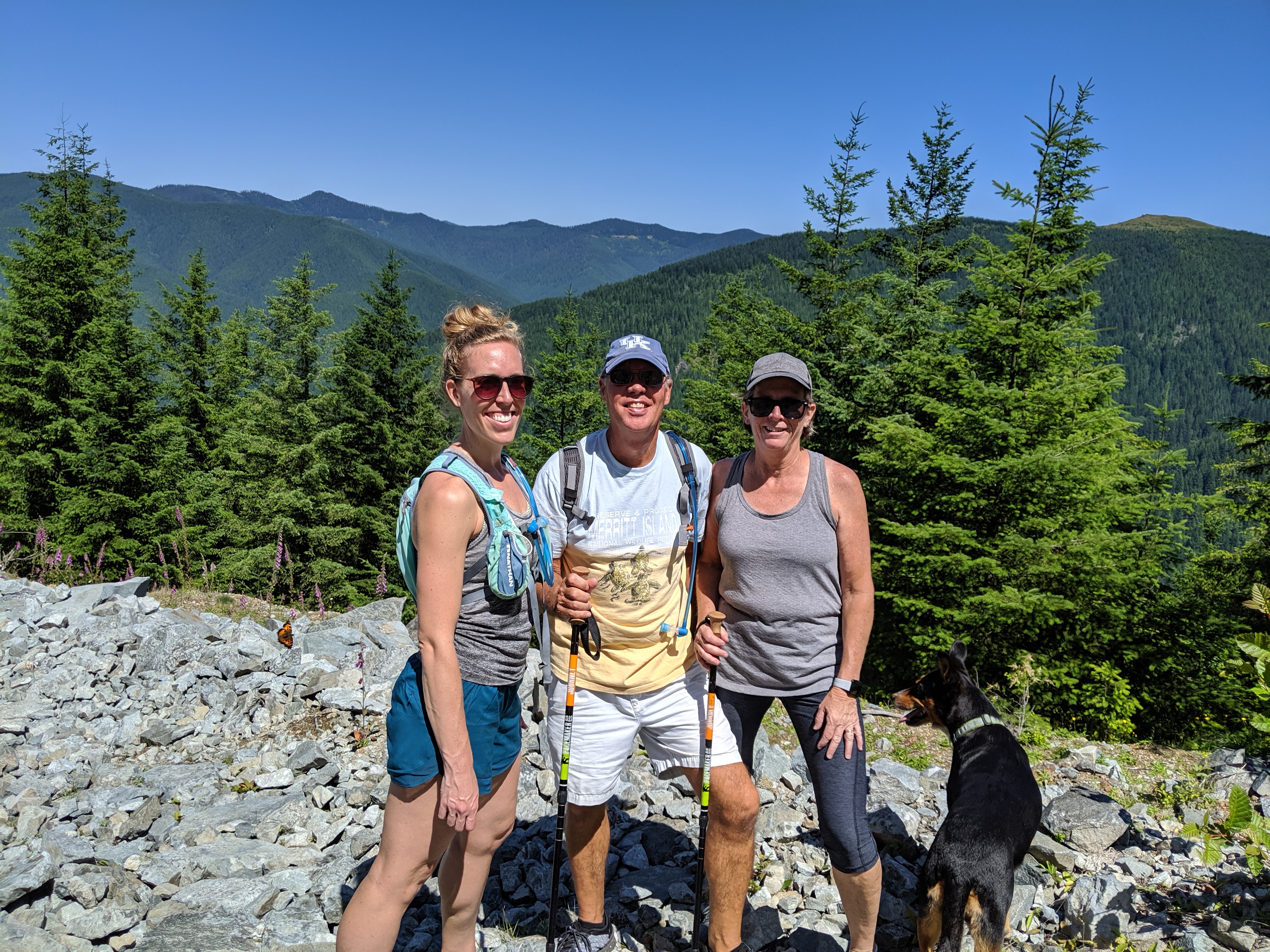
Summer in the Pacific Northwest was a dream. The season is very fleeting, but we relished it while it stuck around. It seemed like it took forever for warm weather to stick around; we had some high temps in June, but it was solidly July before we could pack away the sweatshirts and jeans. The weather was warm, sunny, and dry and we spent most of our time outdoors. I was still in the thick of ultra training, and was so happy to be able to run some dry trails. We had lots of visitors (my parents, Matt’s parents, Jake and Megan!), got in loads of trail time, and enjoyed plenty of beers along the way.
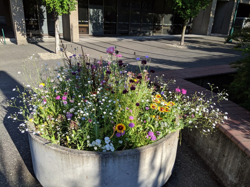
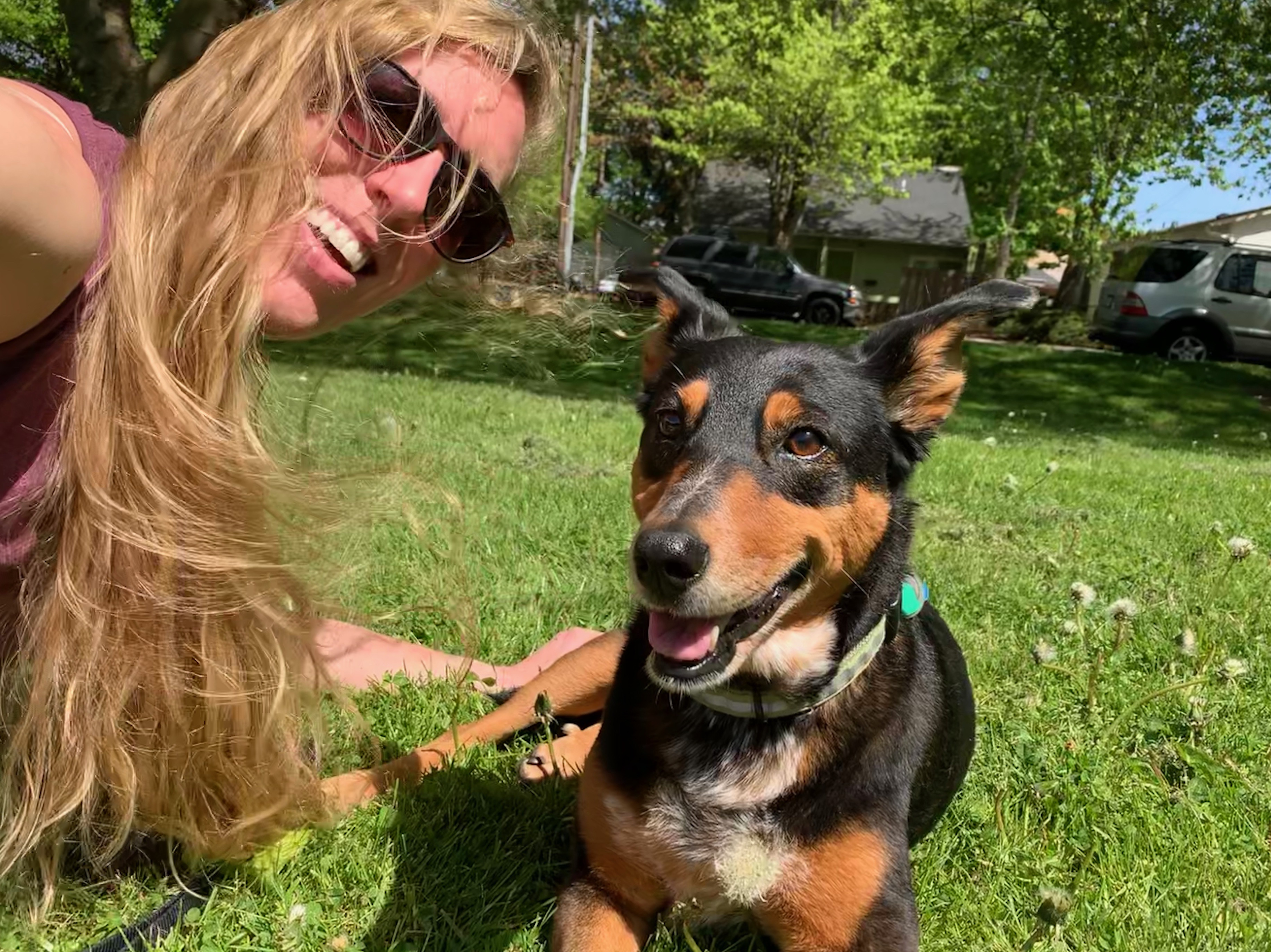
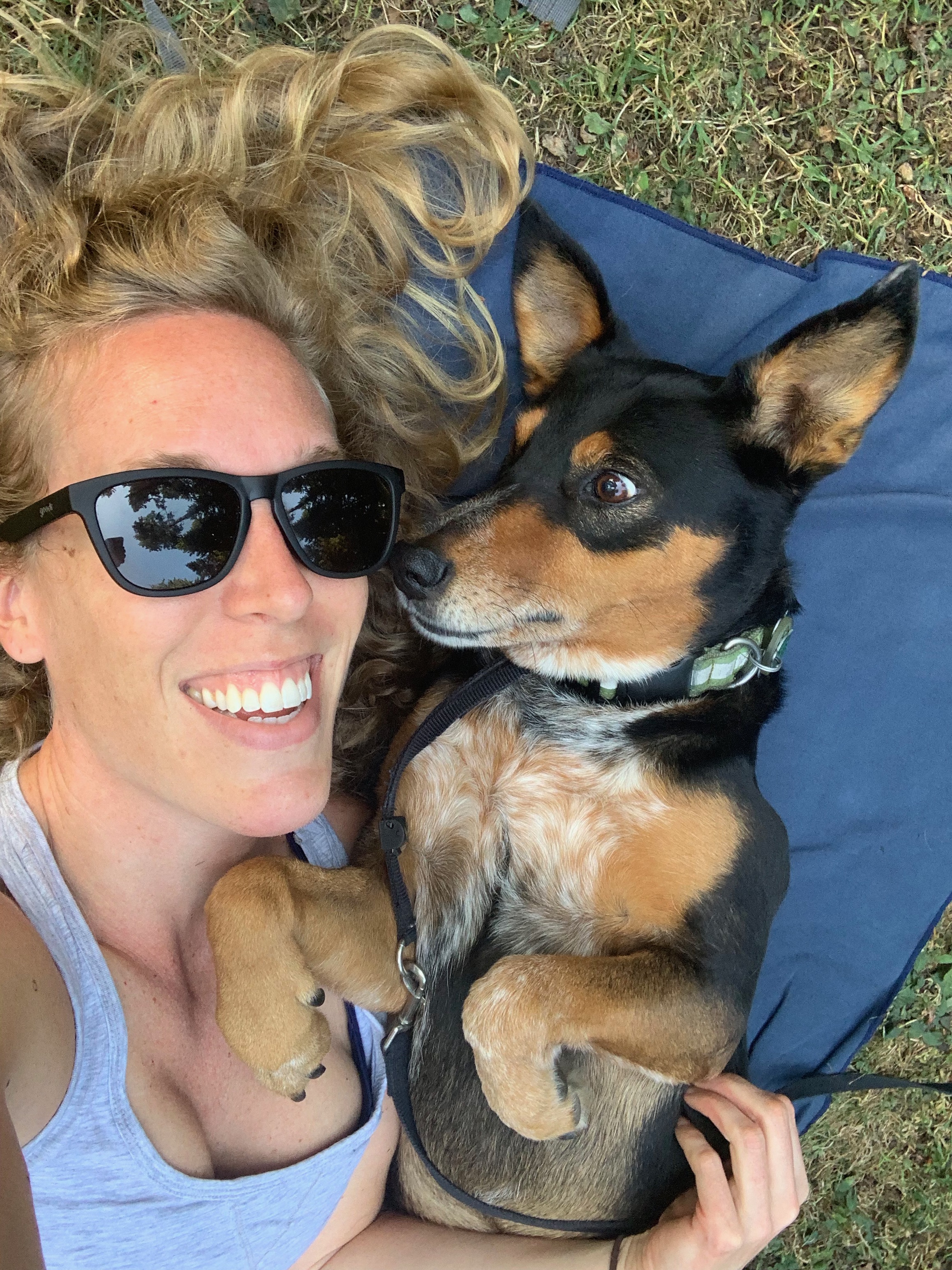
One of our favorite activities was urban foraging. The berry situation was insane! Everywhere we went there were loads of blackberries. It was perfect for an afternoon snack at the park. Speaking of parks, we spent so many afternoons at Washington Park and Mt. Tabor. Snickers could spend all day just sunning herself in the grass.
We got to a few Timbers matches as well. We watched them play Orlando (tie) and Real Salt Lake (W). We loved being able to walk to and from the stadium from our apartment.
Timbers vs. Real Salt Lake
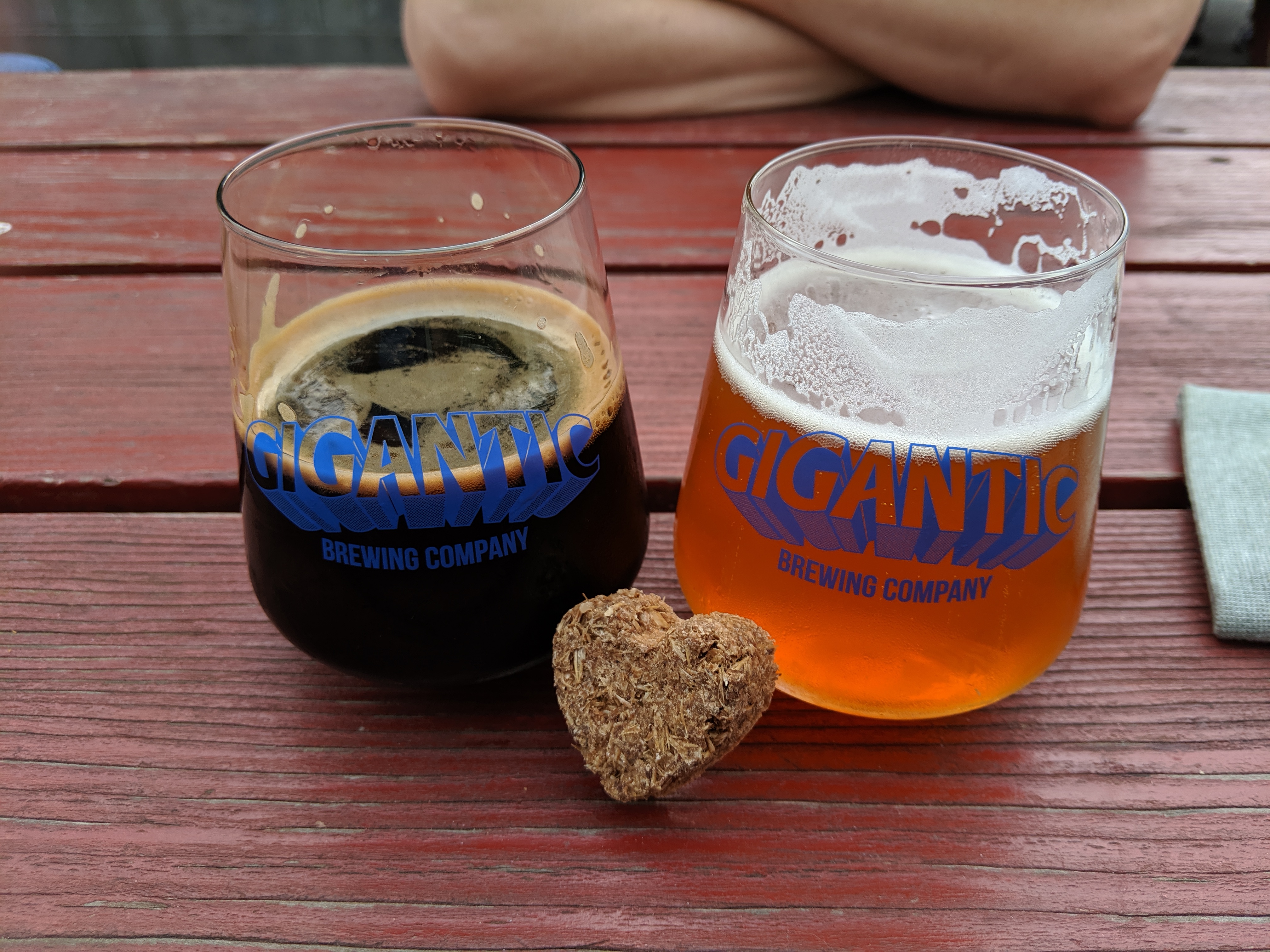
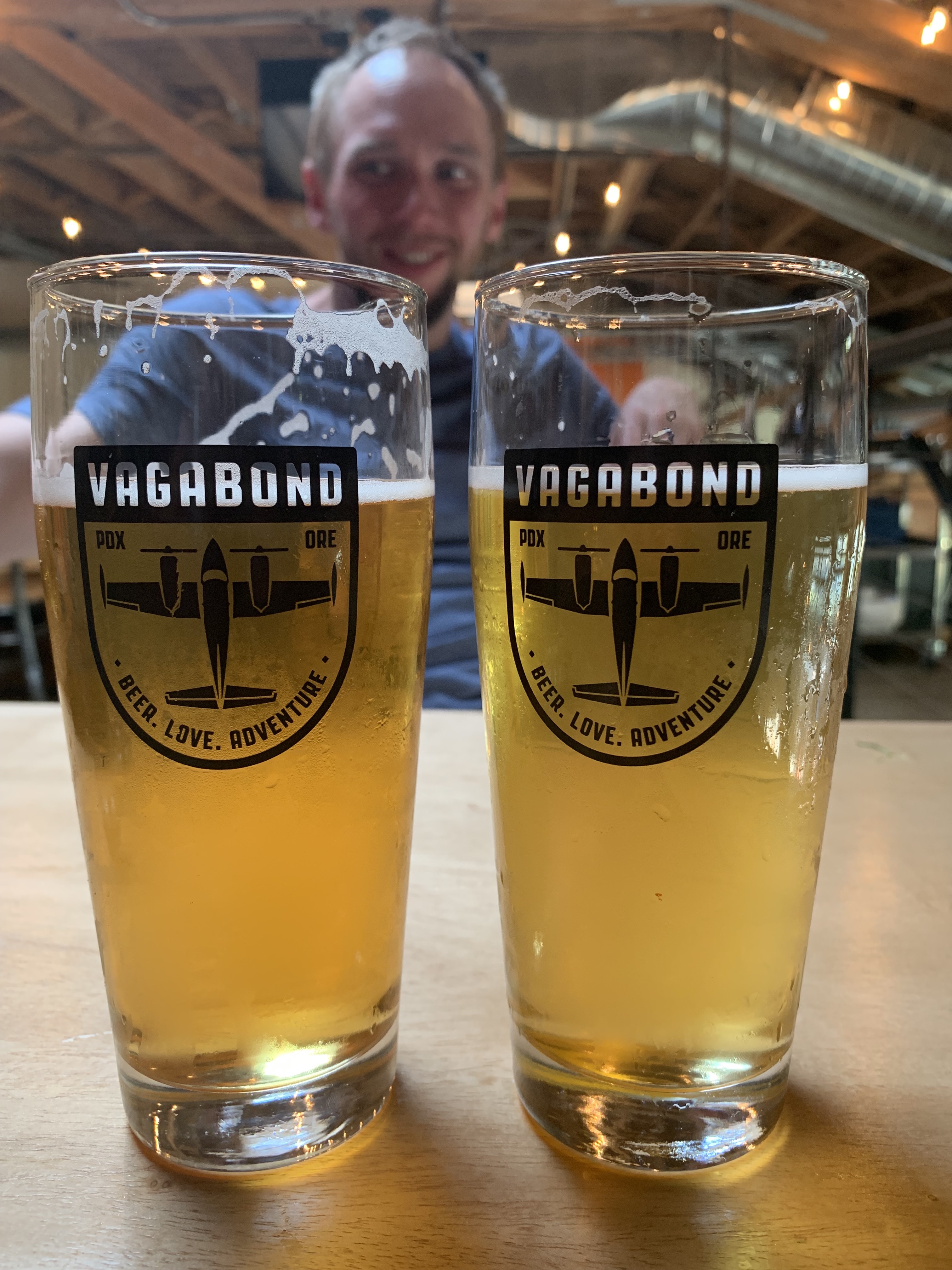
After 2 years, I finally hopped back on my bike! One evening, we hopped on our bikes and rode the Springwater Corridor along the Willamette’s east bank. We ended up at a couple of breweries – Unicorn and Ancestry – and wished we had been doing this for date night all summer long.
Fall came in like a lion right before we left. The trees were awash with spectacular reds and oranges and the nights started getting quite crisp. We started spending a bit more time indoors – with no races to train for, it was a lot harder for me to get out the door when it was raining. We spent the last month soaking in everything about the city that we’re going to miss so much – hiking the lush, mossy trails, eating all of of our favorite foods (Pok Pok, Apizza Scholls, Bamboo, to name a few), and, of course, one last game of Deadpool pinball at Ground Kontrol.
We even started eyeing Zillow for some some houses :). Not quite ready to put down roots yet, but Portland is on the short list for when we are.
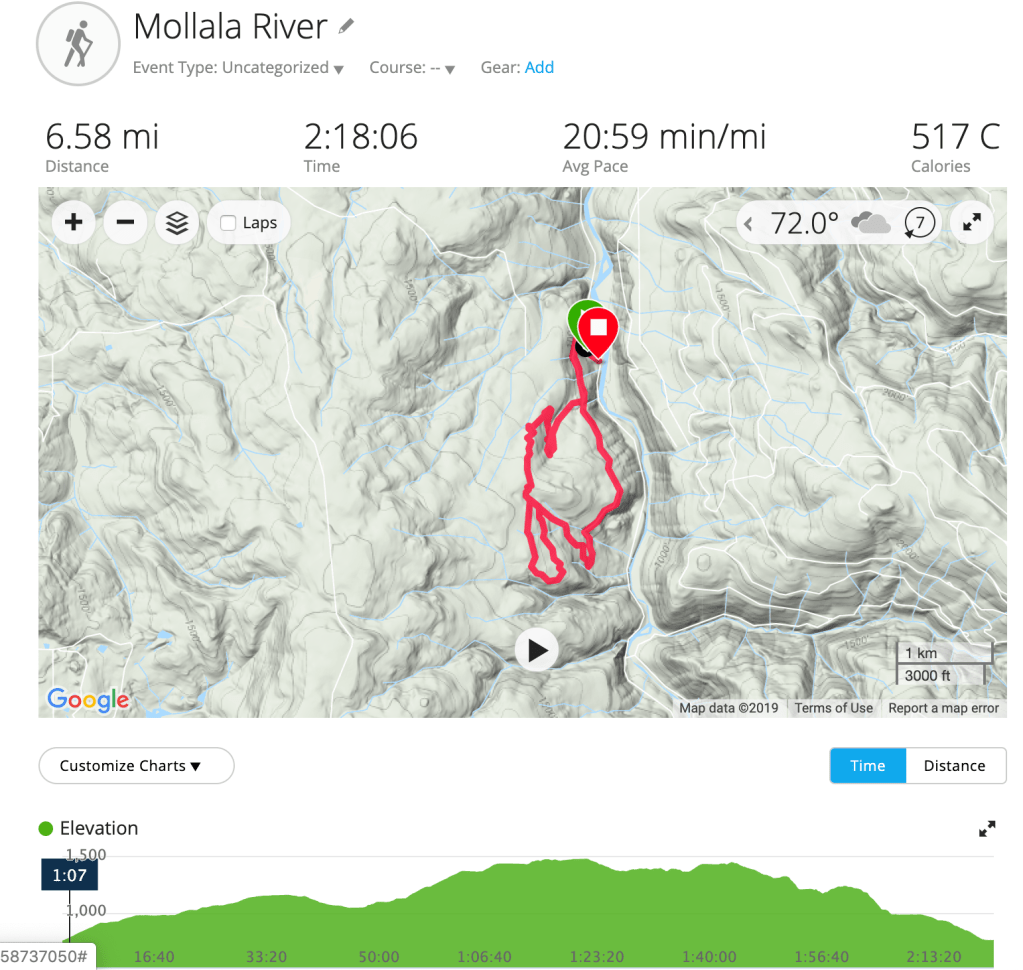
In early September, we hiked in the Molalla Forest, just east of Salem. There were a lot of trails in the forest, so we didn’t do the exact loop listed on AllTrails, but we did a combination of trails for a total of 6.5 miles. The trail started on the Huckleberry Trail, which is a service road. After a couple of miles on that, we were getting bored so we hopped onto some single-track trail and wound our way through the forest. It was a rainy day and very lightly trafficked. The trails were easy, with little elevation gain – we averaged ~1,000 feet over the course of our hike. While it was enjoyable, we wouldn’t recommend this hike since it was mostly service road with a few short single-track trails thrown in.
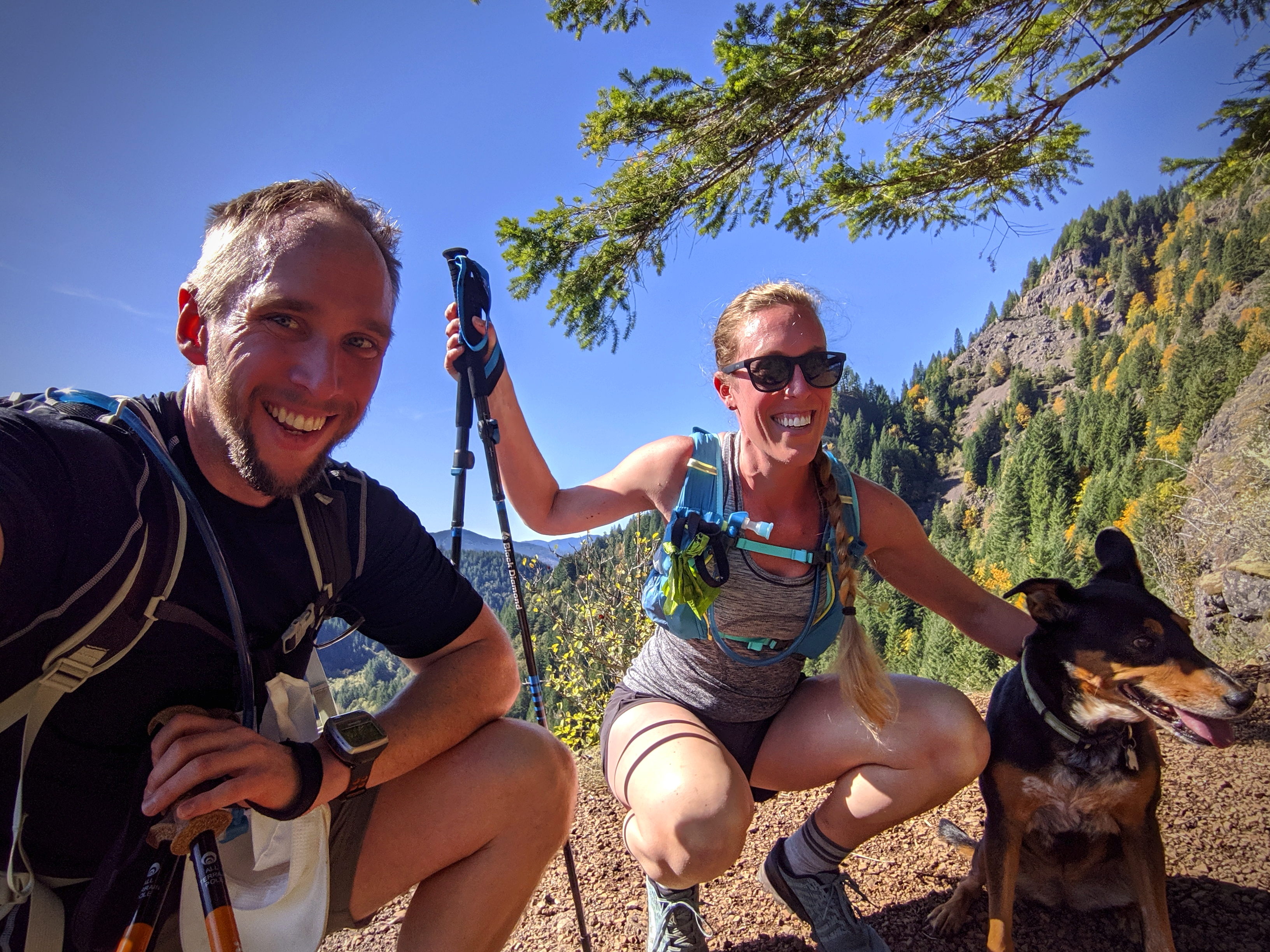
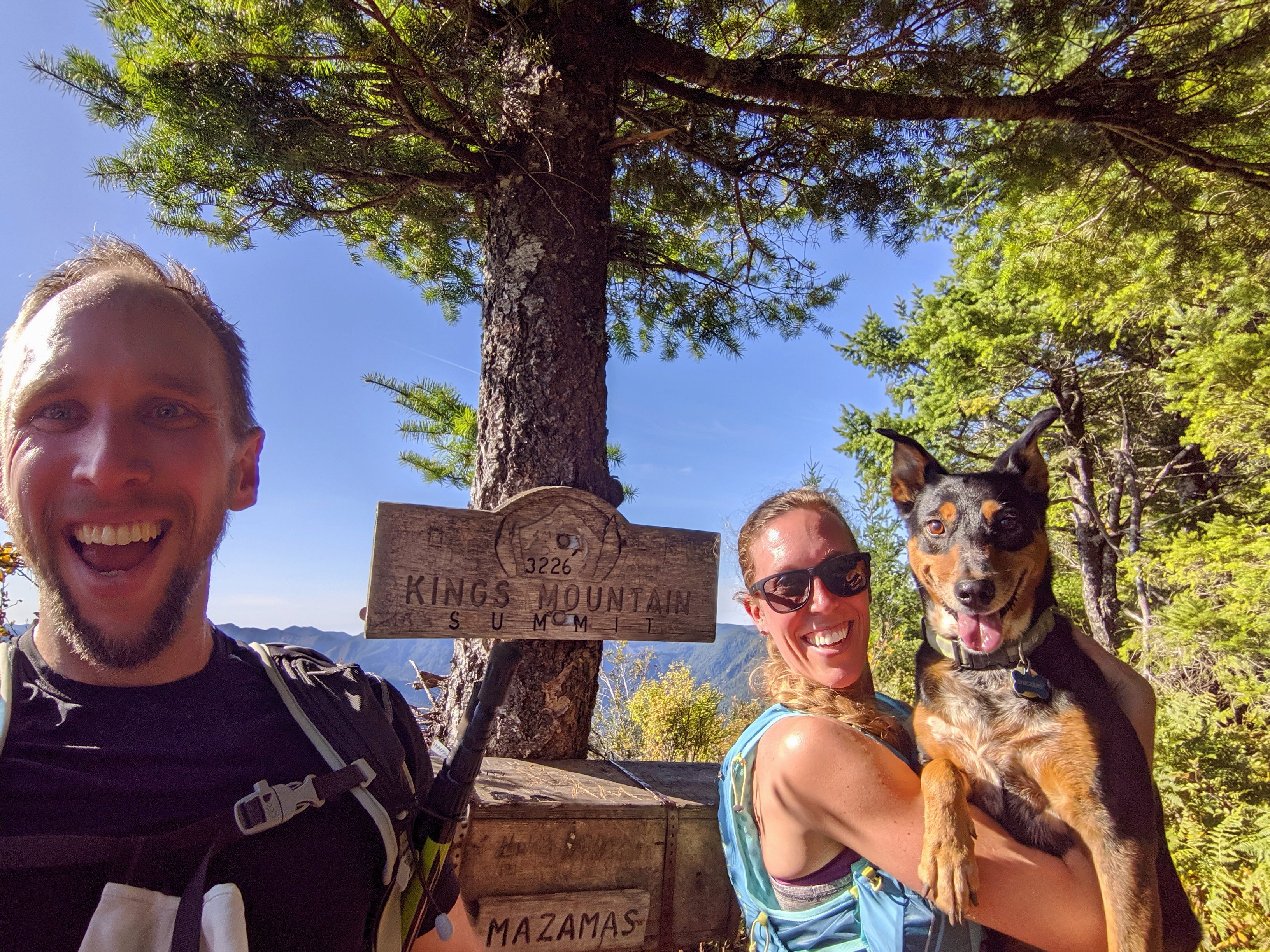
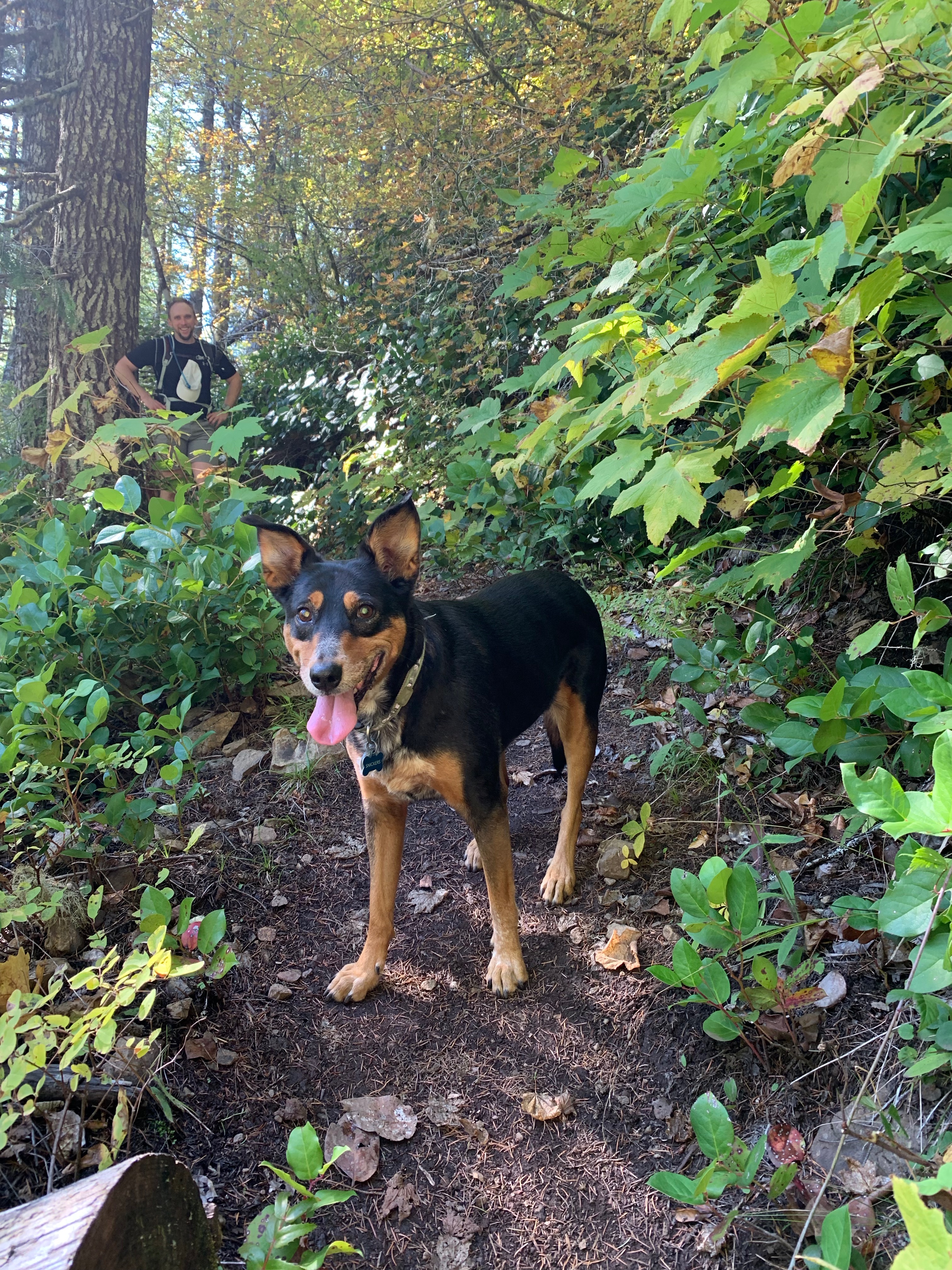
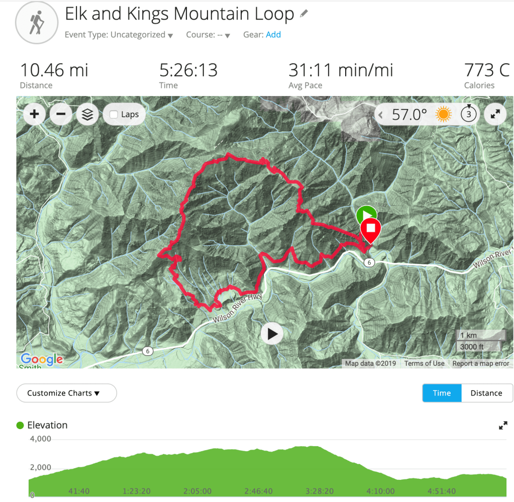
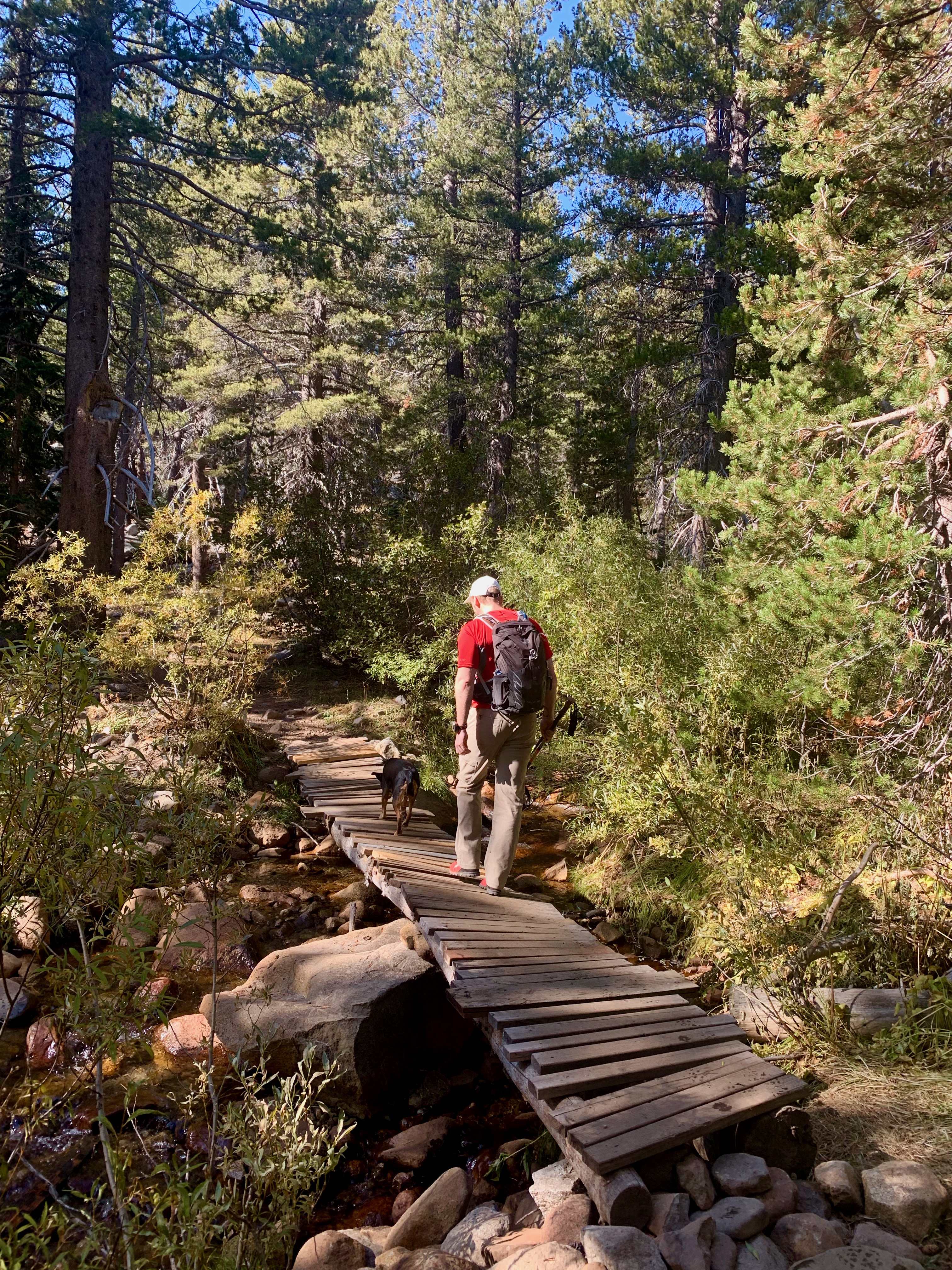
We ended our last weekend in Oregon the same way we started – with some trail time in the Tillamook Forest. The main reason we came to Oregon was so I could run the Elk-King’s 50K and ever since, we’ve been dying to come back and do this loop. We did hike just the King’s Mountain Trail back in December but hadn’t made it back for the full loop. It seemed very fitting that we made this our last adventure.
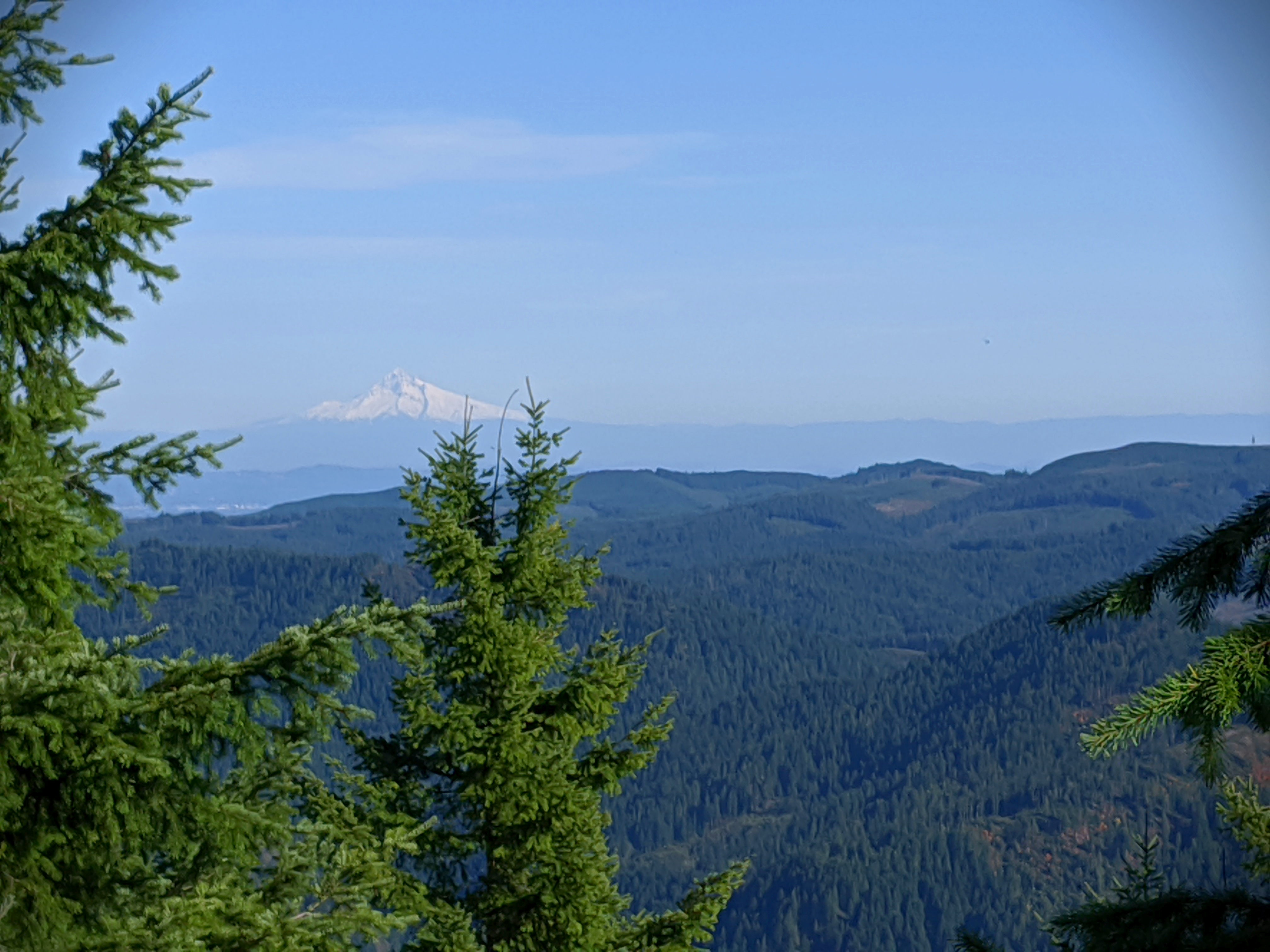
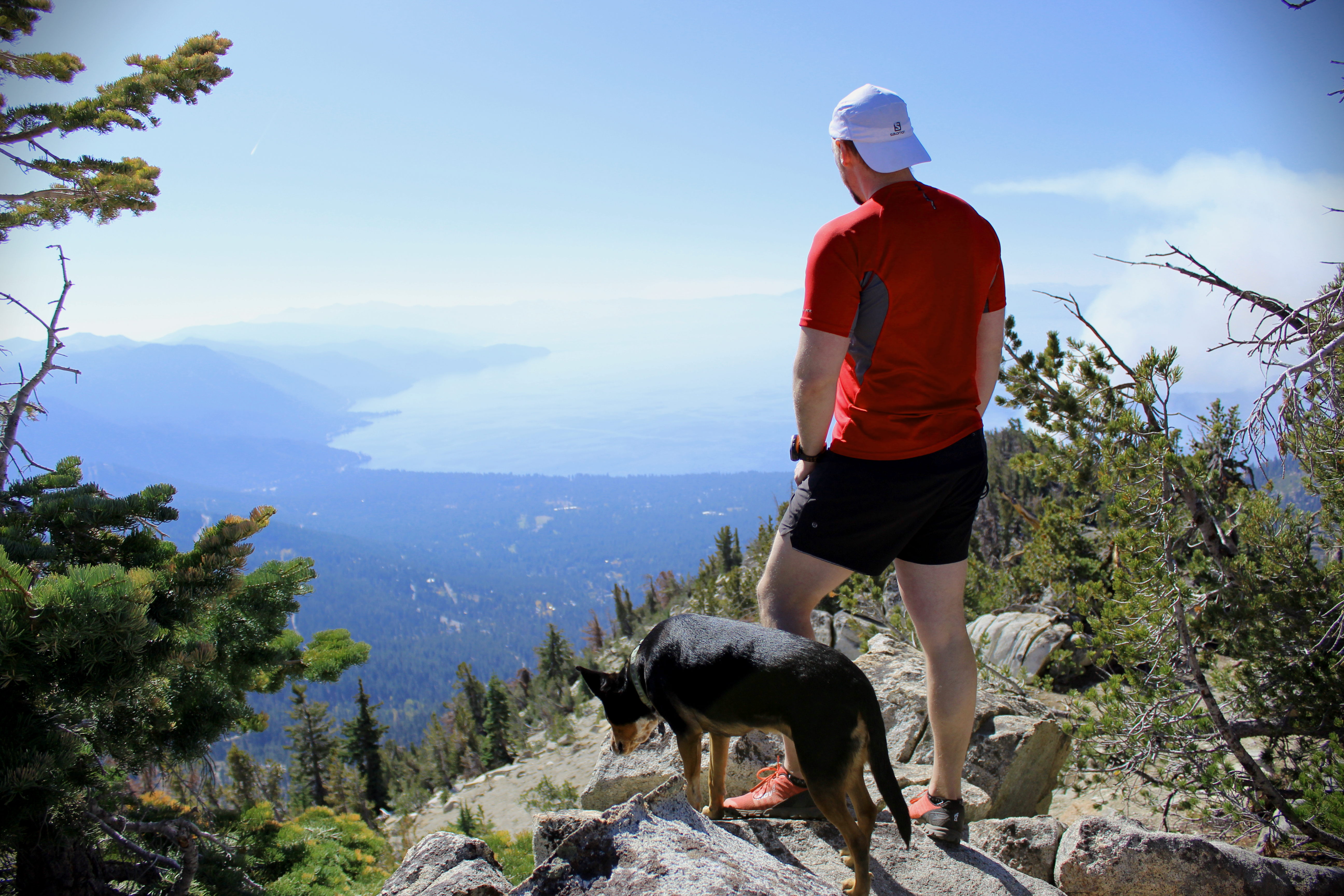
This trail was lightly trafficked and HARD. As avid hikers, we don’t use that description often and it takes a special trail to earn it. We started at the Elk Mountain Trailhead, and the trail climbed over 2,000 feet in 1.5 miles to Elk Mountain. It was brutal! The trail was steep and very rocky. At points it felt like we were just scrambling, and our hiking poles were extremely useful. After a breather at the top, we started the descent to the ridge line that would take us to King’s Mountain. It was more rocky scrambling through this portion and our legs were getting very fatigued. We finally made it to the King’s Mountain summit and the views were spectacular. The last time we were there, it was snowing and you couldn’t see across the valley. This day we had bluebird skies and perfect views of both Mt. Hood and the ocean. From there, it was an easy, gradual descent down the King’s Mountain trail and a 3 mile hike along the Wilson River Trail back to the car for a total of 10.5 miles.
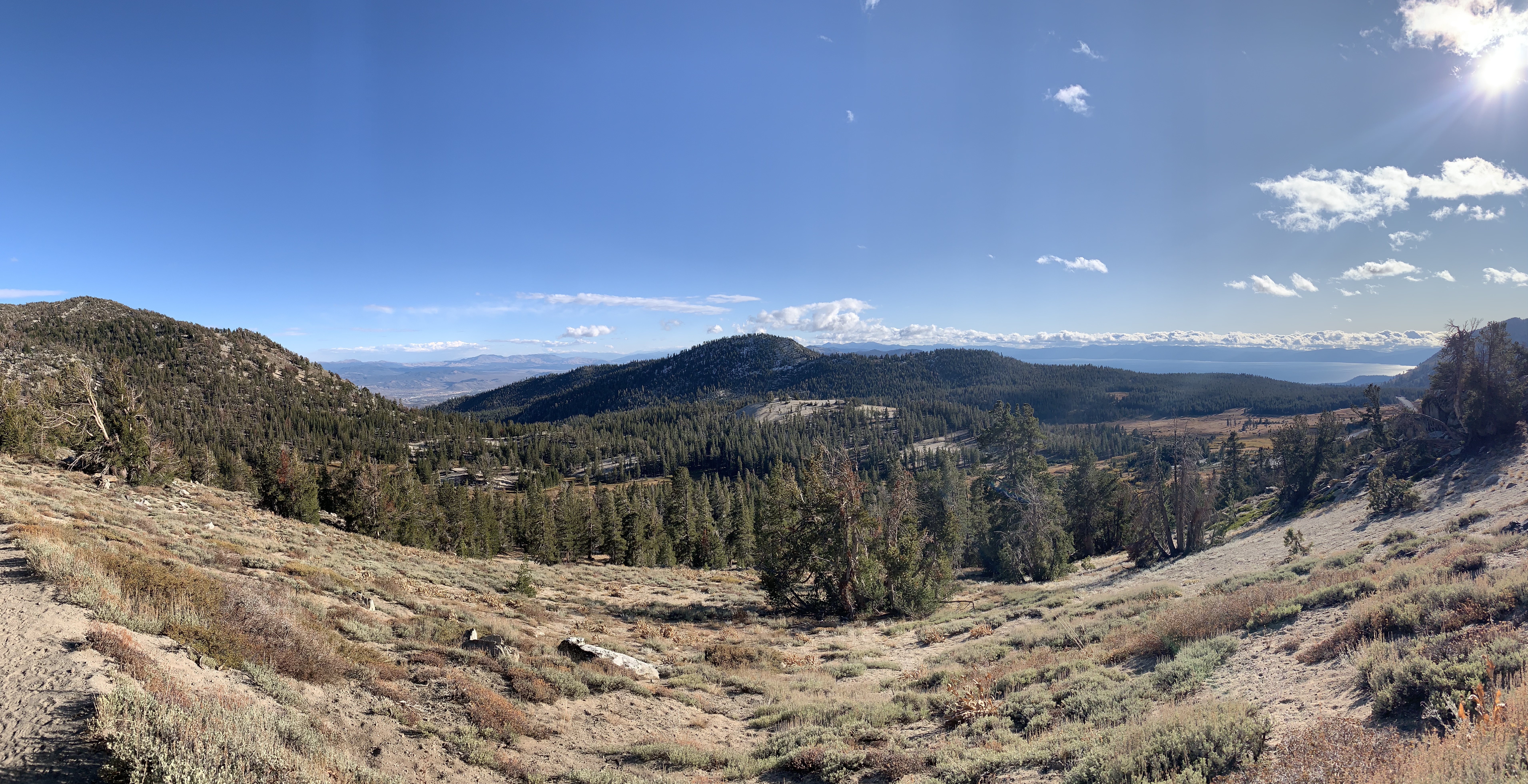
Pat’s Knob is a 4.5 mile trail near Incline Village in North Lake Tahoe. The trail is moderate, but the altitude (over 8k ft at the base) made it a bit strenuous. The trail starts on a service road for ~1/2 mile before veering off into single-track. The actual trailhead can be easy to miss, so keep an eye out. The trail is mostly loose rock, but not overly technical. At the top, there is a great lookout point over Lake Tahoe with some rocks for scrambling. We were the only ones at the top (a rarity!), so we spent a bit of time just hanging out and admiring the view. The return trip was a quick downhill through the forest.
The Secret Cove is a short, gradual trail that leads to a gorgeous cove on Lake Tahoe. The cove is clothing option, so be prepared for some nudity. The weather was in the mid-60s the day we went and, while we didn’t swim, we did enjoy sunning ourselves on the rocks. It was so quiet, and there are plenty of places to escape the other hikers.
We did this 5 mile portion of the Tahoe Rim trail in the evening after work. AllTrails says it’s heavily trafficked, but we went on a cold evening in the shoulder season and didn’t see anyone after the first half mile. There is only 550 ft. of elevation gain making it a great running trail or simply a good intro to hiking at altitude. The majority of the climb is in the first mile and then the trail is mostly flat to the falls. It runs through the forest – there are no views of Lake Tahoe – and you have views of Reno and Tamarack Lake. The trail ends at a small waterfall, which was a bit frozen the day we went. It was a cold, windy day, so we didn’t spend much time at the falls opting instead to high-tail it back to the car before dark. Overall, a very enjoyable, quick hike.
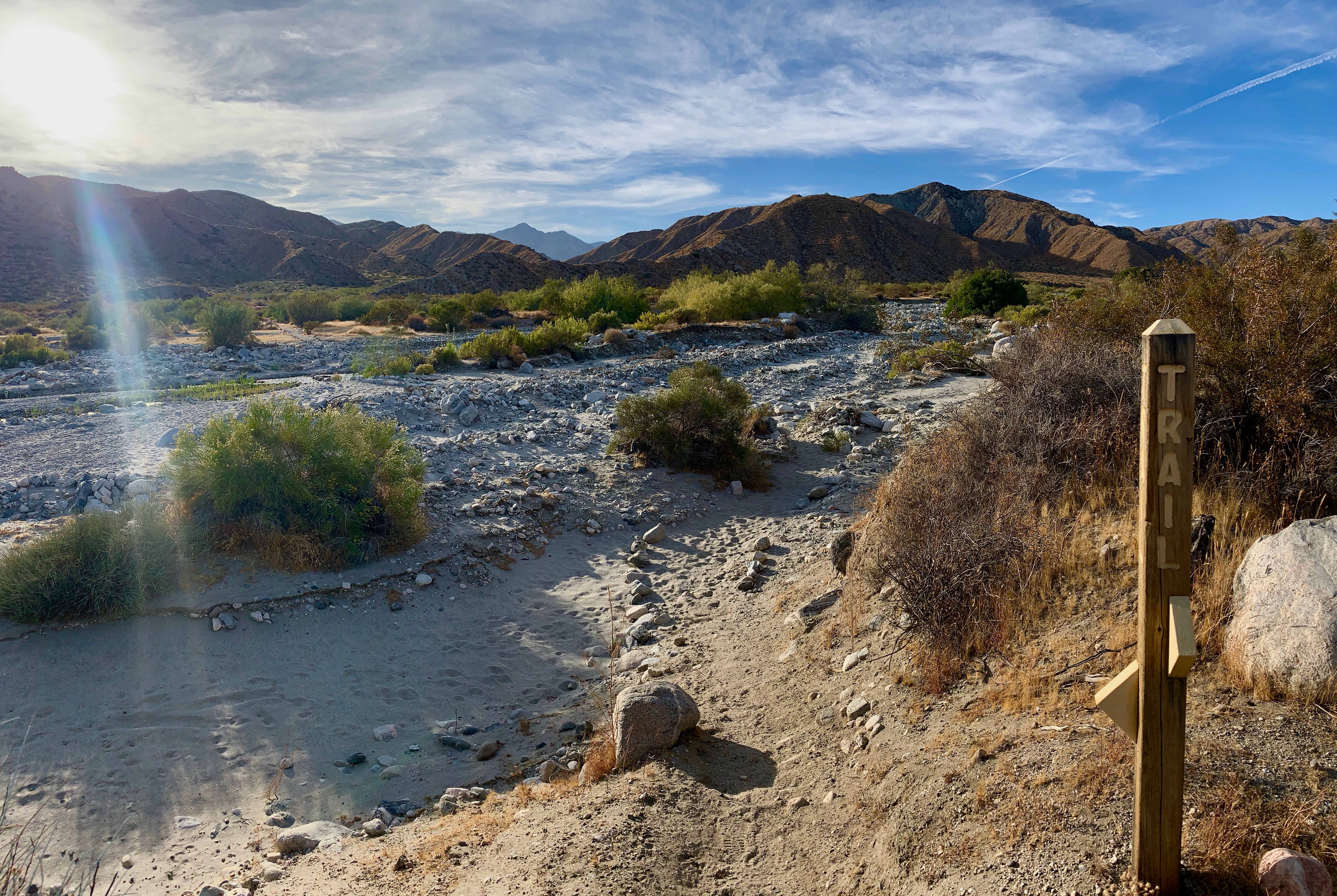
During our stay in Yucca Valley, we did the Mission Creek Preserve Trail twice. There was no shortage of trails in the area, but most of them were sand which makes for a very difficult, very unpleasant hike. This trail runs through a canyon in the Mission Creek Nature Preserve. The first 1.5 miles are on a gravel road – inaccessible to cars – and then it turns into a single-track trail. It actually serves as a connection to the Pacific Crest Trail! We did 5 miles on this trail and thoroughly enjoyed ourselves. The trail climbs very gradually through the canyon before opening up to a sweeping vista of the mountains and river. At 1.5 miles, the trail turns through the river bed and comes out on the other side to continue through the canyon. At this point it got too sandy to run, so we turned back.
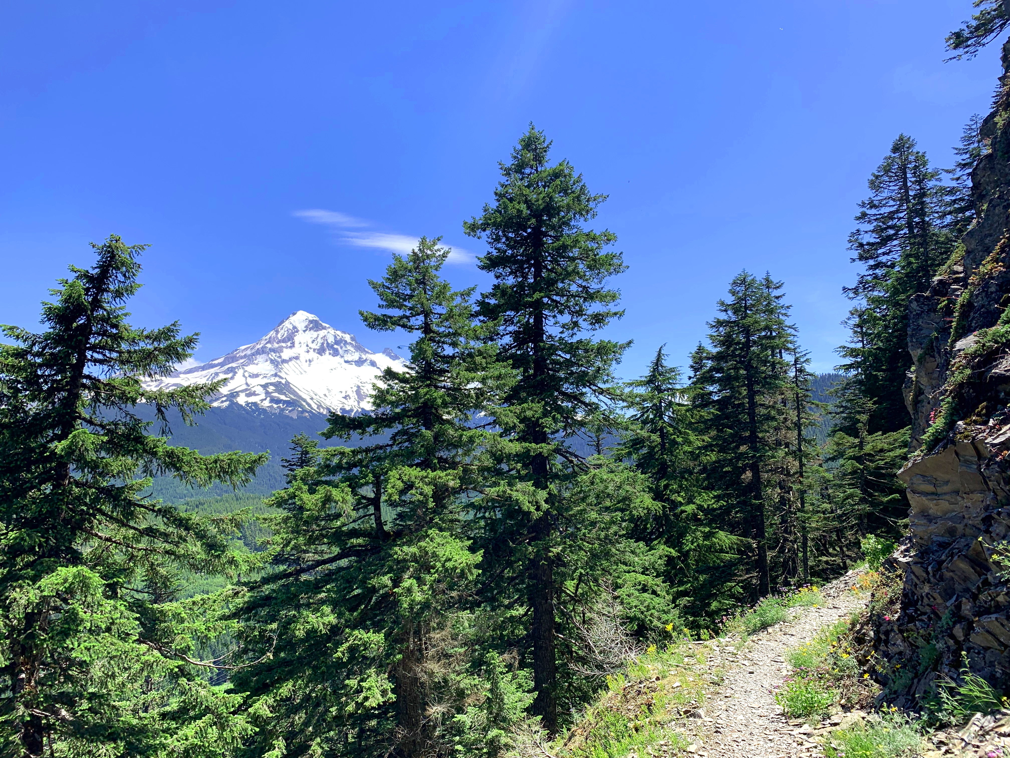
Hamilton Mountain trail is a 5.5 mile hike located in Stevenson, Washington. It’s a moderately trafficked trail and the parking lot can fill up fast. We went in the afternoon around 3pm when crowds had died down. The trail is mostly uphill for the first mile when it comes across a waterfall. There were plenty of people playing in the water to cool off on the hot, August afternoon. From that point, the trail levels off for the next 0.5-1 mile and meanders through the forest with a few gorgeous vistas of the Gorge. Around mile 2 you come to a lookout point where most people stop. If you’ve got it in you, I highly recommend gutting it out for the last mile to the top. The trail is a bit unrelenting as it climbs ~1k feet through countless switchbacks but the reward is worth the pain. At the top there are sweeping views of the Gorge, Mt. Adams, and Mt. Hood. Be sure to take plenty of water; most of the trail is shaded, but the last mile has a lot of exposure and can get very hot.
Horsetail and Ponytail Falls are located in the Columbia River Gorge. We ended up hiking this short trail when the parking lot for Multnomah Falls was overflowing and we didn’t want to wait. Horsetail Falls is the lower falls, right off the parking area. Taking a short 0.5 mile hike up the trail will get you to Ponytail Falls, which is a smaller waterfall feeding Horsetail below. The trail is at an incline, but it’s not a very difficult climb and is an overall easy hike. The trail winds behind the waterfall at Ponytail Falls and the pool at the base is cool and refreshing. Due to the Eagle Creek Fire of 2017, the trail is closed after Ponytail Falls.
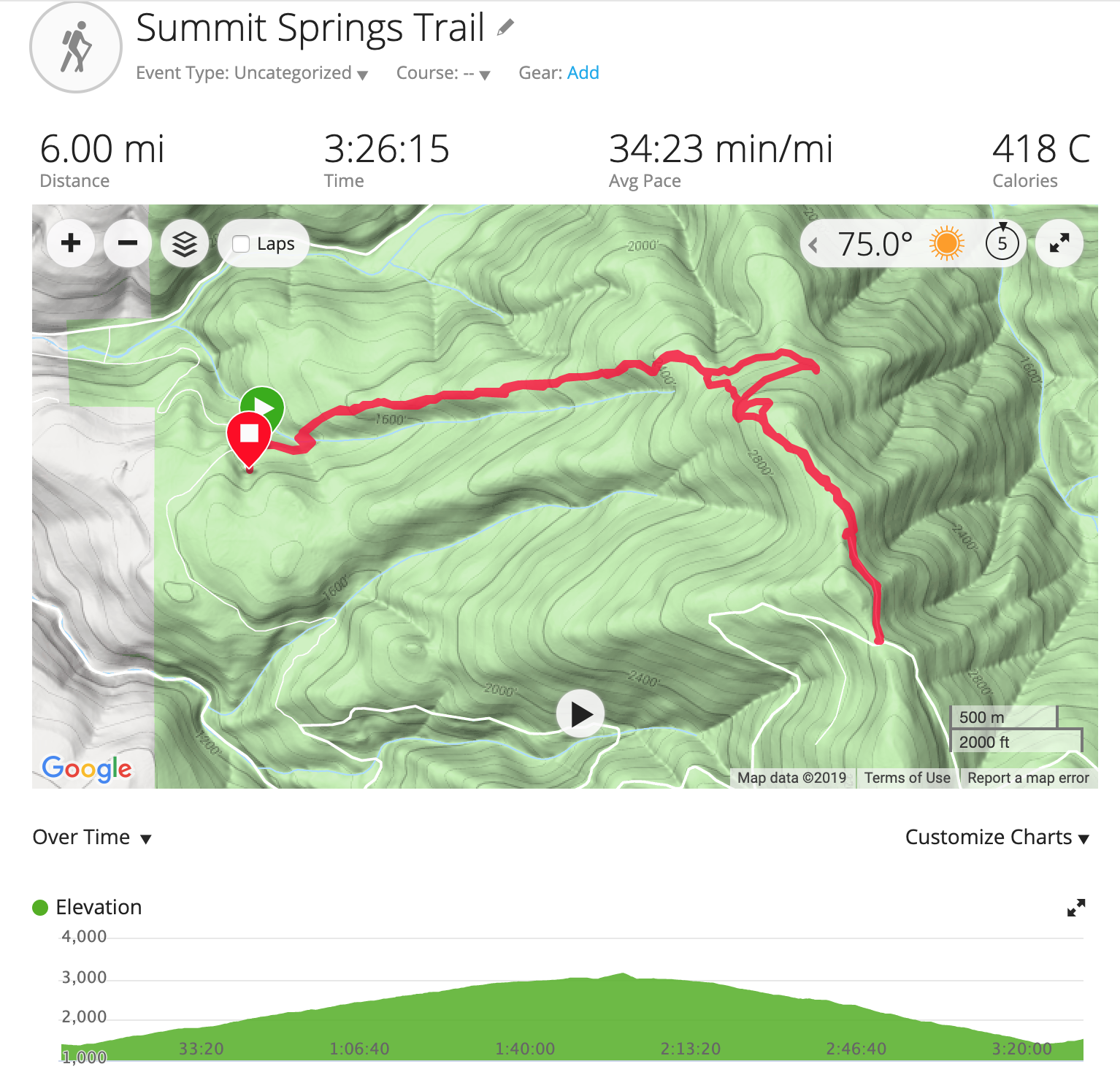
Another Plan B trail – we hiked the Summit Springs Trail when we couldn’t make it up the road to Silver Star Mountain. This is a lightly trafficked trail (we didn’t see a single other person) that winds 6 miles through dense forest. It is a moderate trail that climbs 1,700 feet all in the first half. We took the shortcut halfway up and it was incredibly steep. So much so that we were crawling on hands and knees to get up the climb; probably didn’t save us much time in the end and wouldn’t recommend it. The top opens up to a vista of the hills – no mountain views, but still pretty – with a rock slide area to scramble up. The trail turns into a jeep trail at this point and leads to campsites up the mountain.
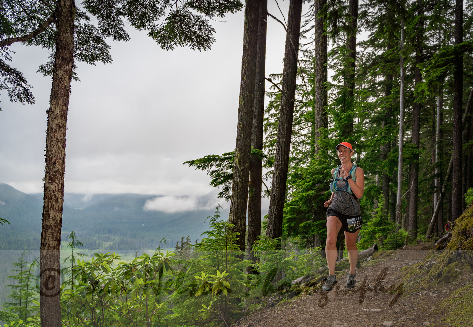
The second weekend in July I ran my first 50 mile race and lived to tell the tale! The Mt. Hood 50M is put on by Go Beyond Racing and I can’t say enough good things about Todd, Renee, and the rest of the team. The course is a double out-and-back course run entirely on the Pacific Crest Trail near Timothy Lake. While we didn’t get the sweeping views of Mt. Hood due to cloud cover, the weather couldn’t have been more perfect.
The race had a 6am start time, so Matt and I stayed at a hotel in Mt. Hood Village the night before. We rolled into the Clackamas Ranger Station at 5:40, I pinned on my bib, and got ready to go. I had run the first half of the course before and knew what to expect, but I was still equal parts nervous and excited.
Miles 1-6: We wound along Timothy Lake for 6 miles before hitting the first aid station at Little Crater Lake. I took this section slow – falling in pace with whatever group was ahead of me – to preserve my legs for later. I cruised through the first aid station and started my first climb.
Miles 7-14: It was 3 miles of uphill to the next aid station and to the rolling ridge line. I didn’t need to stop for aid after climbing the hill so I kept on going the final 5 miles to the turn around. I was keeping pace with a group of people and started chatting with a guy from Cincinnati, of all places. At this point I was able to count the super speedy ladies ahead of me and knew a top 10 female finish was within reach.
Miles 15-19: I reached the turn around and kept moving forward. The photographer was along the ridge line to hopefully get some shots of runners with the mountain, but the clouds were not in our favor. I still pulled out a big smile and headed downhill.
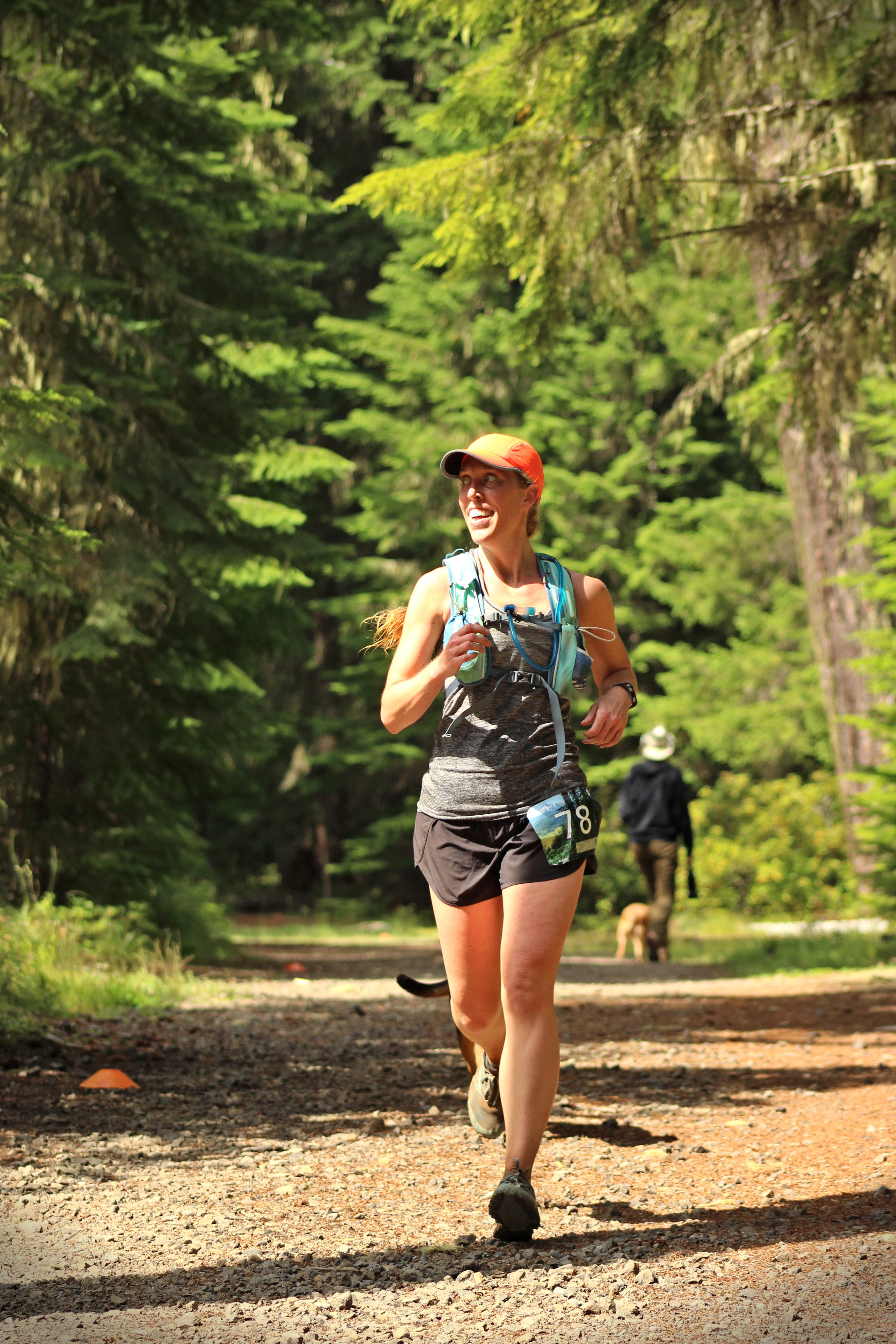
Miles 20-28: I filled my water at the next aid station and let my legs loose. Downhill felt so good after all the climbing and I was finally ready to bust out some fast miles. I ran into Matt and Snickers around mile 21 – Snickers went crazy! After a quick hello I kept on trucking. Since it was only 3 miles between aid stations, I went right through it, but the Wy’east crew was looking dapper in their suits. The next 6 miles were rolling hills at a slight incline; I took them in my usual manner – run when you can, walk when you can’t – and got to the halfway point in 4 hours and 40 minutes.
Halfway: I stopped briefly here to catch up with Matt and Snickers. We refilled my water, loaded up on food (GUs, potatoes, Nuun), slathered on the sunscreen and Body Glide, and I was ready to go again. I felt really good at this point. The Go Beyond Racing team puts on such good races and there was so much energy at the halfway point. My legs felt good and I was excited to hit the back half of the course.
Miles 29-33: The second half of the course was HARD! Not only was I running on tired legs, but there was a lot of uphill and fewer aid stations. While the first half I ran with people, I didn’t see a single person for the first 4 miles of the second half. It was a 6 mile climb to the first aid station and I was moving pretty slowly. I always hike the uphill sections to save my energy, and 6 miles of uphill felt like an eternity. There was also a bit less tree coverage, so I was thankful for the clouds. I made it to the aid station and took full advantage of the water sprayer they had to cool down.
Miles 34-44: It was 5 miles to the final turn around point with a blissful 3 miles of descent right off the bat. I immediately saw the first place male finisher – he was 11 miles ahead of me! Talk about speedy; he finished in 6 hours, 23 minutes!! I sped down the hill and finished the last 2 mile climb to the aid station. The volunteers filled my bladder with ice and water and it was amazing to finally drink cold water. I was out of there in no time and had 11 miles to the finish! I zipped down the 2 mile stretch and power hiked up to the last aid station. After grabbing a GU and another water spray down, I was in the home stretch!
Miles 45-50: Going into the last aid station, I was still holding 9th place female. I saw a woman who had been ahead of me all day talking to a medic; I felt for her – you truly never know what can go wrong in a race – but I couldn’t help smile as I took hold of 8th place. I took the last 6 miles downhill as fast as I could, which isn’t easy when you’re already 44 miles into the day. I was starting to feel the aches in my joints, but felt pretty good overall. With a half mile left I came upon another lady. I gave it everything I had and pulled ahead of her hoping I could push it to the finish.
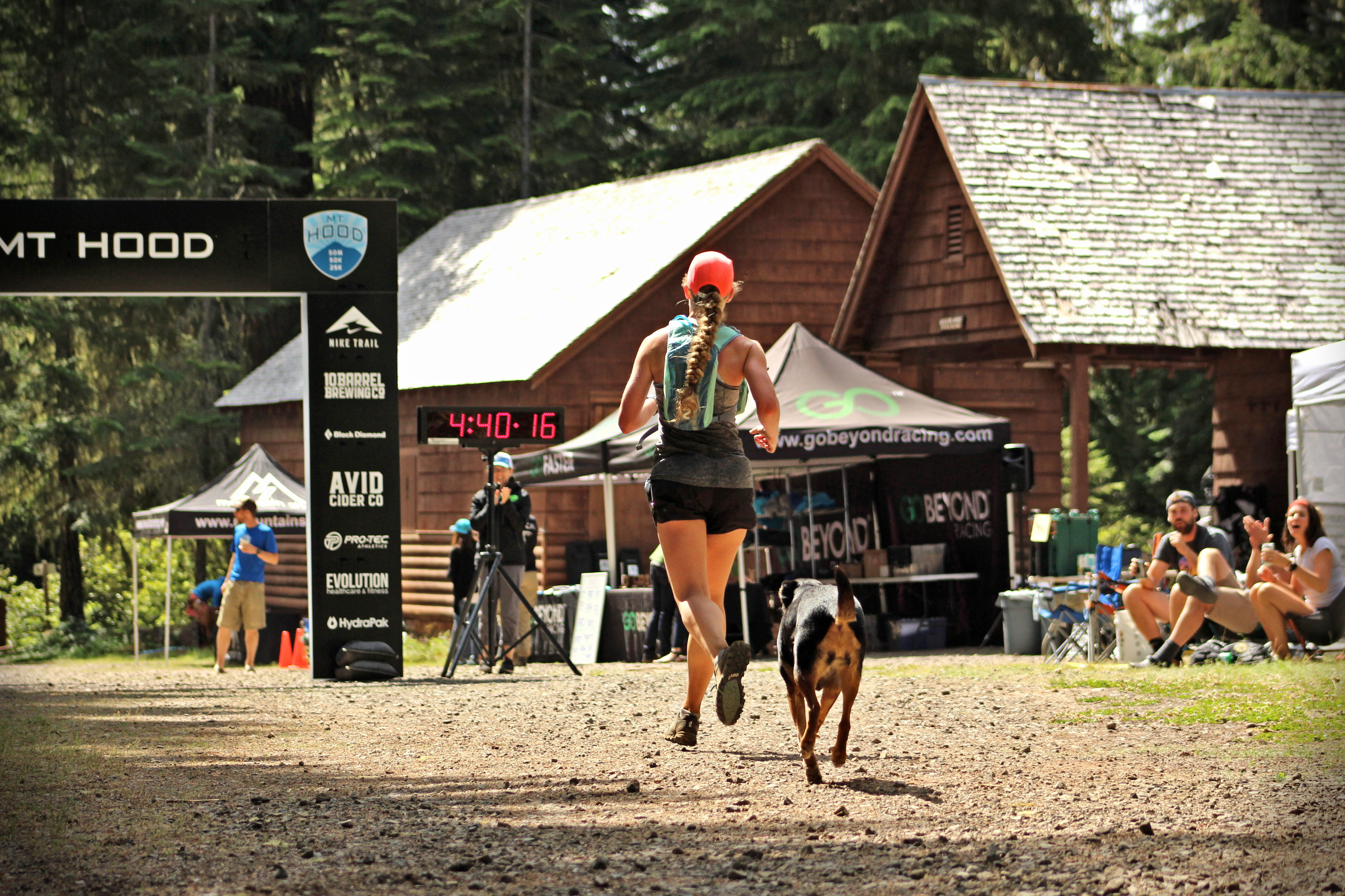
Coming into the finish line was amazing! I could hear the cheering as soon as I hit the road crossing and it powered me to push my legs with energy I didn’t realize I still had.
Going into any race I usually set three goals for myself: 1. finish; 2. a realistic goal I share with everyone; 3. a secret goal that I can maybe hit if the stars align. For the Mt. Hood 50M my goals were:
Finish standing up
Finish in 10.5-12 hours. This seemed like a long time, but given that this was a new distance and my 45 mile training run didn’t go as planned I wanted to include a large buffer for bonking.
Finish in 10 hours and place in the top 10 women
I not only met all of my goals, but I completely knocked the last one out of the park! I finished an HOUR under my anticipated time in 9 hours, 13 minutes. Out of the 144 racers that toed the line, I finished 25th overall, 7th place female, and 3rd in my age group!! I am still shocked at how good I felt at the end of the race.
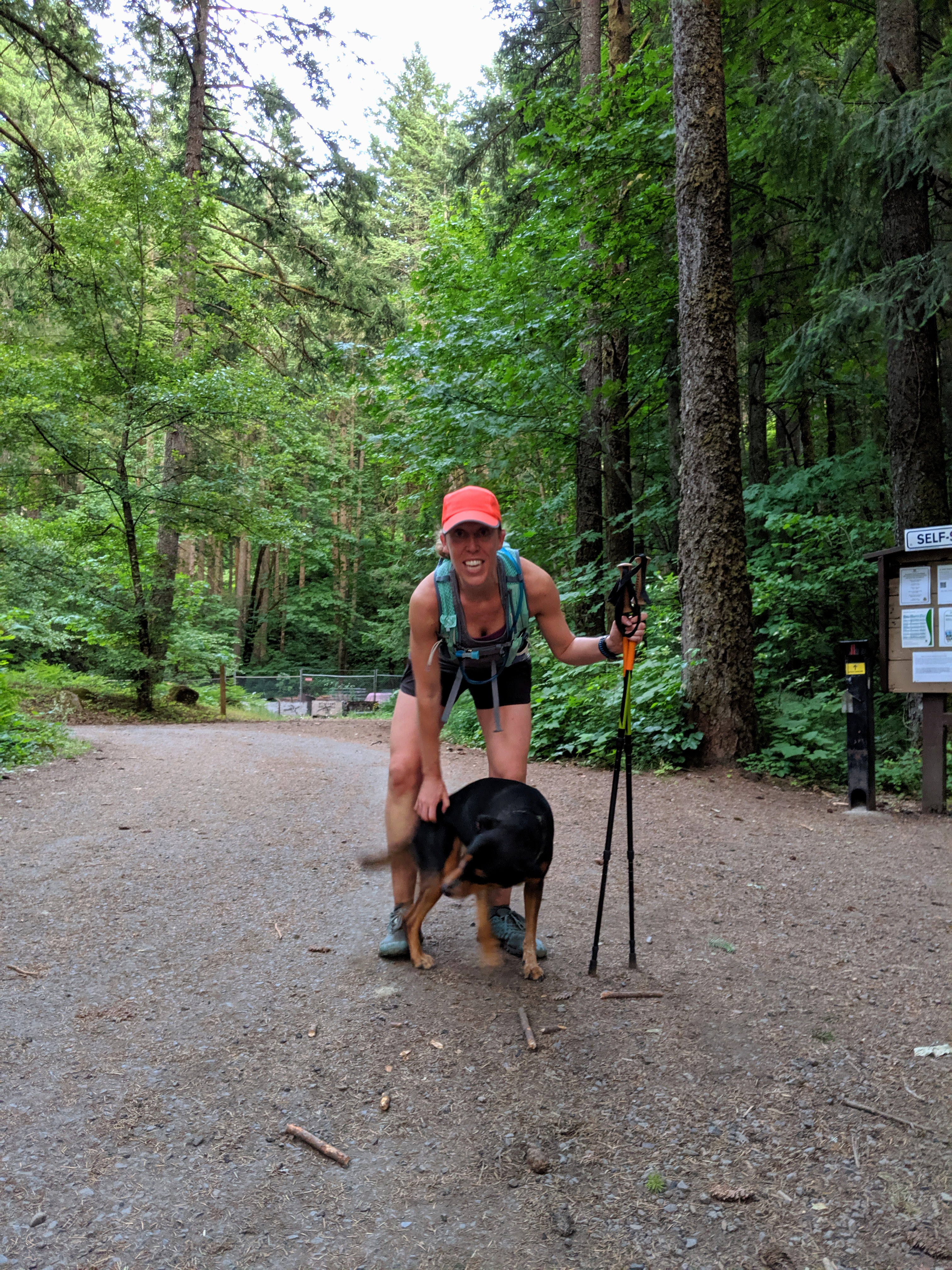
As always, I have to give a huge shoutout to the Go Beyond Racing team for putting on another amazing event. To all of the volunteers continuing to bring the smiles and support to the aid stations. To Paul Nelson for always capturing stellar race photos. And to my personal crew – Matt and Snickers – for not only putting up with my crazy antics but supporting me at every step along the way….even if that means getting up at 4am and hanging out in the woods for 9 hours.
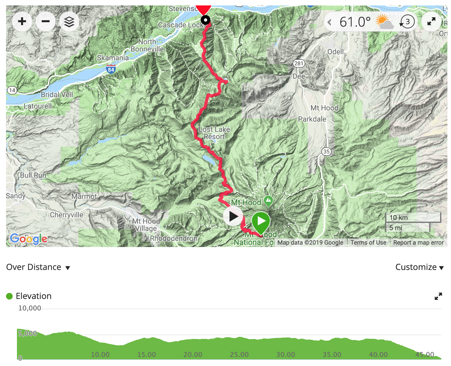
With a big race coming up in July, I decided to go all out for peak week and chose a trail I knew would be both challenging and rewarding. After debating between a few different trails, I decided to run from Mt. Hood to the Columbia River Gorge. Covering 45 miles with 7,000 ft. of ascent, and 13,700 ft. of descent this trail was going to test my mental and physical stamina.
PCT at Timberline Lodge
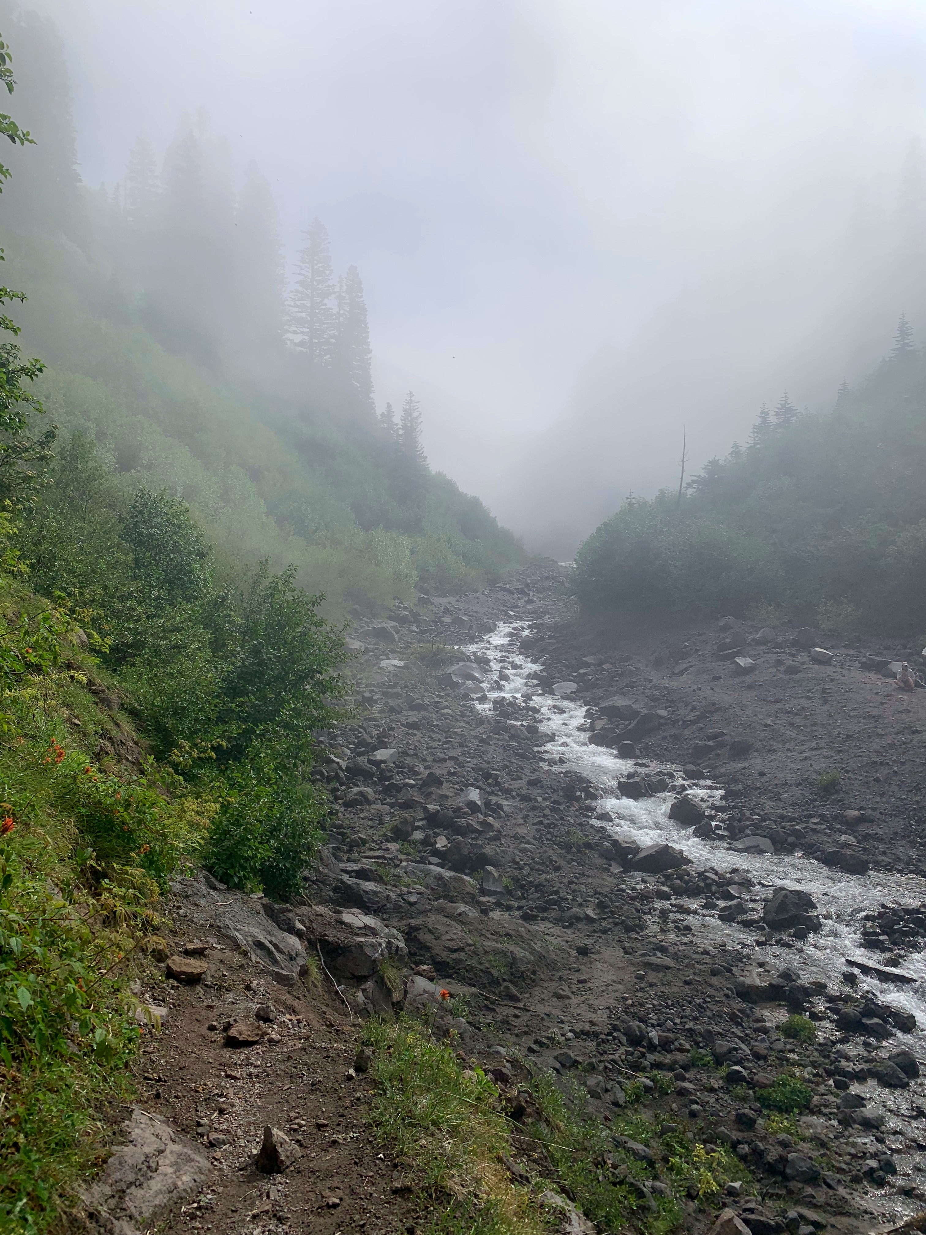
We got a late start to the day, hitting the trail around 9:30. I knew I would be chasing daylight but had high hopes for finishing strong. I started on the PCT at Timberline Lodge with a starting elevation of 6,100 ft. No stranger to altitude, I knew this first section of trail would be challenging on the lungs. The first three miles were fun and quick. There were still patches of snow, which made for some slippery miles, but it was an overall descent to the Zig Zag River. The river was running from the snow melt, but I was able to pick a path across and be on my way.
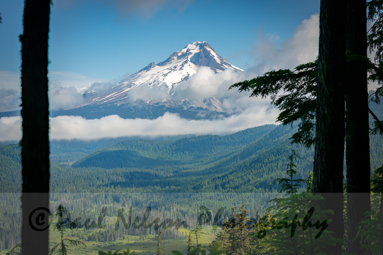
Mt. Hood
Zig Zag River Crossing
The trail proceeded to climb 1,000 ft. over the next 3 miles. With the snow and altitude, it was slow going, but the views of the mountain through the clouds kept me energized. After mile 6, I was met with a blissful 2,500 ft. descent over the next 6 miles. The terrain changed drastically – going from snow, across rocky plains, down a sandy hill, and finally into the pine forest that is ubiquitous in Oregon. I rolled my ankle around mile 9 and thought I might have to tap out. Thankfully I was able to recover quickly. Miles 12-13 were familiar territory – we hiked this portion of the PCT to Ramona Falls way back in 2016. There was a fun creek crossing across two fallen trees where I had to cling to a rope to avoid falling. Then came a grueling 1,600 ft. climb over 2 miles.
Creek crossing near Ramona Falls
I finally met Matt and Snickers at the top of the hill, feeling a little disheartened. My pace was suffering greatly from the climbing and I was about 20 minutes behind schedule. Nonetheless, we powered the next 3 miles (thankfully downhill) to the car at mile 16 to refill food and water. If I wasn’t able to get back to my normal pace, there was a possibility that I’d need to get pulled from the trail at the next stop to avoid running in the dark. I had 16 miles to the next crew point and at that point we would make the decision whether or not to keep going.
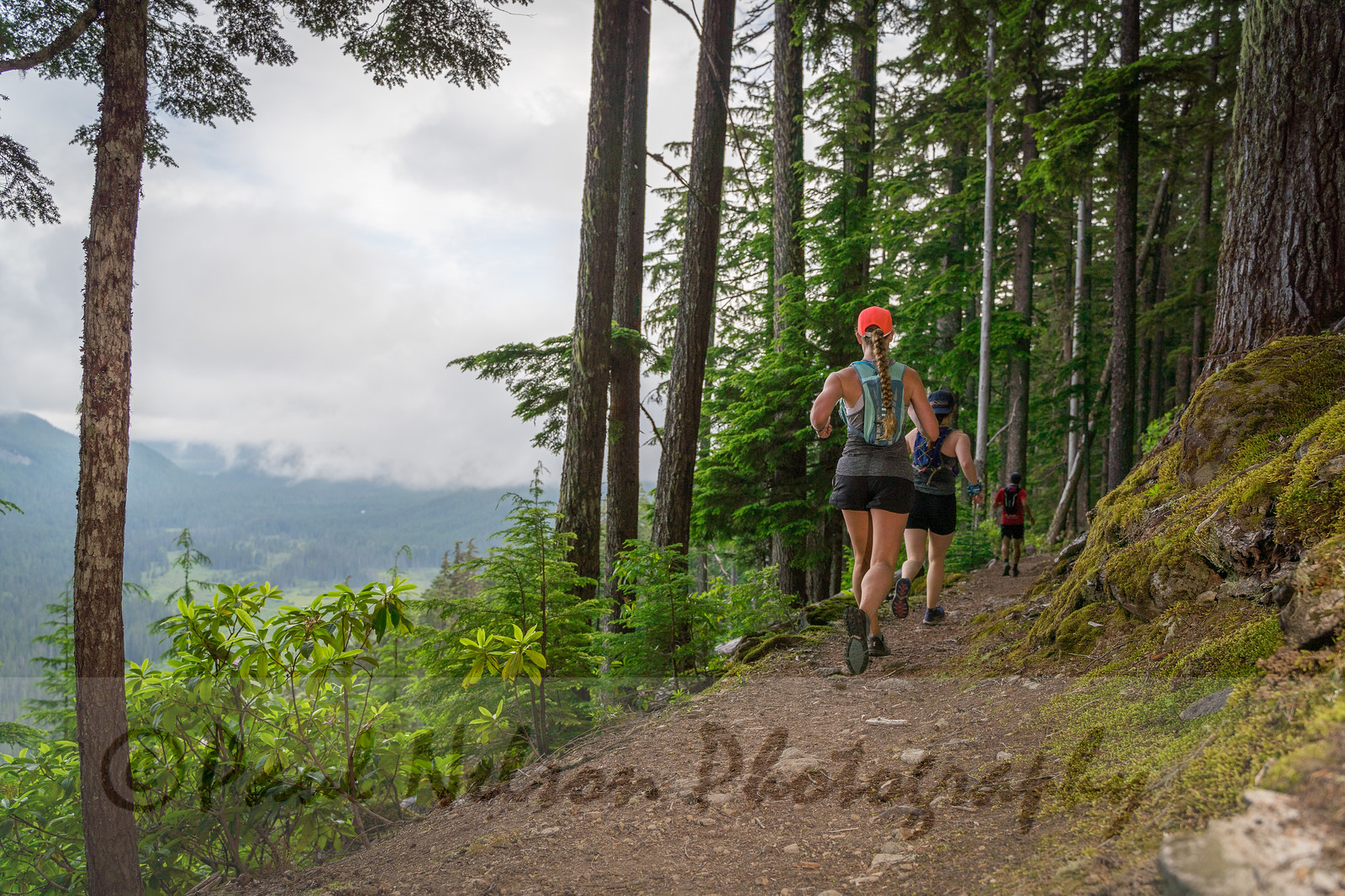
Thankfully the next 16 miles felt great. I had a burst of energy and was able to power through the rolling hills with little issue. There were wildflowers galore and views of Mt. Hood around every turn. This section of trail was very different from the beginning; it reminded me a lot of Utah running. The trail was more rocky and there was a bit less tree coverage. Around mile 28 I rounded a curve and saw Mt. Adams more clearly and up close than I’ve ever seen it before. It was truly a great day to be out on the trail. I finally saw the sign to Wahtum Lake (where I was meeting Matt) at mile 29 and it was straight downhill from there.
Mt. Adams
I felt really good rolling into Wahtum lake at mile 32 and wanted to keep going. We assessed the map and calculated somewhere around 8-12 miles to the end point at Herman Creek Trailhead. The trail I initially planned took the Eagle Creek Trail to Cascade Locks, but that trail is still closed from the wildfires of 2017. I decided to keep going thinking it was going to be mostly downhill. Boy was I wrong.
After leaving the parking lot, I was immediately greeted with a 700 ft. climb in 0.7 miles. It was brutal and I felt like I’d never reach the top. The PCT was rolling hills for the next 9 miles. It wound through rocky terrain and a portion of forest that was burned in 2017. Every time I felt like I was finally descending, the trail would shoot me right back up to the ridge line at 4,000 ft. I was expecting 9 miles to the finish but it was actually closer to 13. When I hit mile 40, knowing I still had 5 miles to go and still hadn’t started the descent, I was hitting a breaking point. I finally hit the descent with 4 miles to go. This part was very rocky and technical and my tired legs kept tripping, so for safety reasons I slowed to a walk. I was finally able to get ahold of Matt at this point and he ran in 2 miles to help me get out. Night was fast approaching and I was so angry and frustrated at myself for not moving faster. When I saw him with 2 miles to go, I officially broke. Mentally and physically I was done. I’m sure I was a sight to see hobbling down the trail with tears running down my face 🙂 . Bolstered by some food, hiking poles, and a pep talk we finished the 2 miles to the parking lot just in time for dusk.
I finished 45.5 miles, 7,000 ft. ascent, 13,700 ft. descent in just over 11 hours total. Even looking at the moving time, which was right at 10 hours, my pace was the slowest I’ve ever run. Mentally I’m disappointed I couldn’t maintain the pace I wanted, but rationally I know that’s silly. I covered more ground and more ascent – by a good 10 miles and 2,000 ft. – than I’ve ever done in a single run. I would’ve liked to finish much faster, but I’m really amazed at the distance I was able to go. I finished standing up with no injuries or GI issues, which is a feat in and of itself.
Sunset in the Columbia River Gorge
I’m ready for my race…let’s just hope my legs stop hurting before then.
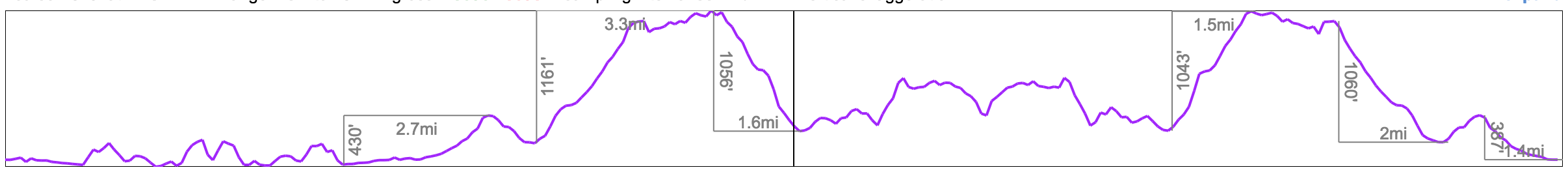
Portland is rife with hiking trails throughout the city. Forest Park, alone, has about 70 miles of trails within its boundaries. The Wildwood Trail runs for 30.2 miles through both Washington Park and Forest Park. When we moved here in October 2018 my goal was to run the trail end to end, and I finally did it in June 2019.
Forest Park is gorgeous this time of year. The trails have dried out from all the winter rain, and the spring foliage is incredibly lush. There is plenty of canopy coverage to keep you cool on a hot day. Spring and summer running make up for all of the wet, winter runs through ankle-deep mud.
I run portions of the Wildwood twice a week, and have run approximately 22 miles of the trail. Since I’m in the thick of ultra marathon training, it was the perfect time to do the trail in its entirety. I needed to hit 35 miles for the day, so I tacked on an additional 6.5 miles to get from our apartment to the trailhead. I started at Portland State University running on Terwilliger to the Marquam trailhead, followed the Marquam Trail up through Council Crest, before finally meeting up at the start of the Wildwood in Washington Park.
The weather was cool and cloudy – perfect for a long run. The first 2.4 miles to the trailhead are on the road and quick. The next 2.6 on the Marquam Trail up to Council Crest are always slow-going for me; the trail climbs roughly 1,100 feet in this section and I end up doing quite a bit of hiking. Thankfully, the next 1.5 miles to the start of the Wildwood are downhill. The Wildwood is mostly rolling hills the 2-ish miles through Washington Park giving a bit of breather before climbing to Pittock Mansion. The trail is closed for about 1/2 mile at Burnside before the hill to Pittock Mansion, but luckily someone posted a detour that runs along the road. After Pittock there’s a downhill to McLeay Falls before a long, rolling climb to Fire Lane 1 (my halfway point). I got to Fire Lane 1 where I met Matt for a refill of my water and to grab some snacks.The second half of the run felt a lot slower than the first. I was able to keep a decent pace and just kept moving forward, even if that meant walking. The Wildwood is a fairly easy trail without a lot of climbing. While this is usually a good thing, a very runnable trail means, well, a lot of running :). I enjoyed the rolling hills and quiet section of trail for next 8 miles, when I started to get pretty fatigued around mile 25. I fueled myself with plenty of GUs, potatoes, and peanut butter crackers, ensured I was staying well hydrated, and kept chugging along. There weren’t any more major climbs after Pittock, so it was mostly a mental game to move forward as quickly as I was able.
After crossing Germantown Road around mile 30, I knew I was in the home stretch with about 5 miles to go. I took a tumble a mile in – tired legs + tree roots are a recipe for disaster – but, aside from a slightly bruised ego I was fine to keep going. I met Matt and Snickers at Firelane 15 with 1.8 miles to the end. They helped me keep moving, though at this point my knees and feet were achy so I was going pretty slowly. We finally made it to the car in around 7 hours. Not the fastest by far, but it felt really good to accomplish something of that magnitude.
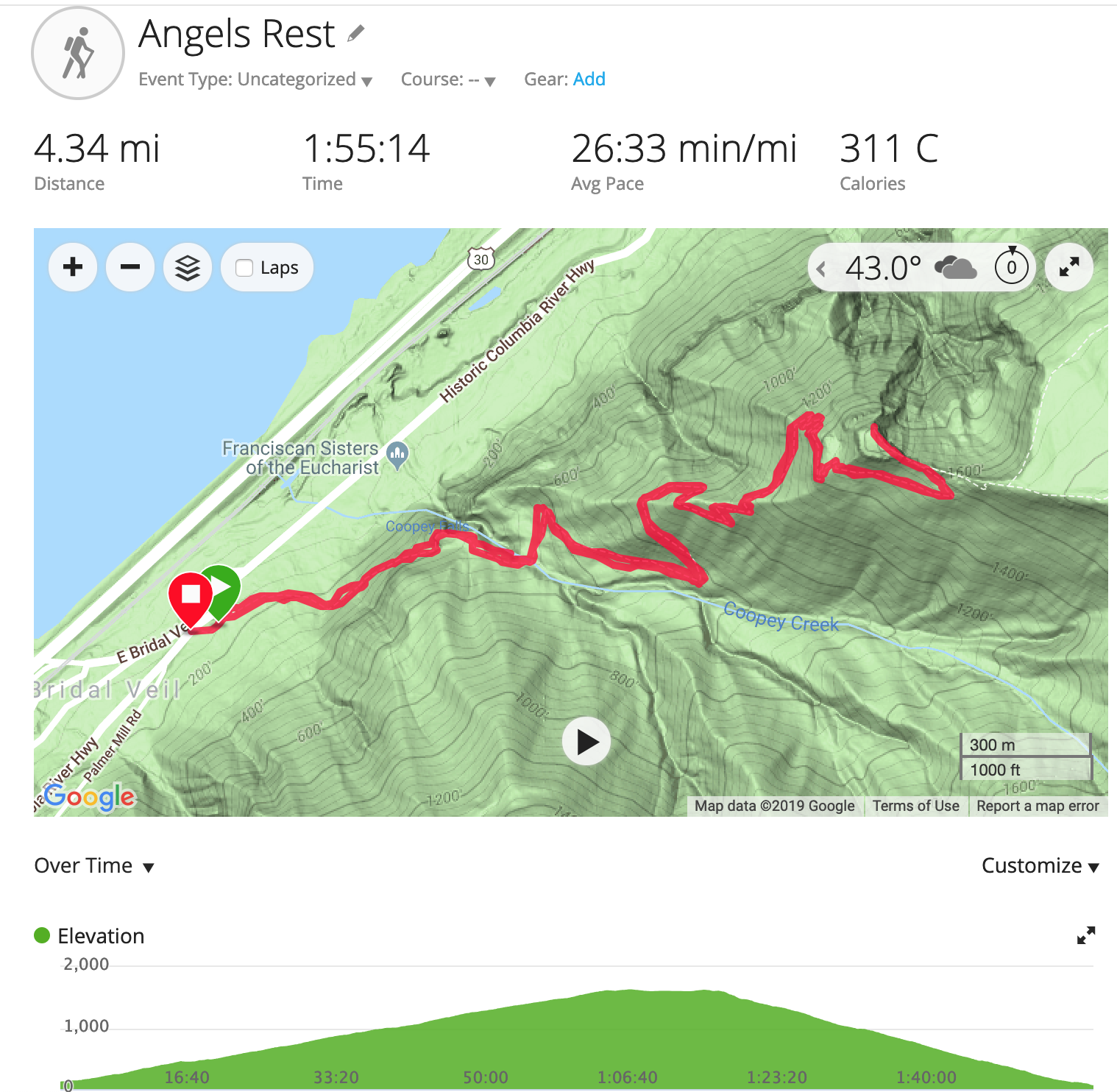
Angels Rest trail is an easily-accessed trail in the Columbia River Gorge, an easy 30 miles from downtown Portland. The trail is a 4.3 mile, moderately trafficked out-and-back with gorgeous vistas culminating in a spectacular view from the top. It is a gradual climb of ~1400 feet and features a stream crossing and waterfall. Since it is right off the interstate it can get busy, so it’s best to go earlier in the day. In early February the trail was quite muddy at the bottom and snow covered at the top, so having proper hiking shoes was imperative. The Gorge experienced a fire in 2017 that shut down most of the trails on the Oregon side of the river; this trail (and many others) only recently opened in November 2018. There is still evidence of burn the higher up you get, but it doesn’t detract from the experience.
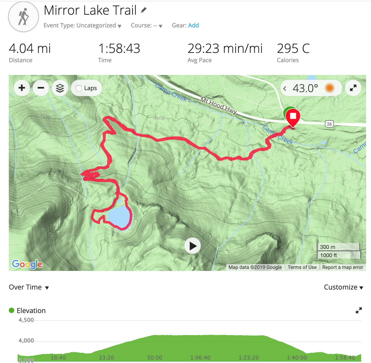
The Mirror Lake loop trail is located in Government Camp at the base of Mt. Hood. The trail is roughly 4 miles with only 650ft. of elevation gain – it’s a very easy and fun hike for all skill levels. We went in mid-March when the weather was sunny and in the low-60s. The trail was moderately trafficked, but I imagine there are a lot more people if you go in the summer. The trail is primarily used for snowshoeing during the winter months. We didn’t have snowshoes, but luckily the snow was hard packed and we didn’t experience any postholing. Once we got to the lake, the original intention was to continue on to the Tom, Dick, and Harry trail, but the snow was too deep and not hard-packed so we were in it up to our knees. One of the coolest things was the bridge crossings – the snow was so deep that we were walking at the top of the railings, a good 3+ feet above the trail! This is a great trail and easy way to get up close and personal to Mt. Hood without doing very strenuous climbing.
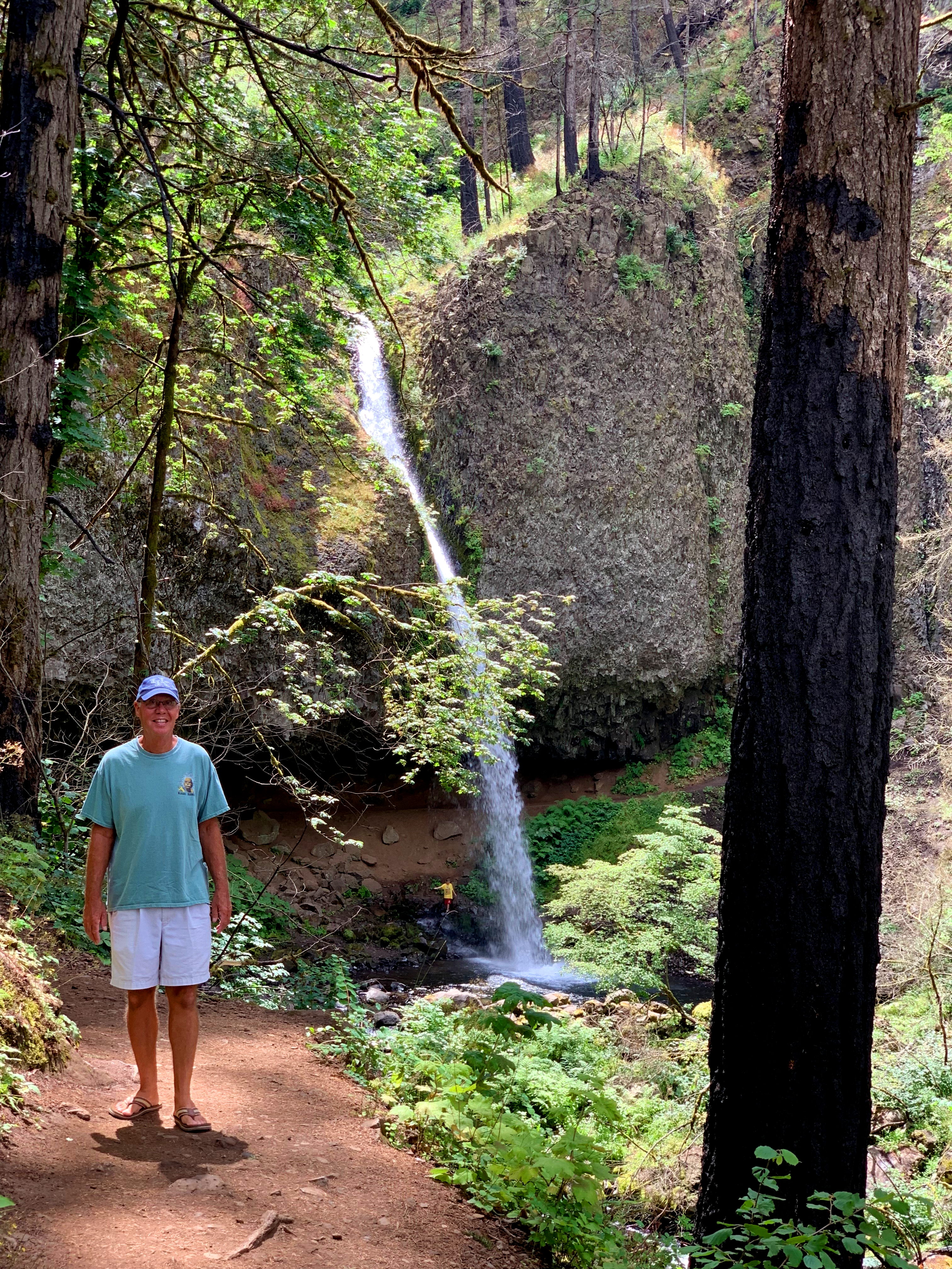
We headed to Salem on a Sunday afternoon to hike the Shellburg and Stassel Falls loop. The trail is 6.5 miles and is on the easy side of moderate. The majority of the trail was on service roads with a couple of portions on single-track trail. The first mile or so is on a road through cow pastures. Once you enter the Santiam State Forest, about a mile and half in, you’ll be standing at the top of Stassel falls. The majority of people bypass the entire loop in favor of just seeing Shellburg Falls, but we opted to hike the entire trail. It was lightly trafficked the day we went and we didn’t see another person until we were on our way out (according to AllTrails this is not usually the case). The highlight of the hike was Shellburg Falls – a 100 ft. waterfall that you can walk behind. Snickers was a little scared to walk behind the water, but she loved running the muddy trails. If you’re in the area, Shellburg Falls is a great sight to see, but otherwise we weren’t too impressed with the trail. We do recommend stopping in Salem at either Salem Ale Works or Bine Valley for some beer after the hike.
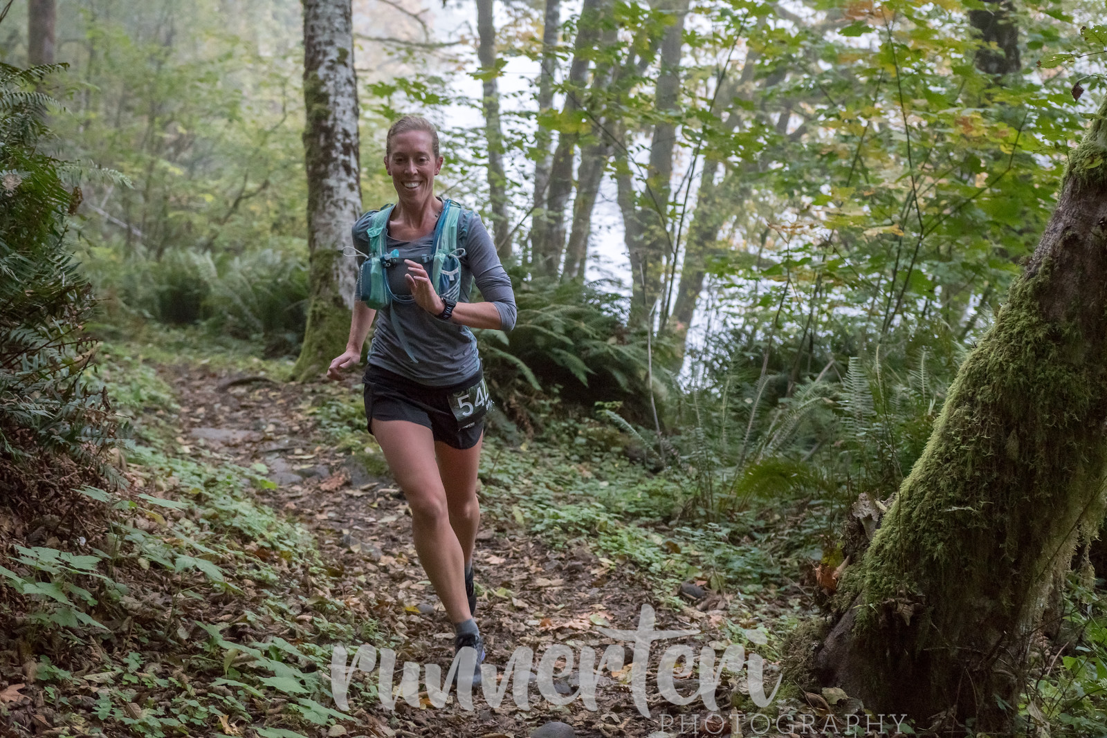
On a beautifully cool and sunny October morning, I ran the Elk-Kings 50K in the Tillamook State Forest in Oregon. I’ve never been much of runner, but I got it in my head last year that I wanted to push my body to see just how much it was capable of. I followed a 16 week training program and felt prepared both mentally and physically when October 13th rolled around.
The race started at the Jones Creek Day Use Area. The weather was crisp and cold and there was a gorgeous fog blanketing the forest. The trail was a double out and back; it went out for 4 miles along the Wilson River before turning back to hit the starting point again and head out in the other direction for 12 before turning back around and finishing at the Tillamook Forest Center. There was roughly 5,600 ft. of elevation gain by my Garmin (though the website says it was closer to 6,500 ft.) with the majority occurring in the second half of the course. (source)
The first 11 miles went by quickly. The trail was full of rolling hills and the energy was high. I rolled my ankle at mile 4 – the terrain was much softer than the rocky ground I trained on in Utah – but I was able to walk it out and keep moving forward. Though it was cold when the race started, the sun came out and I was able to shed my outer layer around mile 8. Matt and Snickers met me at the second aid station around mile 11 to give me a fresh water bladder and take my shirt.
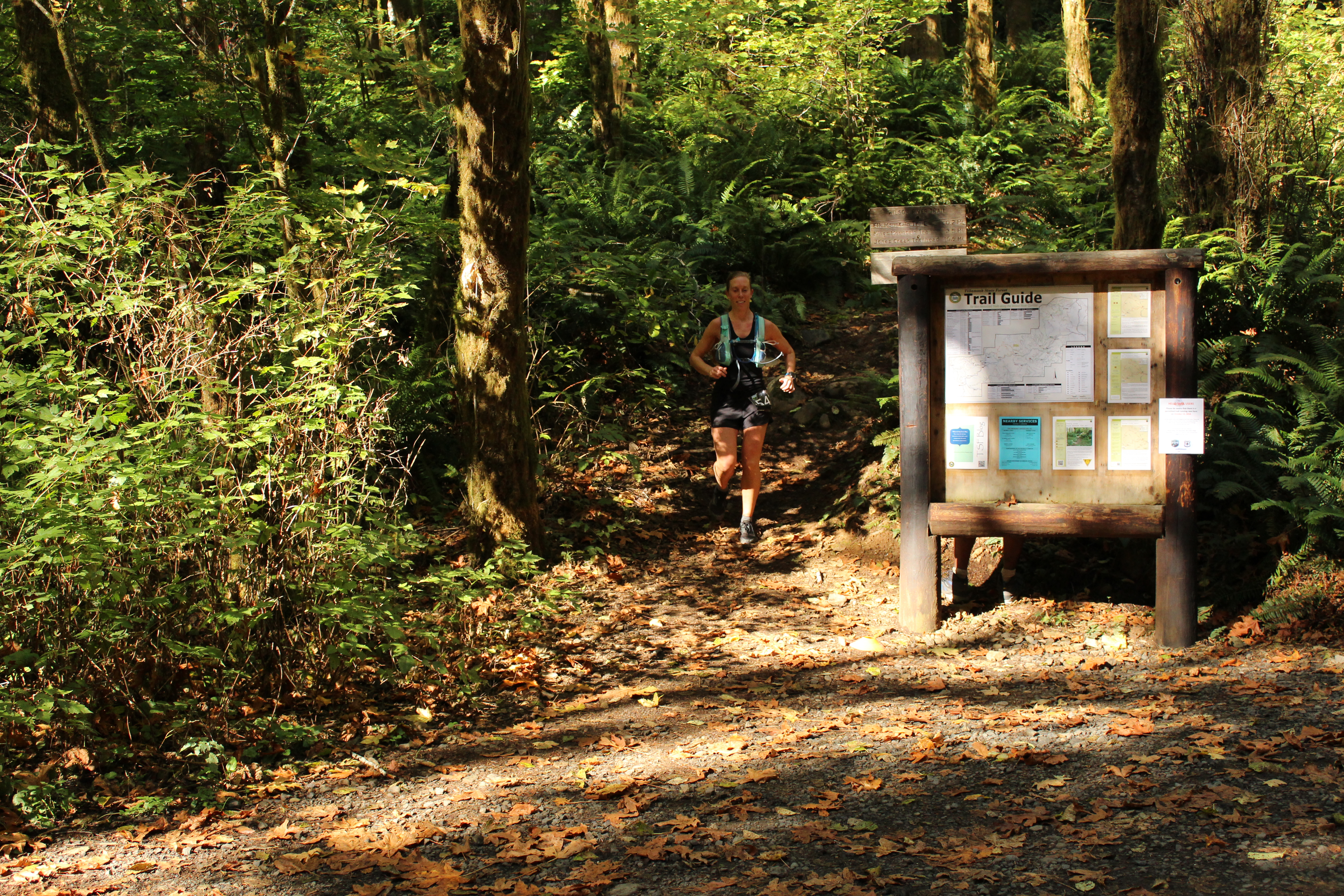
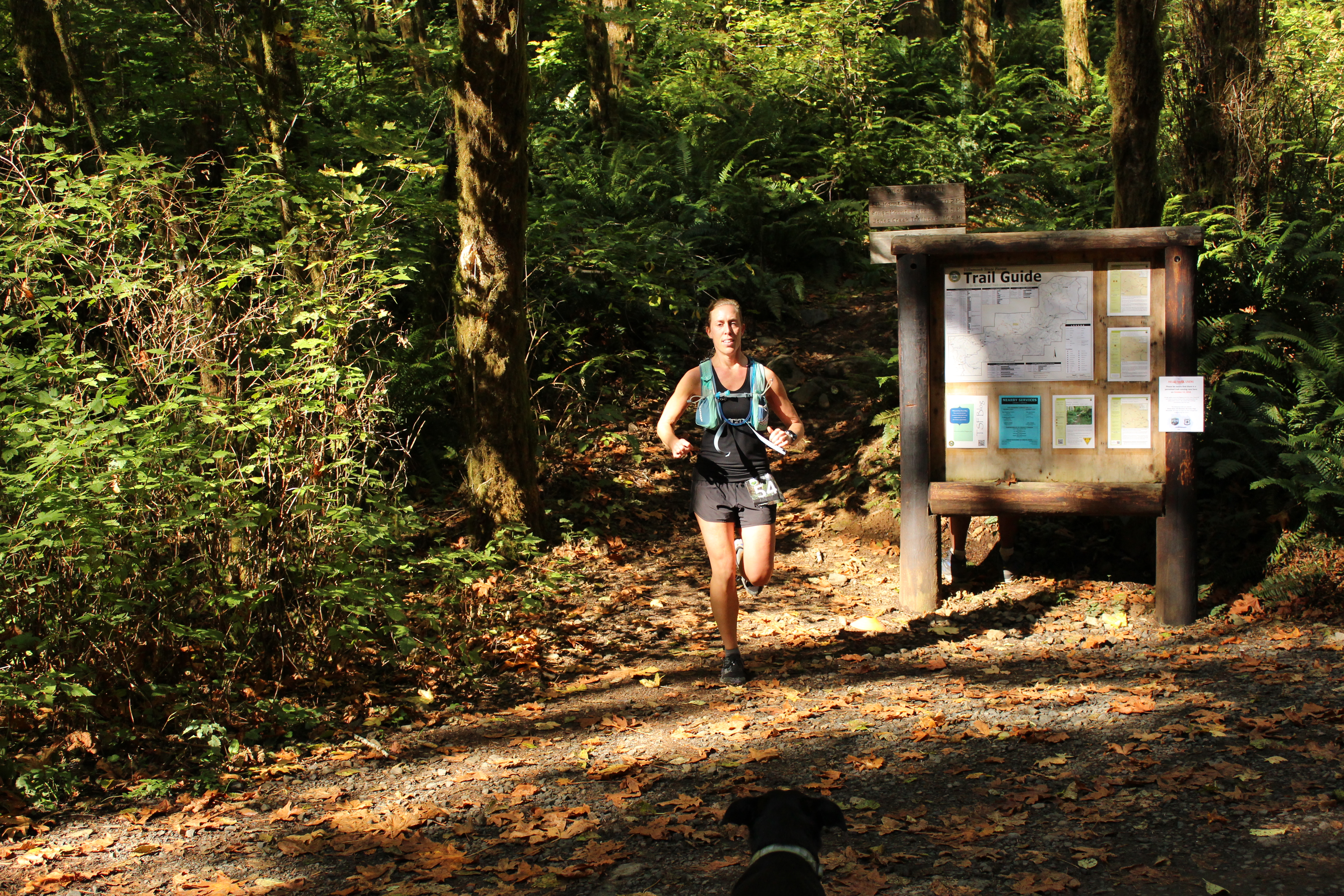
The trail started to get much more difficult after that point. We crossed a bridge and climbed about 1,200 ft. in 3 miles. There was a steep downhill followed by some rollers and another climb before hitting the turn around point at mile 19. At this point my right IT band was getting inflamed from all of the downhill and my knee was in pain (you can see it on my face in the photos below). Luckily Matt came to my rescue with some Ibuprofen and some motivation and I was on my way again.
The return was HARD. The 1,200 ft. we climbed on the way out was compressed into 1.5 miles on the return and my glutes and hamstrings were on fire. I wanted to stop so many times, but literally pushed my legs up that hill. At this point I knew I was 5th place female – the lady in 4th place was behind me in the first half, but left the aid station before me – and thought if I pushed it I could potentially catch up to her. I was never so relieved as when the trail went down again to the aid station at mile 29. From that point, it was 2.75 miles of rolling hills to the end where Snickers and I crossed the bridge to the finish line.
Since I did pretty much all of my training solo, being in a race environment was both foreign and invigorating. I pushed myself harder than I probably would have otherwise. I finished 31.76 miles in 6:09:13 by the race time (5:59:44 moving time – I stopped with Matt and Snickers at a few aid stations), which was far better than I could have hoped. Going in I just wanted to finish under 7 hours with a goal in the back of mind of 6.5, so to finish just over 6 hours was amazing for me. I was 21st overall, 4th place female (out of 30), and 1st place female in my age group (the top 3 overall weren’t eligible for age group prizes, so I technically finished 3rd in my age group 🙂but I’ll take the win).
A big thanks to Matt and Snickers for being my cheerleaders and support staff all summer and to the Go Beyond Racing crew who put on an amazing race.


 I run portions of the Wildwood twice a week, and have run approximately 22 miles of the trail. Since I’m in the thick of ultra marathon training, it was the perfect time to do the trail in its entirety. I needed to hit 35 miles for the day, so I tacked on an additional 6.5 miles to get from our apartment to the trailhead. I started at Portland State University running on Terwilliger to the Marquam trailhead, followed the Marquam Trail up through Council Crest, before finally meeting up at the start of the Wildwood in Washington Park.
 The second half of the run felt a lot slower than the first. I was able to keep a decent pace and just kept moving forward, even if that meant walking. The Wildwood is a fairly easy trail without a lot of climbing. While this is usually a good thing, a very runnable trail means, well, a lot of running :). I enjoyed the rolling hills and quiet section of trail for next 8 miles, when I started to get pretty fatigued around mile 25. I fueled myself with plenty of GUs, potatoes, and peanut butter crackers, ensured I was staying well hydrated, and kept chugging along. There weren’t any more major climbs after Pittock, so it was mostly a mental game to move forward as quickly as I was able.


 (
(
 (
(
 (
(